
At first, it didn’t feel like a volcano at all. But as we moved forward, the landscape began to change, and it wasn’t just the volcano itself — it was the nature shaped by it that welcomed us.
We had left Tokyo that morning, yet it already felt like a distant memory.
1.Long Trail Route Overview
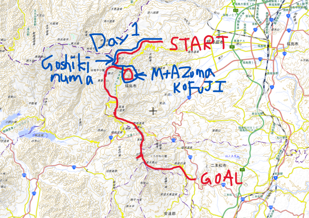
Long Trail Route Overview (3 Days / 2 Nights)
• Day 1: Takayu – Nakatengu – Mt. Issaikyo – Jododaira – Mt. Azuma-Kofuji
• Day 2: Jododaira – Mt. Higashi-Azuma – Makukawa Onsen – Noji Onsen – Tetsuzan Hut
• Day 3: Tetsuzan Hut – Umanose – Mt. Adatara – Dake Onsen
Day 1 – Azuma Area Route
Takayu Onsen – Fudosawa Trailhead – Nakatengu – 駱駝山(Rakuda-yama) – 一切経山(Issaikyo-zan) – Sugadaira Hut – Jododaira – 吾妻小富士 (Azuma-Kofuji)
2.Highlights of Day1
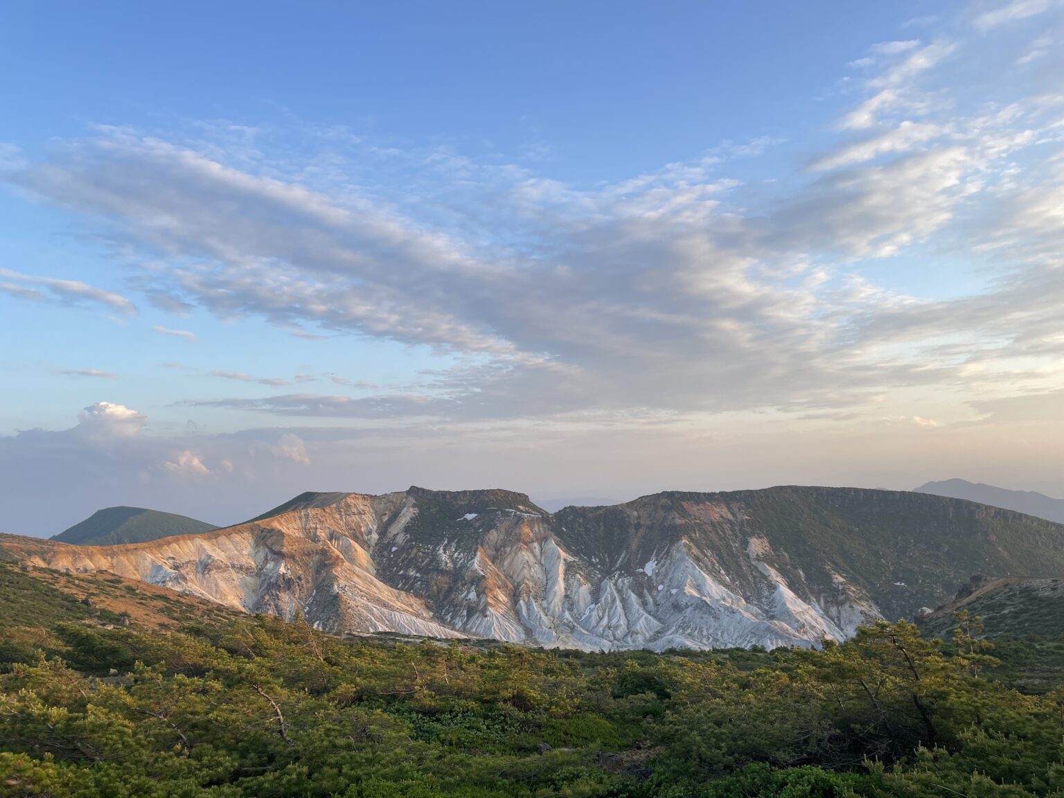
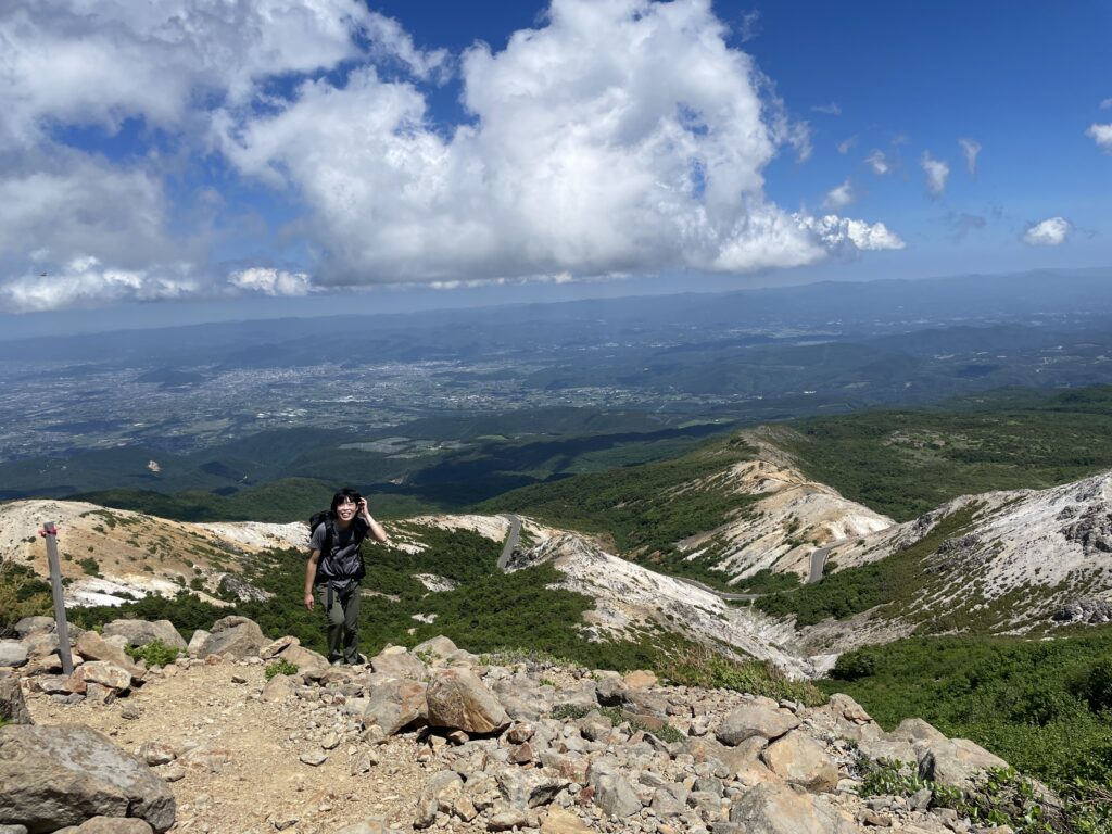
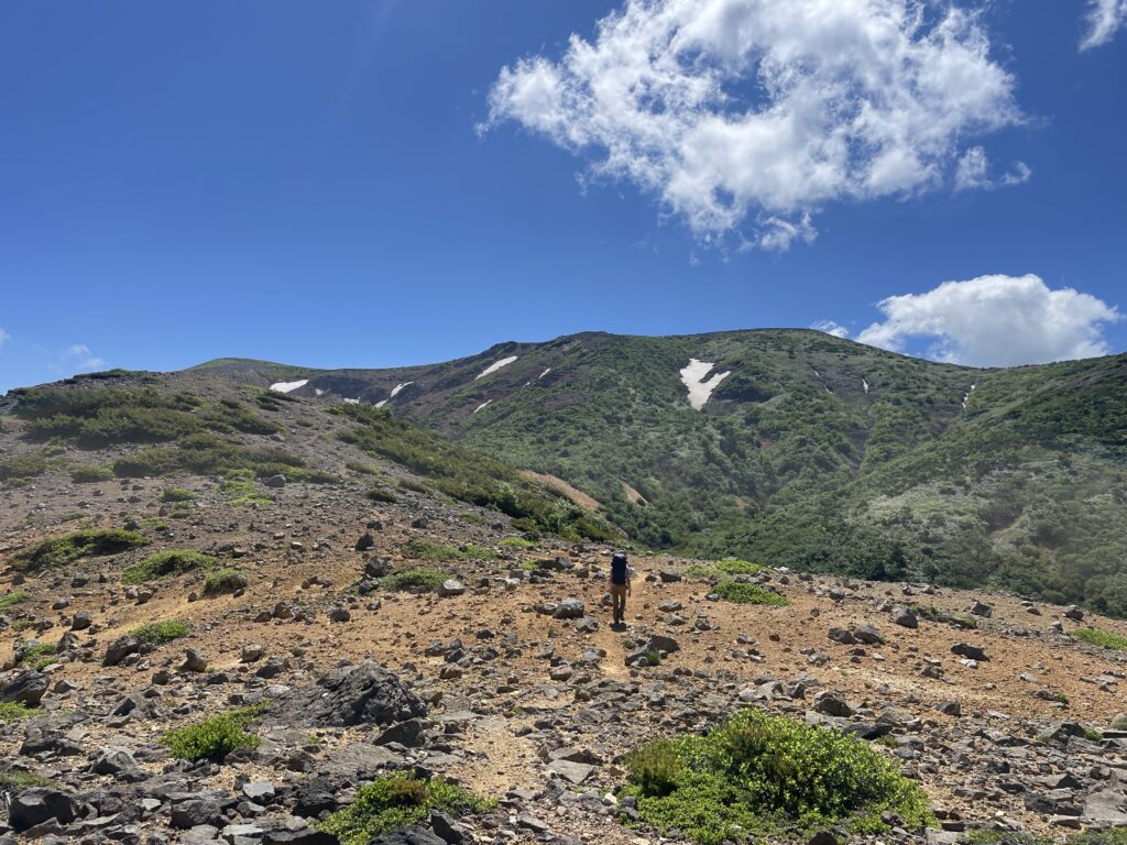
1. Azuma-Kofuji from Rakuda-yama
Starting from the Takayu bus stop, the first stretch is a humid, sweaty climb through dense vegetation.
Honestly, I was thinking, “Where’s the ‘Volcano Trail’ I was promised?!”
But once you reach Nakatengu, the view opens up and a cool breeze saves you.
The best view, however, is from Mt. Rakuda, about 3 hours from the start.
Azuma Kofuji looks incredible from a distance—its tilted crater rim and the winding Bandai-Azuma Skyline road create a stunning, cinematic landscape.
2. Goshiki-numa (The “Witch’s Eye”)
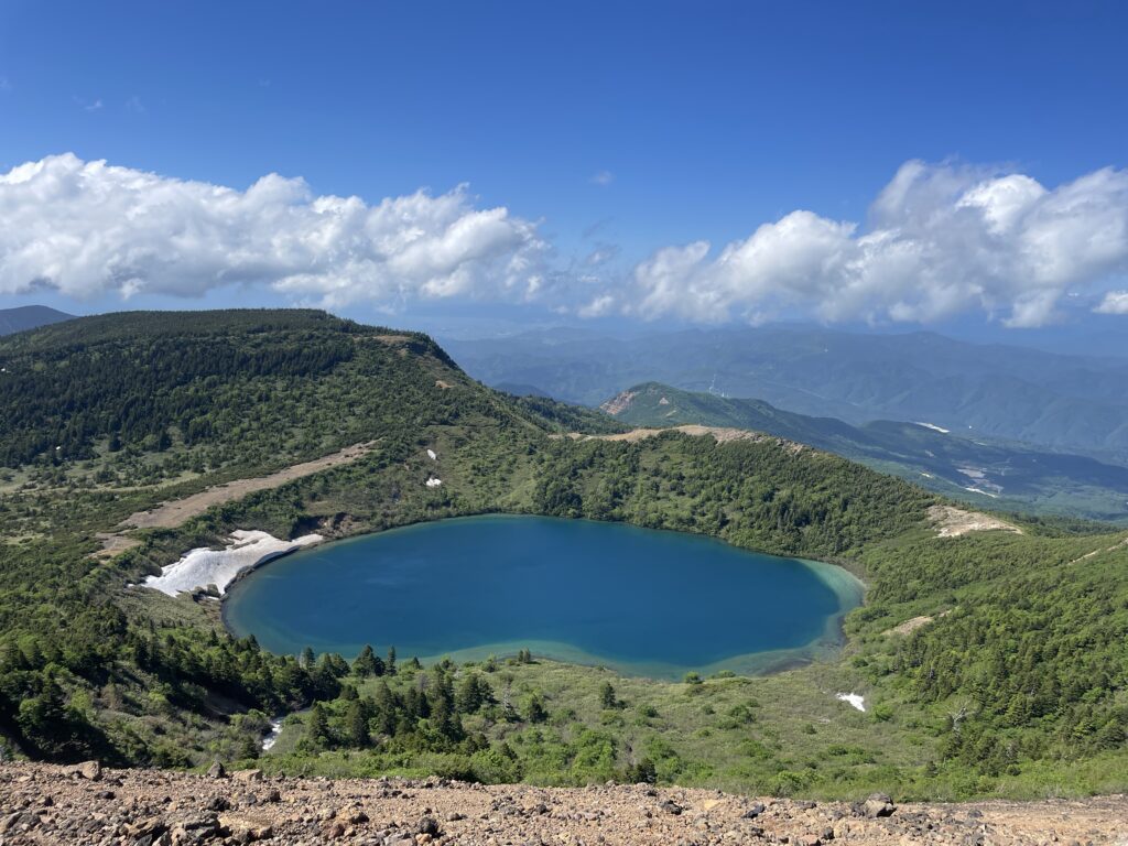
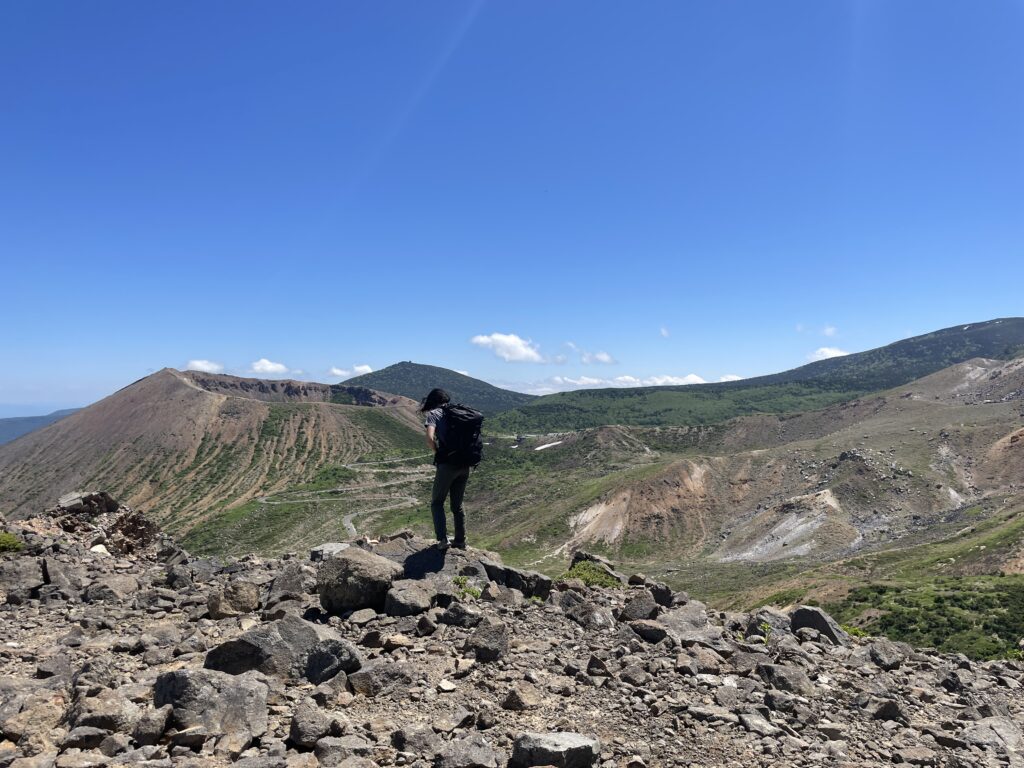
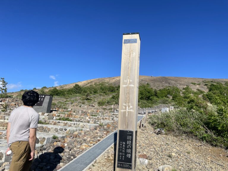
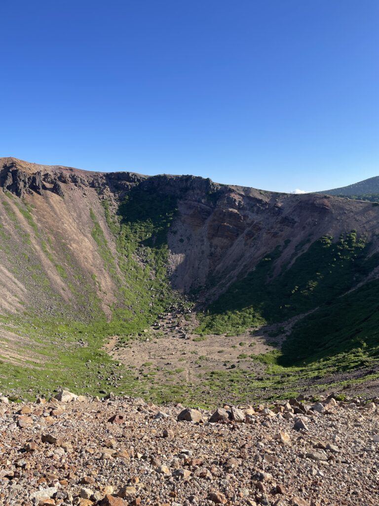
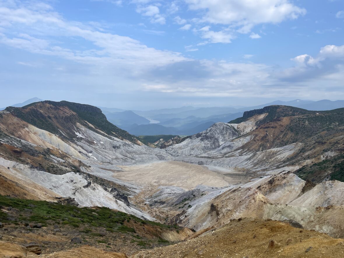
An hour’s ridge walk from Mt. Rakuda brings you to the summit of Mt. Issaikyo. At first glance, it’s just a wide, flat space with a lonely signpost. You might think, “Is that it?”
But don’t stop there! Walk to the northern edge of the summit, and suddenly—BAM! A brilliant, cobalt blue lake appears out of nowhere.
I literally gasped, “Where were you hiding?!” Known as the “Witch’s Eye,” the water shifts shades of blue depending on the sunlight.
I used to think the photos on SNS were over-edited, but I apologize for doubting—it really is that turquoise! It’s like a giant sapphire embedded in the earth.
3. Jododaira Wetlands
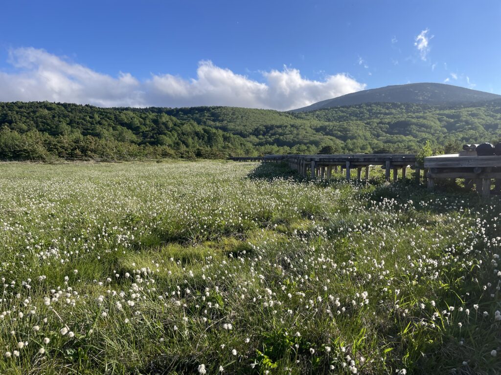
On the way down toward the Jododaira Visitor Center lies the Jododaira Wetland.
This marshland was formed when volcanic ash from Issaikyo-zan weathered into a water-resistant layer, allowing water to accumulate at the surface.
Wooden boardwalks make it easy and pleasant to walk.
From late June, cotton grass blooms here, creating a soft white landscape that feels almost unreal.
There are benches scattered throughout — a perfect lunch and rest spot after the rugged volcanic ridge.
3.Trail Notes
Takayu Onsen – Nakatengu
About 30 minutes by bus from Fukushima Station to Takayu Onsen. The climb begins through deciduous forest.
It was over 35°C in Tokyo that day — and Fukushima was just as hot. I was drenched in sweat.
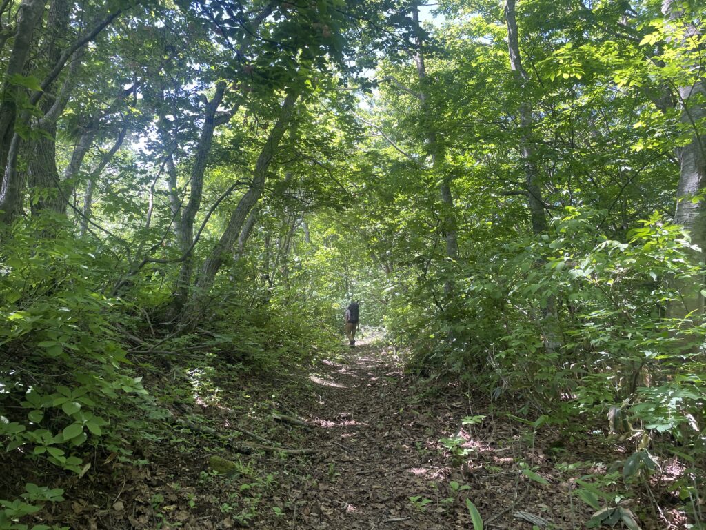
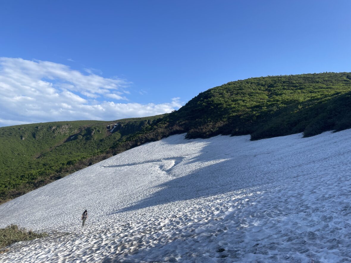
After crossing a small stream between Sai-no-kawara and Nakatengu, the forest gradually opens up. The wind begins to flow.
About two hours in, the vegetation changes.
You start thinking: “Is the volcano finally coming?”

Nakatengu – Rakuda-yama
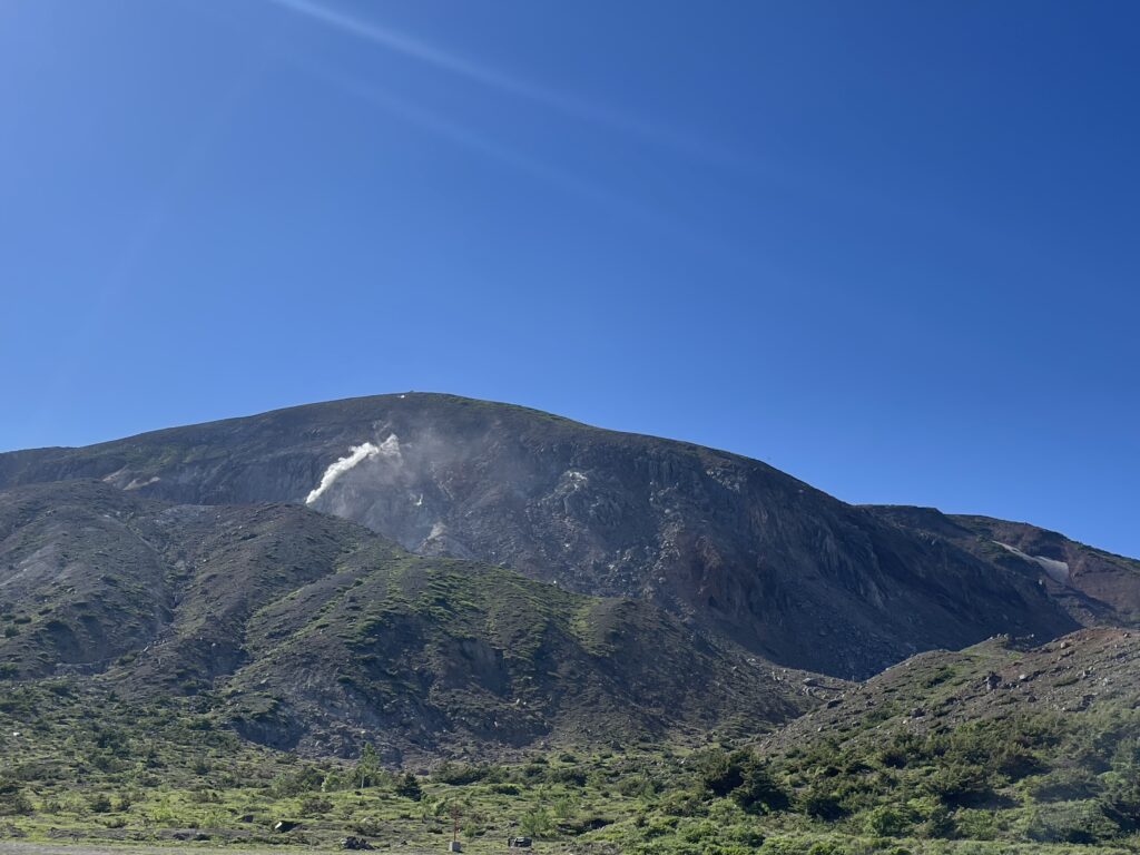
Once on the ridge, Azuma-Kofuji appears.
You’ll probably start taking photos immediately — but trust me, the best angle is from Rakuda-yama. It’s only about 30 minutes away.
And then — boom.
Azuma-Kofuji stands there in full form.

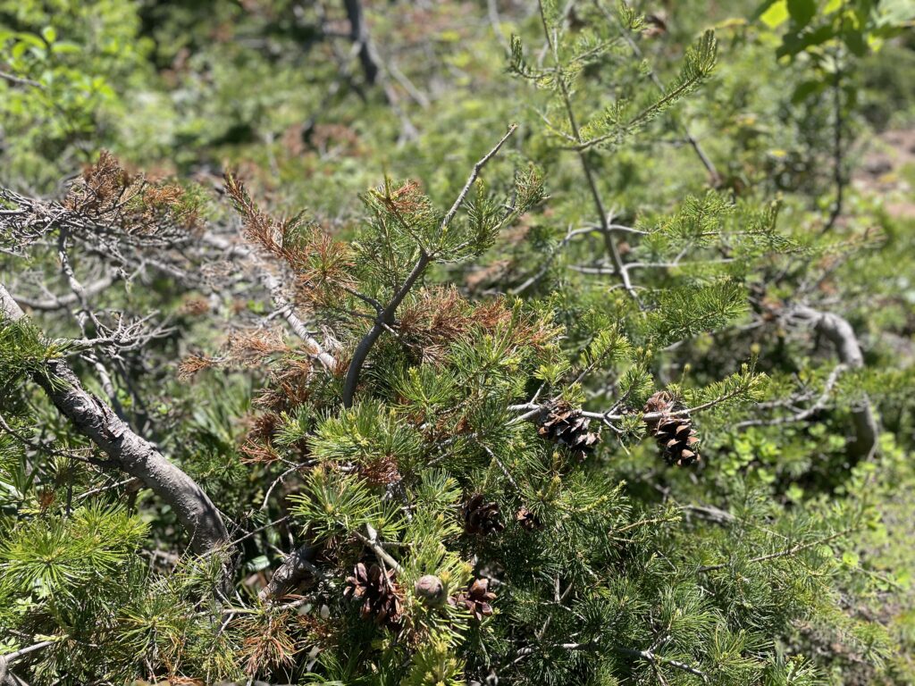
This area is sometimes called the “bonsai trail.” Pines everywhere.
The region is home to Azuma five-needle pines, shaped by heavy snow and relentless wind. Many lean in the same direction, showing just how strong the wind is here. Nature’s sculpture garden.
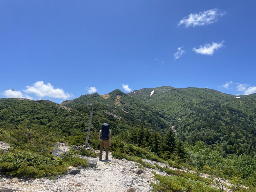
Issaikyo-zan – Sugatami-daira Hut
From Rakuda-yama to Issaikyo-zan takes about an hour.
The ridge walk feels open and refreshing.
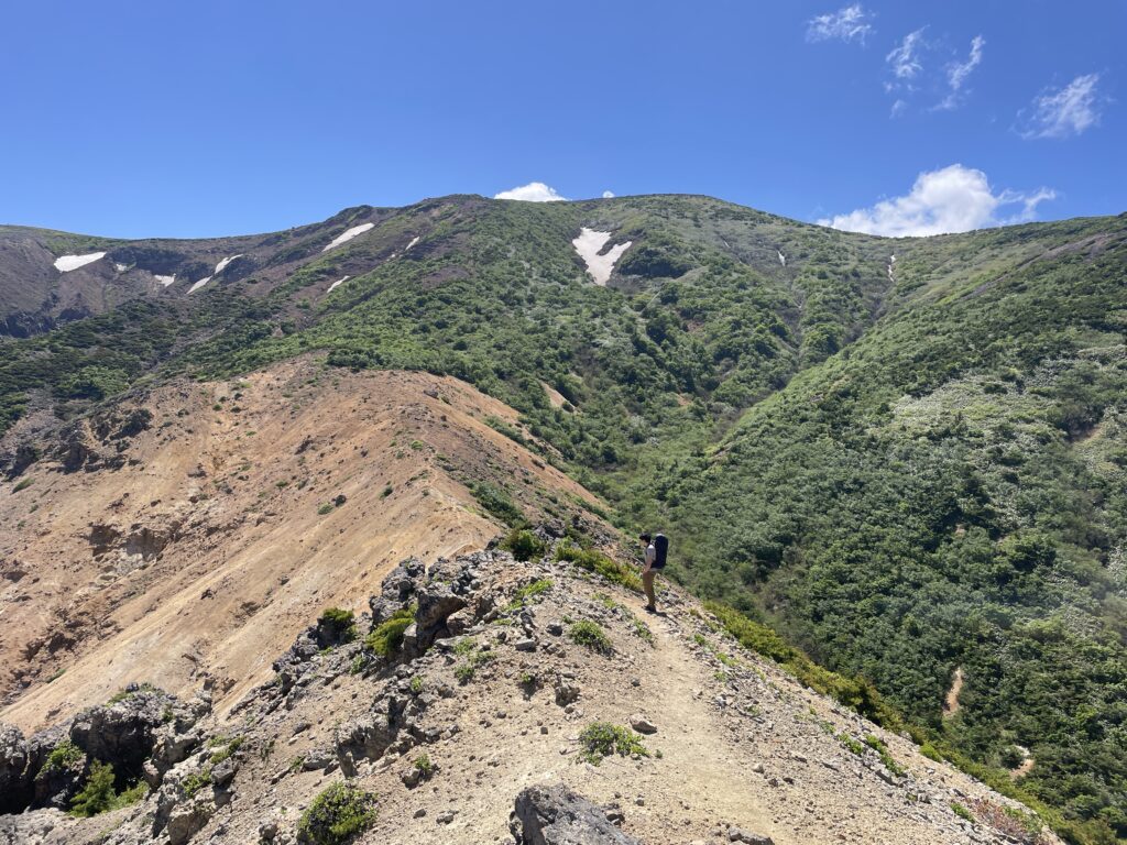
The summit itself feels underwhelming at first — until you walk to the northern edge and discover the Witch’s Eye glowing below.
I considered descending to the lake, but like Azuma-Kofuji, it felt better admired from above.
So I continued toward Sugadaira Hut.


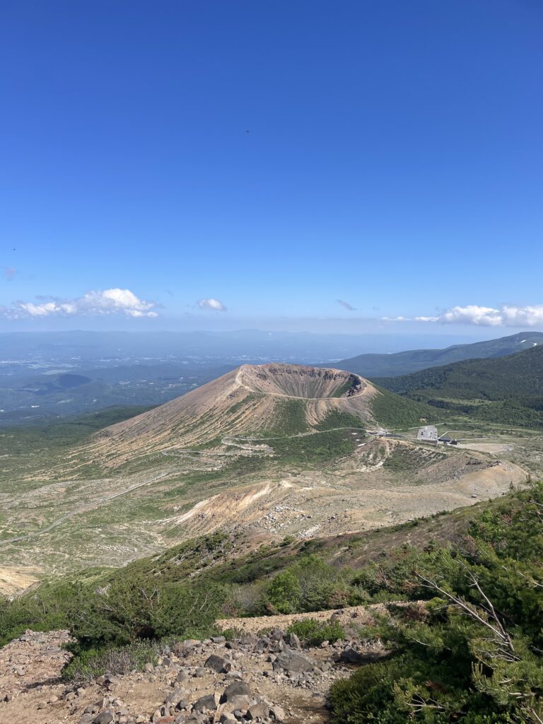
Jododaira Visitor Center – Azuma-Kofuji
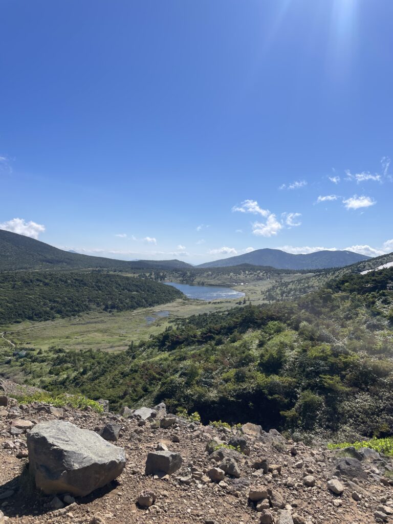
From near the hut, you can see Kama-numa — tomorrow’s wooden boardwalk adventure.

Heading toward the visitor center, the boardwalk begins and the mood shifts. It suddenly feels… civilized.
There’s a shop and light snacks available, but no bread or rice balls — so plan accordingly.
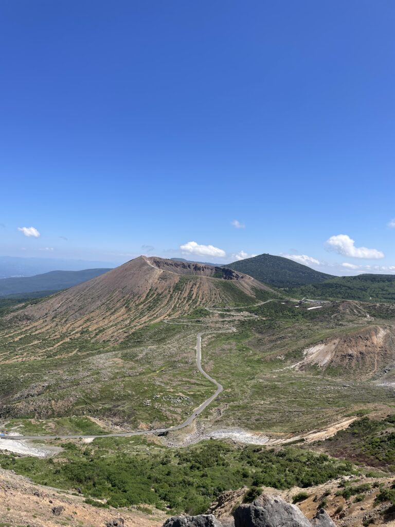
Azuma-Kofuji rises right in front of the visitor center.
Walking its crater rim gives you a dramatic view into the crater and across the Fukushima Basin.
After descending, I wandered through the wetlands filled with blooming cotton grass. Benches, open sky, soft wind.

This Rakuda-yama to Jododaira area is windy. That night, my tent shook loudly in the gusts — though I fell asleep quickly.
Earlier, I had been overheating in the forest. But once on the ridge, the wind cooled everything instantly.
It was an unusually hot day, so I carried minimal insulation — but in autumn, mornings and evenings would likely be quite cold.
Tomorrow, we leave the Azuma volcanic world and move toward the Adatara range.
What kind of landscape is waiting for us?
Day 2 and beyond →
The map below was used as a reference for this hike. this is the most detailed hiking map covering the Bandai, Azuma and Adatara volcanic area. Essential for route planning.