If you’re looking for a runnable trail near Tokyo that’s accessible by train and easy to navigate, this 10.6 km point-to-point from Ome to Ikusa-bata is one of the most beginner-friendly options in the area.
The elevation gain is modest for the distance, and the trail follows the JR Ome Line the whole way — meaning escape routes to nearby stations are available throughout, giving first-timers genuine peace of mind.
The wide, well-marked path lets you focus on running rather than navigation, and the relaxed atmosphere of local hikers sharing the trail makes it a pleasant place to be.
Why Choose This Route?
・Highly runnable terrain: Wide paths, minimal branching, and a predominantly flat profile mean you can run from start to finish with few interruptions.
・Beginner-friendly escape routes: The trail runs parallel to the JR Ome Line the entire way, with bail-out options at Miyanohira, Hinatawada, Ishigamimae, and Futamatao stations. If something goes wrong, help is never far away.
・Easy to follow: Signposts appear throughout the route with remaining distances marked, making pacing straightforward. The trail is essentially one continuous path — getting lost is unlikely.
Who Is This Route For?
・First-timers looking for an easy trail run near Tokyo
・Visitors to Tokyo without a car
・Those looking for a half-day route that still feels rewarding
・Anyone who wants easy escape options along the way
Quick Facts & Access
Distance: 10.6 km
Elevation Gain: 577 m (approx. 1,893 ft)
Start: Ome Station (JR Ome Line)
Finish: Ikusabata Station (JR Ome Line)
Moderate pace with breaks: 2.5–3 hours
Level: Beginner
Best season: Autumn to Spring (roughly September through May)
⚠Summers are very hot and humid in this area. Plan carefully and start early if running in warmer months.
GPX: Download here.
Note: To help us improve our guides for the climbing community, please answer a quick 2-minute survey to unlock the GPX download link.
Access from Shinjuku:
1. Take the JR Chuo Line toward Ome. A transfer at Tachikawa may be required depending on your service.
👉Taking the “Holiday Rapid Okutama” is the fastest way to get there.
👉Check the train schedule beforehand, as trains from Ikusabata Station are less frequent (1–2 per hour).
(Approx. 75–90 minutes total. Fully covered by Suica/PASMO.)
Peaks & Facilities
Peaks & Landmarks
・Sanpouyama (三方山, 454.3 m)
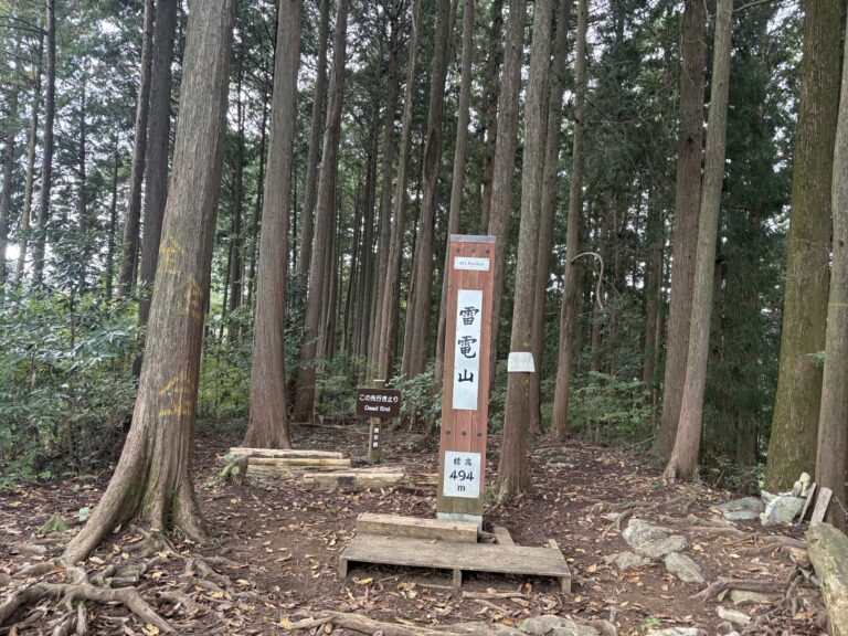
・Raiden-yama (雷電山, 494 m): The high point of the route. The name comes from a rain-prayer ritual once performed on the summit during droughts. Not particularly scenic, but a satisfying checkpoint.
Facilities
Convenience Stores: Near Ome Station (at the rotary).
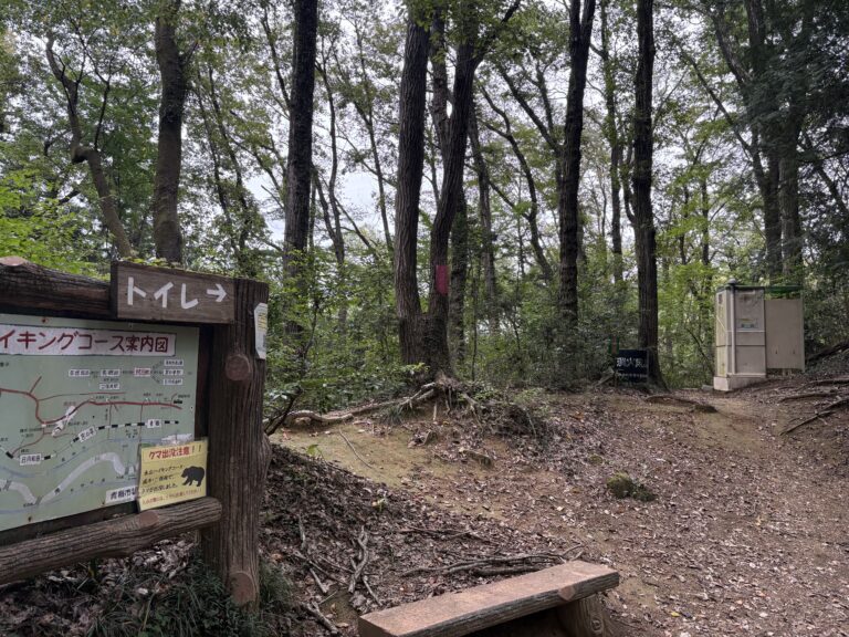
Toilets: Ome Station, Nagayama Park, along the Ome Hills Hiking Course, Ikusabata Station.
note: the portable toilet mid-trail is in rough condition — treat Nagayama Park as your last reliable stop
Water: Vending machines and a convenience store are available at Ome Station. There are no water sources on the trail itself, so carry what you need from the start.
Route Breakdown
Ome Station → Nagayama Park
The run starts from Ome Station, where a convenient rotary area with a convenience store makes last-minute supplies easy to pick up.
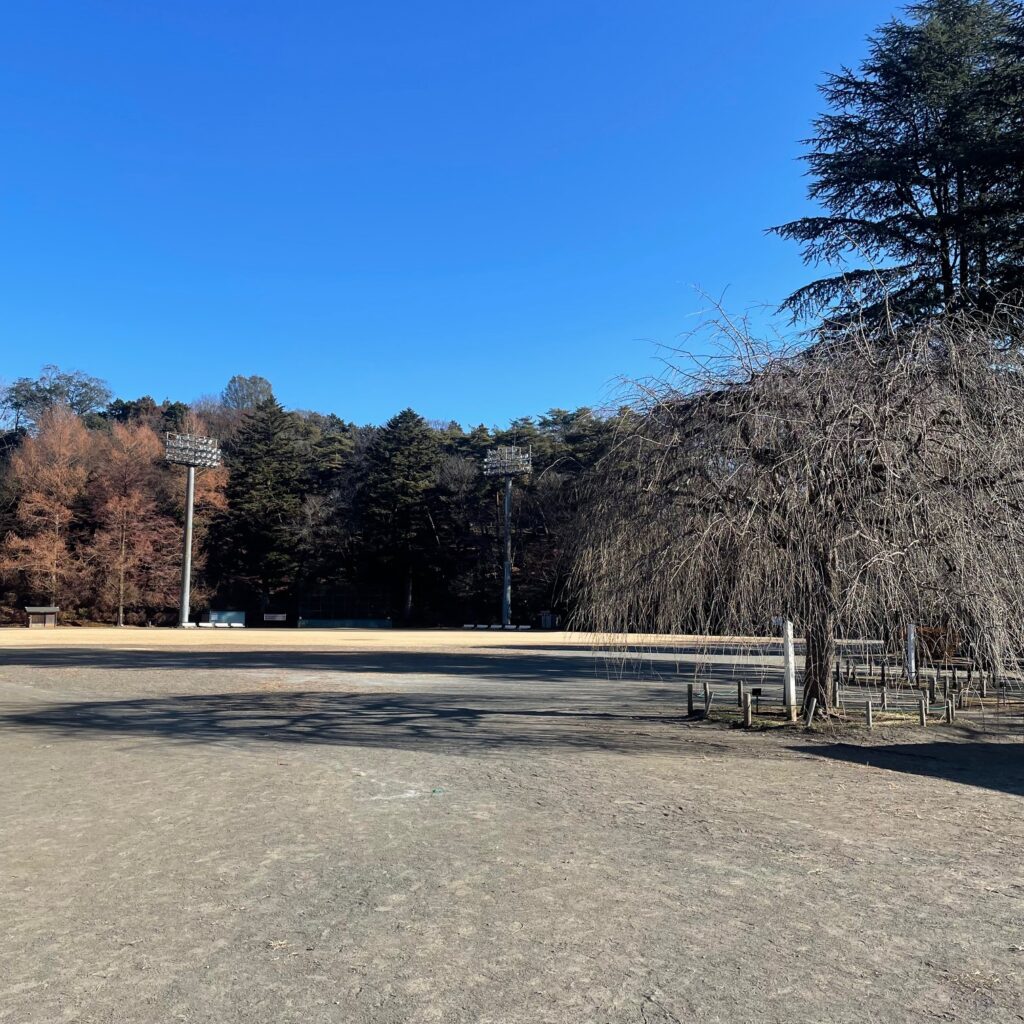
From the station, head toward Nagayama Park — a pleasant warm-up on paved roads before the trail begins. The park has clean, well-maintained toilets, which are worth using before you head into the hills.
Nagayama Park → Ome Hills Hiking Course → Yaguradai
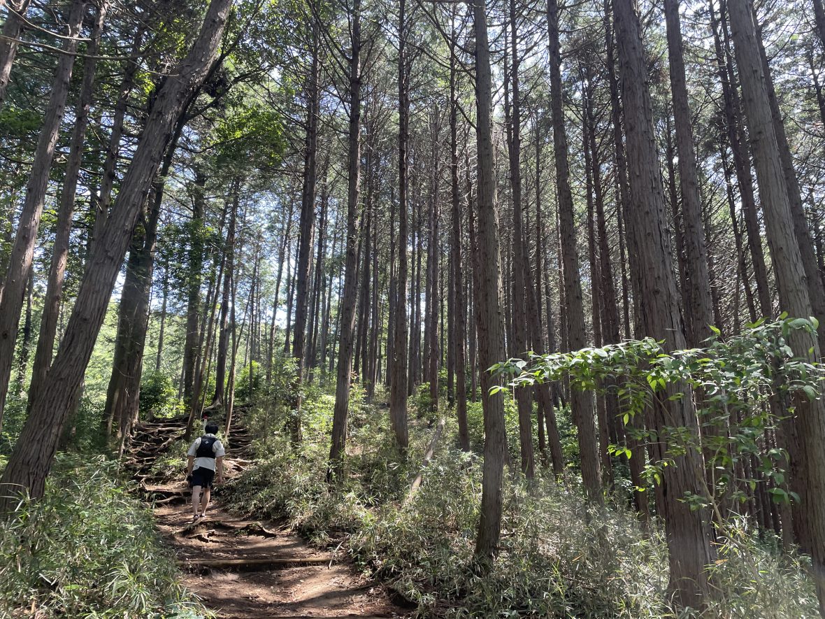
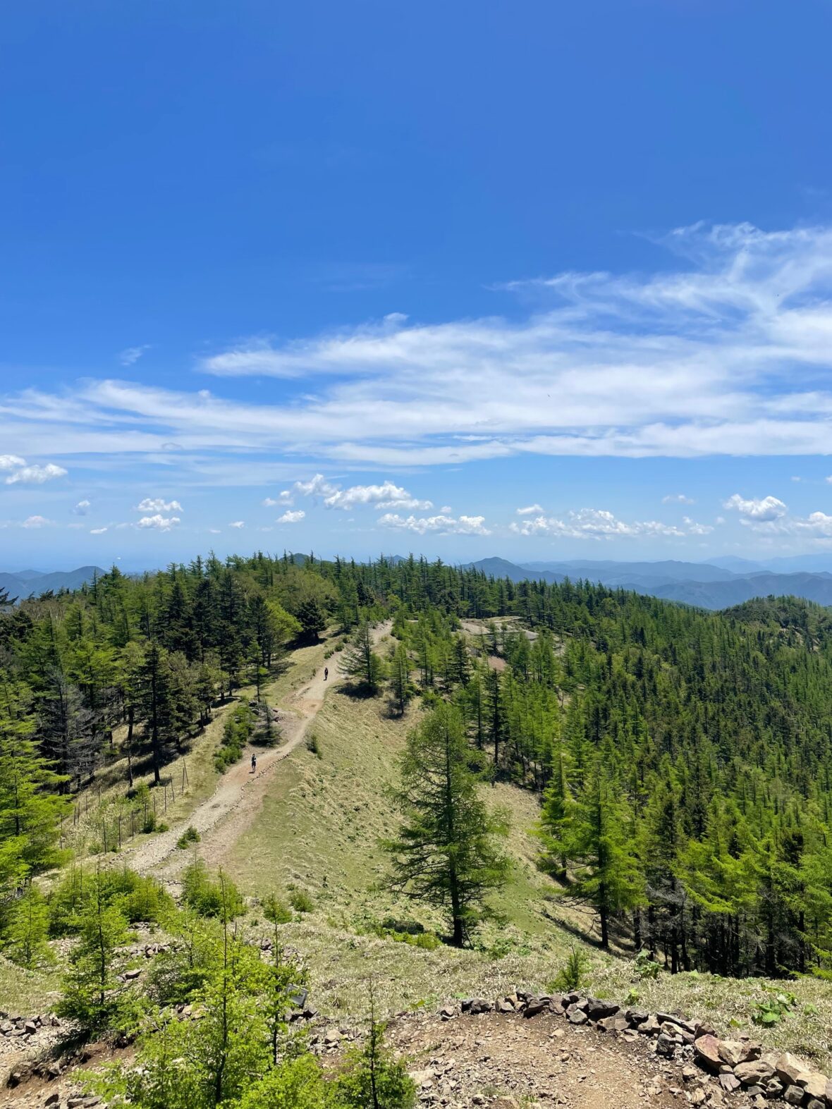
From the back of the park’s sports ground, a staircase leads up into the Ome Hills Hiking Course (青梅丘陵ハイキングコース). This section is approximately 3 km of wide forest trail — comfortable underfoot and popular with local walkers.
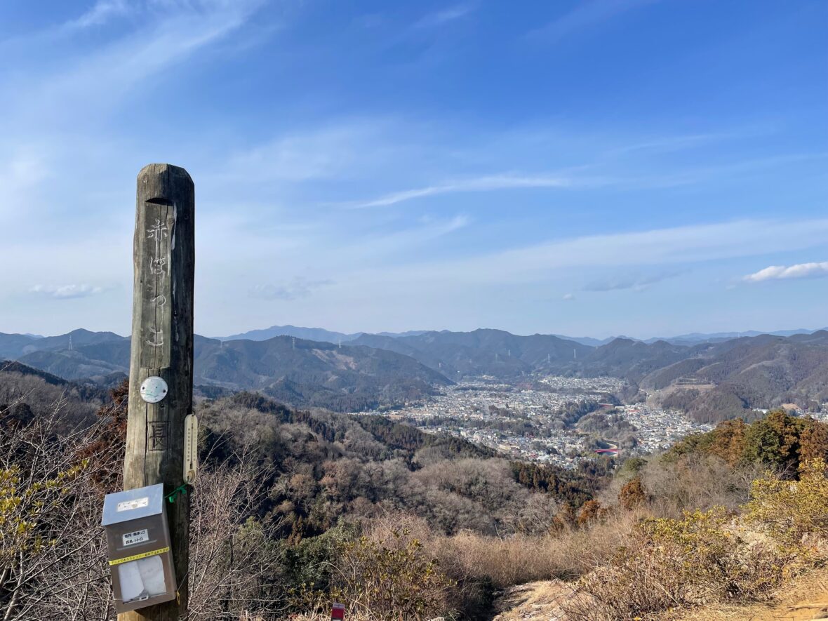
Four rest shelters are spaced along the way, each offering views over the town of Ome. The atmosphere is calm and friendly; on my run, several locals called out “have a good run!” as I passed.
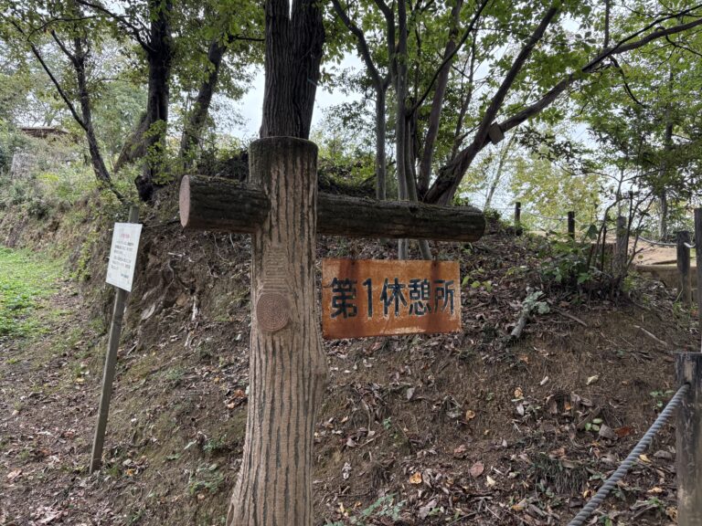
The trail remains well-populated as far as the third rest shelter, after which it quietens down and the forest takes over.

A portable toilet appears mid-trail, but the condition is rough enough that most people will think twice before using it. Treat Nagayama Park as your last reliable toilet stop.
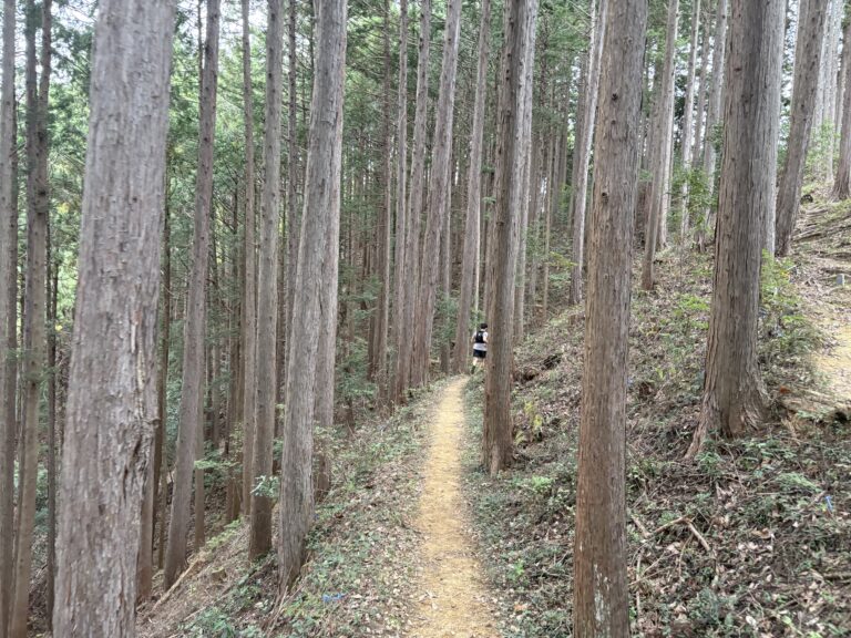
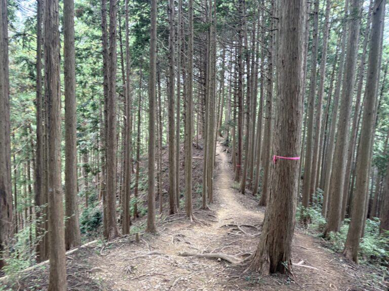
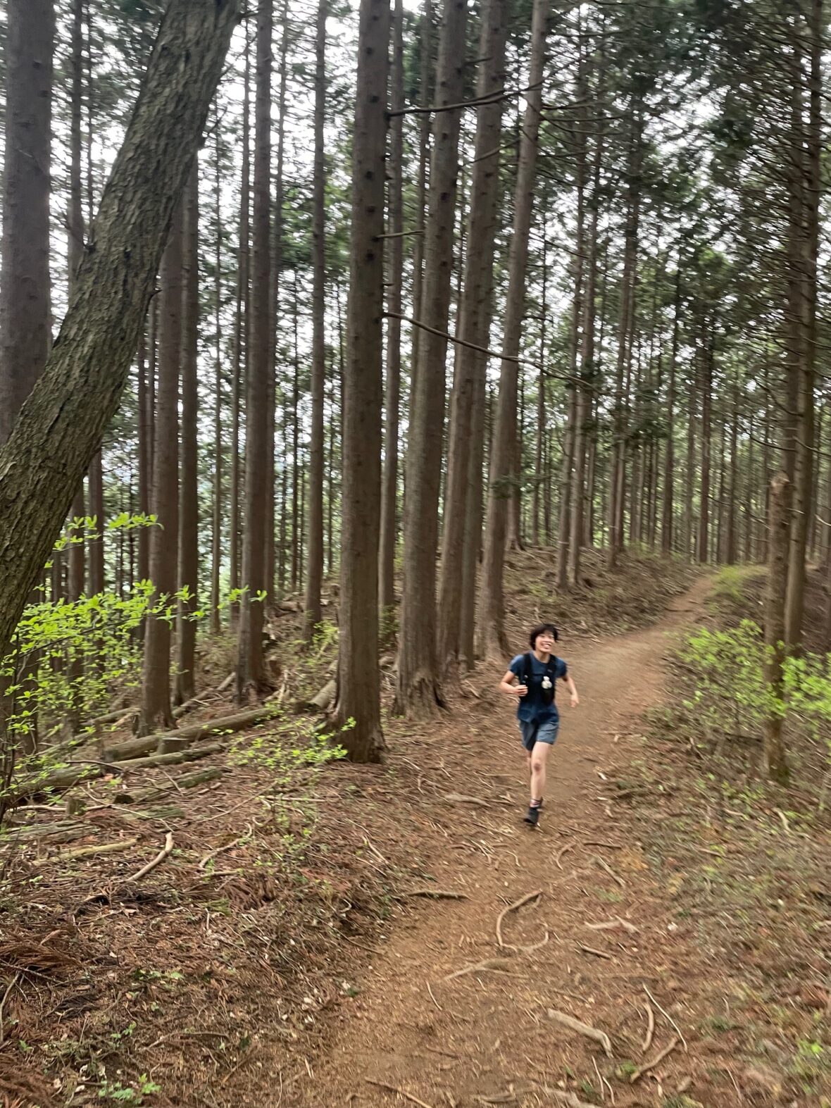
From Yaguradai onward, the trail feels more like true trail running terrain.
Yaguradai → Raiden-yama
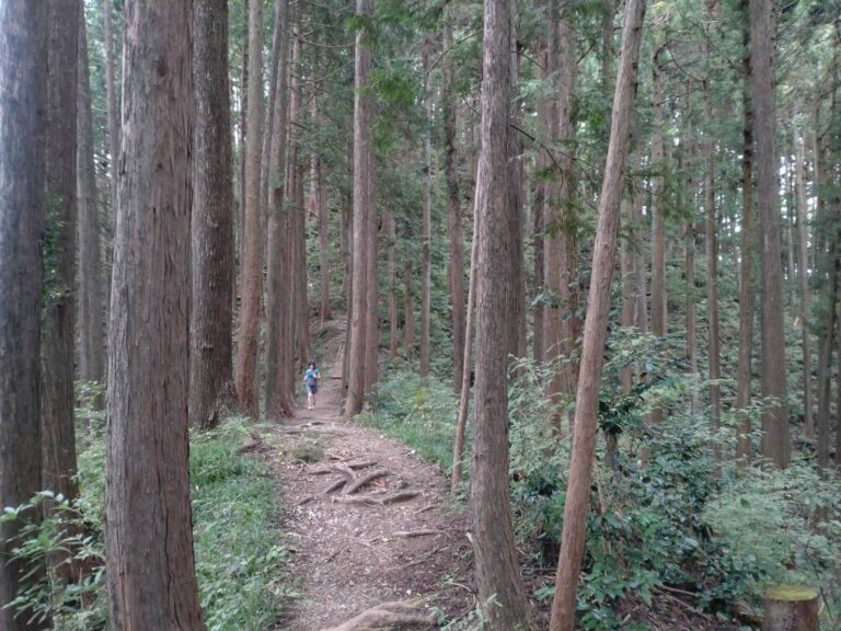
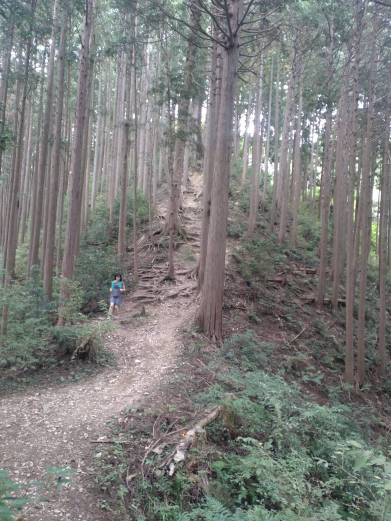
Beyond Yaguradai, the path narrows compared to the hiking course, but remains wide enough to pass other trail users comfortably. The number of hikers drops noticeably here, and the trail opens up.
Signposts appear regularly with distances marked to Raiden-yama, making it easy to gauge your pace.
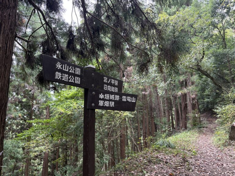
Occasional signs indicate bail-out routes down to Futamatao Station and other points along the Ome Line — reassuring if you’re new to the area.
The profile stays remarkably flat for most of this section. There’s a short stretch of rolling terrain just before the summit, but nothing that should interrupt your running.
Raiden-yama (494 m) arrives before you expect it. The summit is forested rather than open, but worth a quick stop and a photo. The name derives from a rain-prayer ceremony historically held here during droughts — a small piece of local history in a quiet spot.
Raiden-yama → Ikusa-bata Station
After the summit, the trail continues on good footing and then transitions quickly to paved road for the final descent into town.
From the road junction, it’s a straightforward run down to Ikusabata Station — the end of the route. The paved road down to Ikusabata Station is surprisingly long and steep. It can be a bit of a shock to the legs after the trail, so stay focused until the very end!
Ikusabata Station has a small shop and vending machines. After the run, a cold drink is well-earned.
Estimated Time
Japanese Standard Hiking Time: 5 hours
My Time (example): 2 hours
10:25 Nagayama Park → 11:55 Raiden-yama → 12:20 Ikusabata Station
Estimated trail running times:
・Strong intermediate runner: under 2 hours
・Moderate pace with breaks: 2.5–3 hours
Always allow extra time for train schedules.
FAQ:Ome to Ikusa-bata
Q: Is this route crowded?
A: No — far quieter than the Takao area. The Ome Hills Hiking Course section sees a steady flow of local walkers, which gives the trail a pleasant, safe atmosphere without feeling busy. Beyond Yaguradai, numbers drop significantly and you’ll often have the trail to yourself.
Q: Can I extend the route?
A: Yes. Beyond Raiden-yama lie the Takamizu Sanzan (高水三山) — three peaks including Takamizuyama(高水山), Iwatakeshiyama(岩茸石山), and Sogakusan(惣岳山) — which add approximately 3.5 km to the route. If you continue to all three, you’ll finish at Mitake Station(御嶽駅) (two stops past Ikusa-bata on the Ome Line) rather than Ikusabata.
Q: Where can I bail out if needed?
A: The trail runs parallel to the JR Ome Line throughout, with marked descent routes to Miyanohira(宮ノ平), Hinatawada(日向和田), Ishigamimae(石神前), and Futamatao(二俣尾) stations. The descent to Futamatao is the most clearly signed and straightforward.
Q: Can I run the route in reverse?
A: Yes, with no major issues. The elevation profile is nearly symmetrical, though running from Ikusabata to Ome means slightly more climbing overall.
Q: Is navigation difficult?
A: No. The trail is well-marked throughout with clear signposts and distance markers. While most signs are in Japanese, the route is straightforward and getting lost is unlikely, even for first-time visitors.
Upgrade Your Run with the Full Guide
🏃♂️ Personalized Trail Planning
Looking for a custom itinerary? I also offer personalized trail planning tailored to your fitness level and schedule. Feel free to contact me for a bespoke running plan!
👉[Check out my Custom Itineraries here]
This is part of a series of trail running routes near Tokyo, from beginner to longer runs.
👉 Looking for more trail running routes in Okutama area? Check out my complete guide here.
👉 Ready to explore more? See the full list of Tokyo trail routes here