
When you hear the Kuju Mountains, you might imagine only hard, demanding climbs, since they’re home to Kyushu’s highest peak.
But this route is different — no summits, just a scenic, journey-style hike through landscapes that change with every step.
Contents.
1.Highlights
1. Landscapes You’d Never Expect
Along this route, you’ll pass through Bōgatsuru and KitaSenrigahama.
Bōgatsuru is a wide, straight path stretching ahead, with a landscape that fills you with excitement — as if a journey is just about to begin.
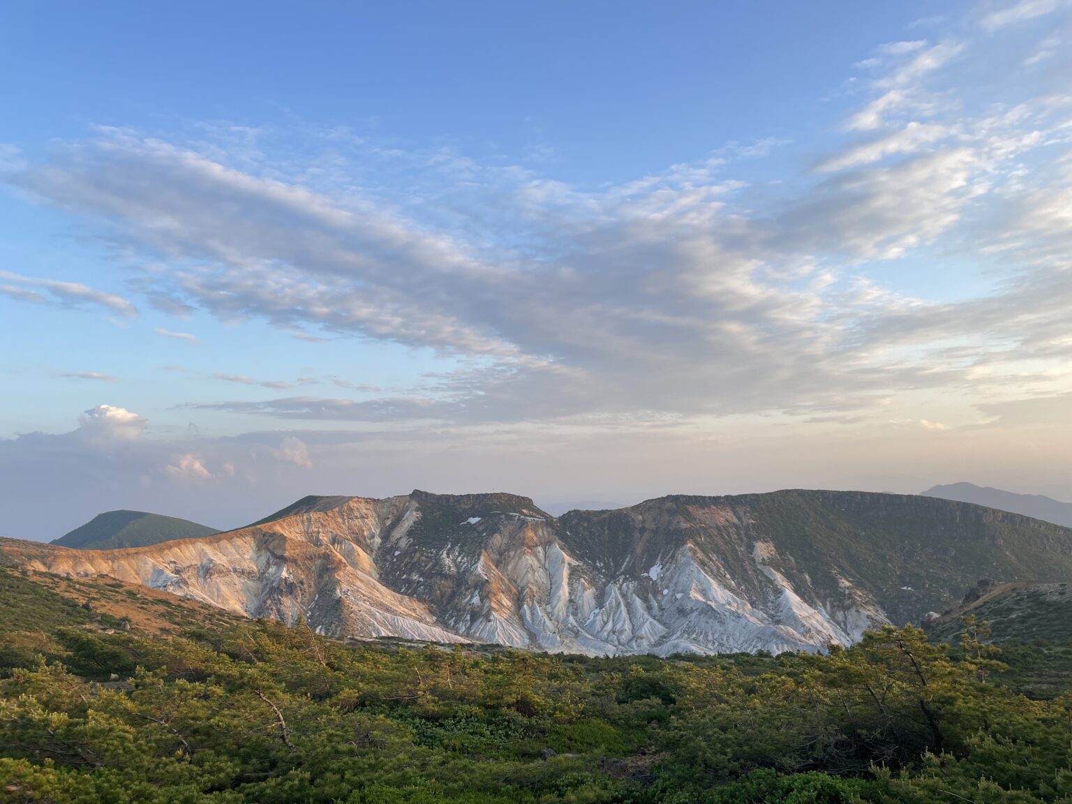
KitaSenrigahama feels volcanic, barren, almost Himalayan—but the closest feeling is “Sai no Kawara”, said to be the border between this world and the afterlife.
Everyone may imagine something different, but one thing’s certain: the sheer scale of the landscape will blow you away.

2. A Long-Trail Style Journey
This route doesn’t include any peak summits, which makes it feel more like a long-distance journey than a classic Japanese mountain hike.
Instead of climbing up to look down at the views, you walk through them at eye level—an incredibly immersive experience.
Because there’s no steep peak involved, it’s also accessible to a wider range of hikers.

2.Course Overview
Distance: Approx. 10.8 km
Elevation Gain: 657 m
Estimated Hiking Time: 4 hr 47 min
Difficulty:Beginner
Start / Goal: Chojabaru Trailhead
Major Spots: Bōgatsuru (1200 m), Sugasamori Pass (1505 m)
Convenience Store: None
Toilets: Chojabaru Visitor Center, Bōgatsuru, Hōkeiin Onsen Mountain Hut
3.Access
By Car
Chajabara Visitor Center (free)
By Train & Bus
About 50 minutes by the Kuju Town Community Bus (Kuju Trailhead/ Makino Pass Line) from JR Bungo-Nakamura Station
The timetable is here.
4.Bear safety measures
There are no bears living in Kyusyu, so bear safety measures are not necessary.
5.Trail Report
April 16 – Sunny
A blue-sky morning! I started from the Chojabaru trailhead.

Tadehara Marshland
Right away, the boardwalk begins. The boardwalk makes the trail easy to walk and really pleasant.
Even though it was just after the annual controlled burning and still brown, in summer it becomes lush and green.

After passing through the marsh, the trail enters the forest.
Somewhere along the way I spotted… a raccoon dog? A weasel? Still not sure what it was!

Amaga Pond
Another marshy area. I love wetlands—they feel calm yet full of life.

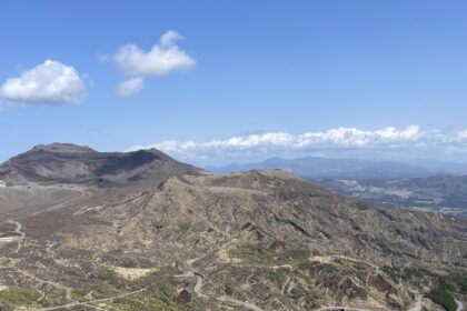
Then the forest gradually opened up and—boom—Bōgatsuru appeared.
Bōgatsuru
I had assumed this was “just a campsite,” but the views completely exceeded expectations.
With wide-open plains and mountains in the back, it felt like the American West or New Zealand.
Honestly, it made me feel like my own long-distance hike was about to begin.
This place alone is worth the visit, and I can imagine the night sky being incredible here.

After a break, I continued along a single-track trail toward Hōkeiin Onsen Mountain Hut. The openness, the line of the trail, and the distant Mt. Nakadake… everything added to that long-trail vibe.
There’s that “start of a journey” feeling in the air, and I’m buzzing with excitement!
I originally planned to climb Mt. Mimata, but the beauty of this trail convinced me to skip it.

Hōkeiin Onsen Mountain Hut
This hut is surprisingly well-built—almost too nice to be called a “mountain hut”—and yes, it has hot springs.
I immediately thought, “I want to bring my parents here.”

From here, the trail heads toward Sugasamori Pass over rocky terrain.

North Senrigahama
As soon as I crossed the pass, the scenery changed dramatically.
A barren volcanic plain, rivers cutting through the ash-colored ground, the snow-topped Mt. Hoshio and sulfur-spewing Mt. Io…
Is this Nepal? Alaska? Or some other planet? The closest feeling is Sai no Kawara, said to be the border between this world and the afterlife.

It was so stunning that I stopped again even though I had just taken a break.
I couldn’t believe a place like this existed in Japan.

From here, the trail gently descends toward Tadehara Marsh again, returning to peaceful, green scenery—almost hard to believe the harsh volcanic landscape was just a short walk away.
Although walking the road back is quicker, I chose to return via the marsh to savor the nature a little longer.

Before leaving, I stopped by the visitor center. They have excellent exhibits on the Kuju mountains and the history of controlled burns. Very informative!
Post-Hike Treat
On the drive back, I stopped at Milkland Farm for ice cream.
I chose milk + blueberry. The milk flavor was rich and delicious, and the handmade blueberry was surprisingly amazing.

6.What I Learned on This Trail
This course offers landscapes that feel far beyond “typical Japan.”
You don’t need to climb a peak to enjoy incredible views, making it accessible for many hikers.
Walking through Bōgatsuru, Kitasenrigahama, and the surrounding plains provides a sense of journey, not just “a hike.”
With campsites like Bōgatsuru and the luxurious Hōkeiin Onsen Mountain Hut, you could easily turn this into a slow-travel, multi-day experience.
If you want to feel Kuju’s nature—not just stand on a summit—this is a perfect route!

lf this hike makes you want to explore more, here are my favorite trails in Aso and Kuju.
And you can also check out recommended trails, climbing spots, and other activity areas across Japan here!