This is one of the most enjoyable ridge runs near Tokyo—a course that feels custom-designed for trail running. After a sustained initial climb, the route opens up into a long, flowing ridgeline that allows you to maintain a steady rhythm all the way to Musashi-Itsukaichi Station.
Why choose this route?
・Exceptional Flow: Once you reach the ridge, the terrain is incredibly smooth and runnable.
・Simple Navigation: Very few junctions, so you can focus on running rather than constantly checking maps.
・Cultural Depth: Passes near the historic Musashi-Mitake Shrine, adding a unique spiritual dimension to your run.
・Iconic Experience: This route overlaps with the final 10 km of the Hasetsune Cup, Japan’s most legendary trail race. You can almost feel the electric race-day atmosphere as you charge down one of the region’s most exhilarating descents.

Who Is This Route For?
• Visitors staying in Tokyo without a car
• Runners who prefer flowing ridgelines over technical scrambling
• Those who want to experience Japanese mountain culture while running
• Anyone wanting to experience a piece of the legendary “Hasetsune” race course.
Quick Facts & Access
Start: Mitake Station (JR Ome Line)
Finish: Musashi-Itsukaichi Station (JR Itsukaichi Line)
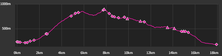
Distance: 17.7 km
Elevation Gain: 920 m
Moderate pace with breaks: 4 – 5.5hours
Best season: Autumn to Spring (roughly September through May)
⚠Summers are very hot and humid in this area. Plan carefully and start early if running in warmer months.
GPX: Download here
Note: To help us improve our guides for the climbing community, please answer a quick 2-minute survey to unlock the GPX download link.
Access to Mitake Station from Shinjuku
1.Take the JR Chuo Line to Ome Station.
2.At Ome Station, transfer to the JR Ome Line toward Okutama.
3.Get off at Mitake Station (7 stops from Ome).
(Approx. travel time: 90–120 min. Fully covered by Suica/PASMO)
⚠ Check the return train schedule at Musashi-Itsukaichi Station. Trains to central Tokyo usually run 2–3 times per hour.
Peaks & Landmarks on Route
• Mount Hinode (902 m) : Offers panoramic views over the Okutama mountains.
• Mount Mitake (929 m) : Home to the ancient Musashi Mitake Shrine.
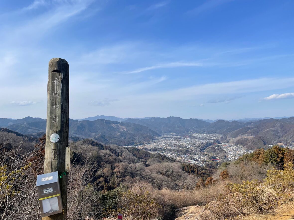
• Mount Konpira (468 m) : A quiet peak just before the final descent to the station.
Facilities
Convenience Stores:
None on the trail. There are two convenience stores at the finish (Musashi-Itsukaichi Station).
Toilets:
• Mitake Station & Musashi-Itsukaichi Station
• Tokyo Mitake Visitor Center (toilets + vending machines)
• Near Konpira Shrine area
• Musashi-Itsukaichi Station
Water : You can find vending machines at the Tokyo Mitake Visitor Center. But there is no water access between Mt. Hinode and the finish (approx. 12km).
Summer can be extremely hot and humid despite the elevation
Route Breakdown
Section 1: Mitake Station → Tokyo Mitake Visitor Center
Distance: ~5.4 km
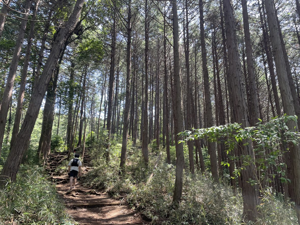
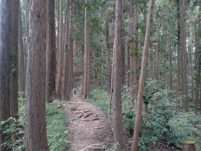
From Mitake Station (御嶽駅), you’ll run along the Tama River before heading up the main approach (Sando) to the shrine.
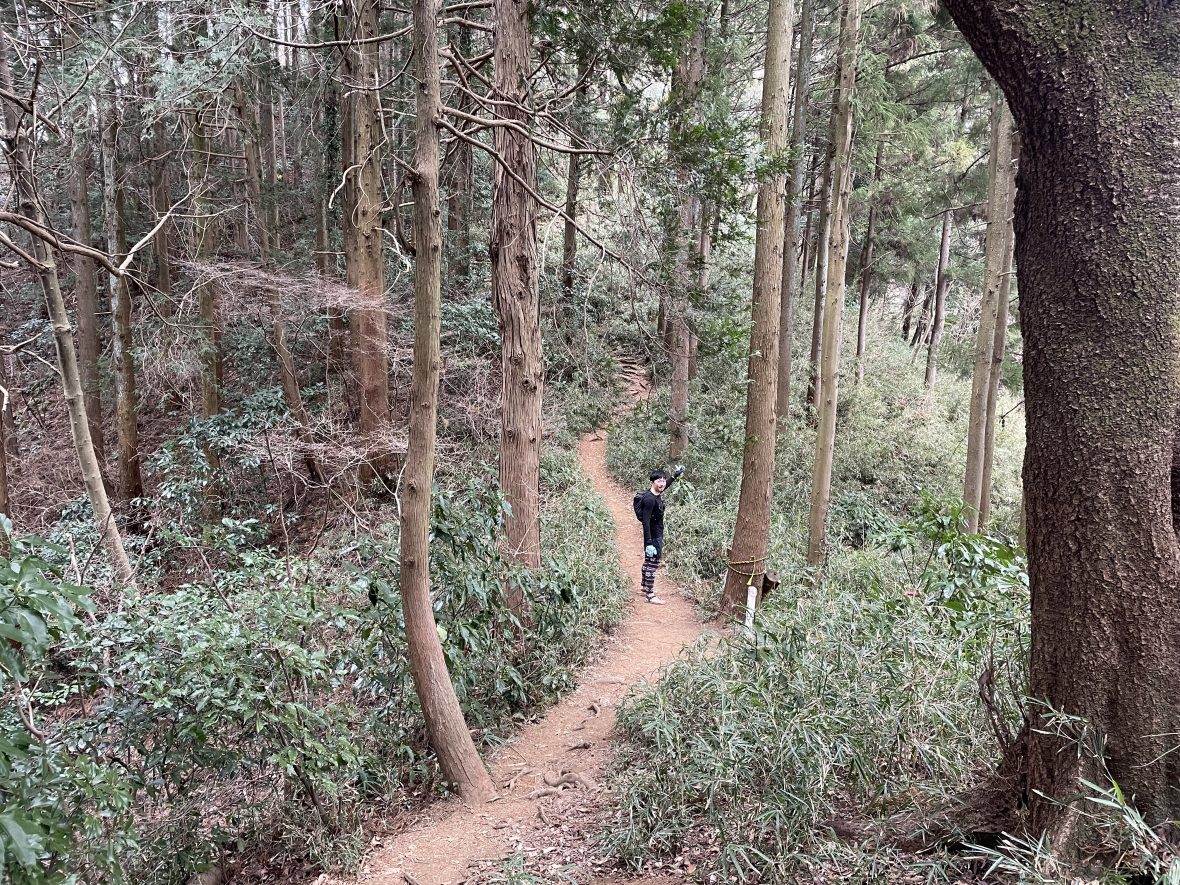
You will pass through a large Torii gate and begin climbing a forest trail lined with ancient cedar trees. Approximately 784 cedars were planted here as sacred trees, many over 300 years old!
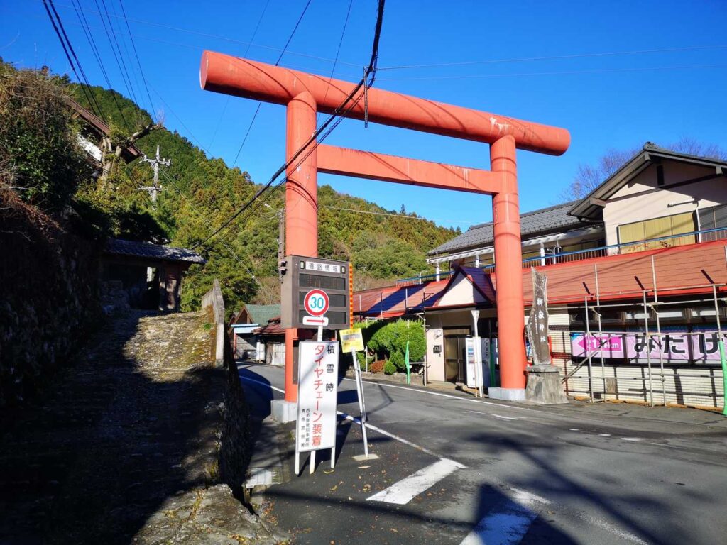
The climb to the Tokyo Mitake Visitor Center is steep and consists of switchbacks. Most runners will hike this section, which is perfectly fine. Take your time and enjoy the forest while admiring the “God Trees” (Goshinboku).
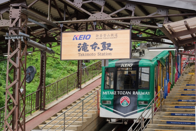
⚠ Alternative Option:
If you want to skip the steepest climb, take a local bus from Mitake Station to Takimoto Station (滝本駅), then ride the Mitake Cable Car up to the visitor center. This saves you about 1.1km (Elevation Gain 400m) of vertical climbing!
Section 2: Tokyo Mitake Visitor Center → Musashi-Itsukaichi Station
The Start of an Exhilarating Ridge Run
Distance: ~12.3 km
After passing the visitor center, the trail gradually opens up as you make your way toward the ridge.
The summit of Mount Hinode (日の出山) offers wide-open views and, true to its name (“Hinode” means sunrise in Japanese), it is one of the best spots in the area to catch the first light of day.
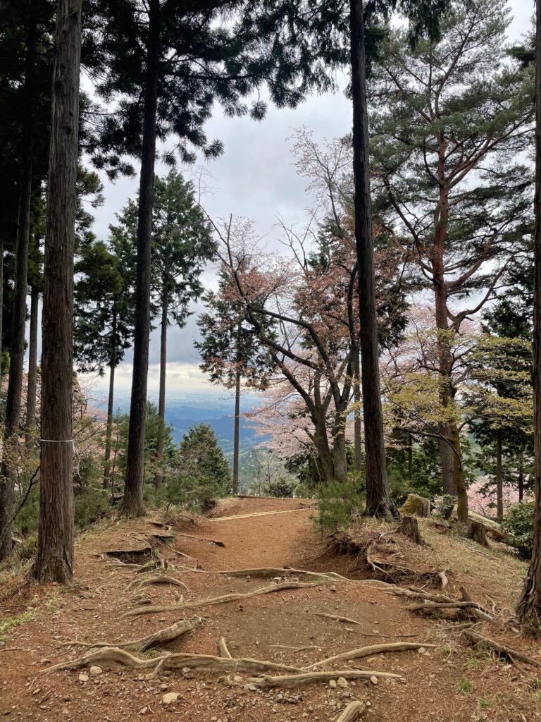
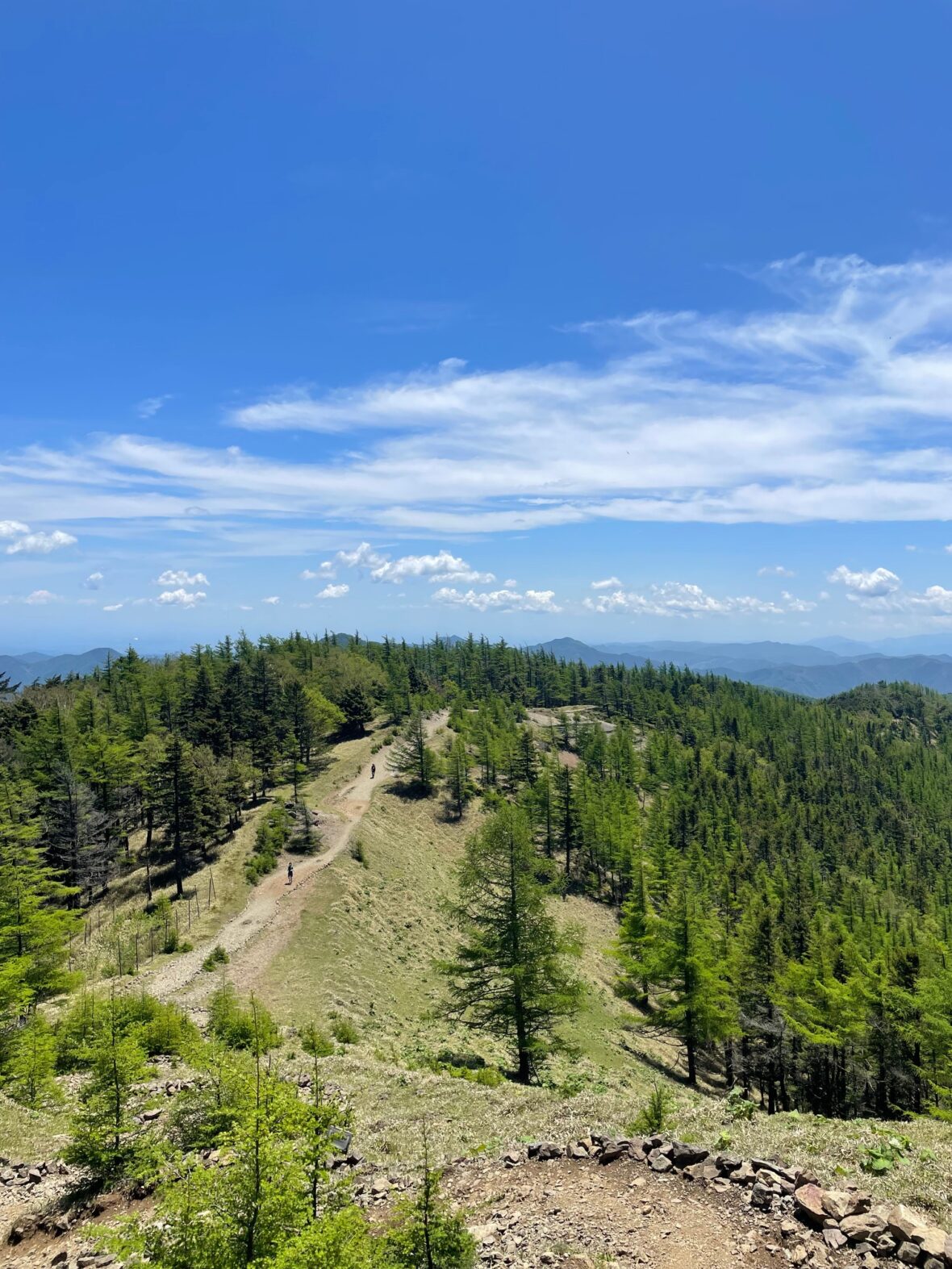
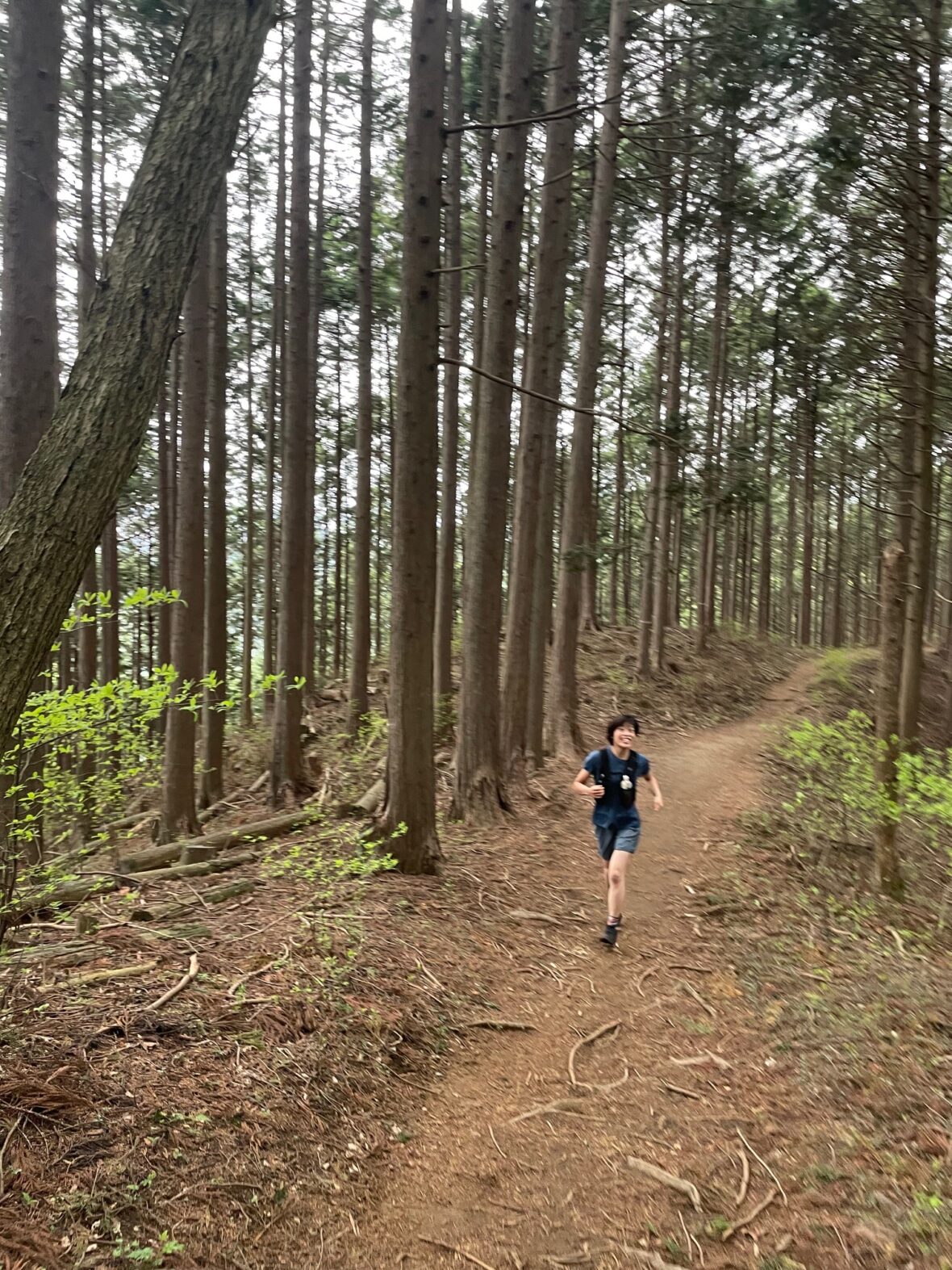
From here, the character of the run shifts.
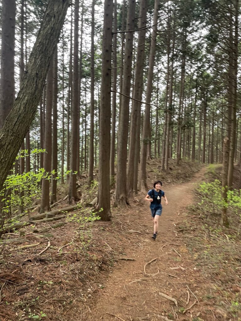
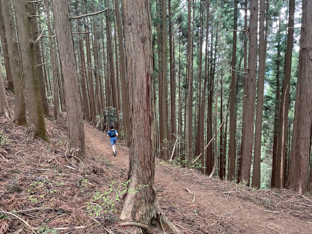
The Konpira Ridge is exceptionally runnable — long, gentle, and incredibly smooth with flowing downhill sections. It truly feels designed for trail running.
Although there are occasional signposts, the trail is mostly straightforward and difficult to get lost on.
Mount Konpira’s (金毘羅山) summit itself is forested with limited views. A traverse trail allows you to bypass the summit if you prefer to maintain flow.
The final section descends onto pavement, followed by approximately 1 km through a quiet residential area before reaching Musashi-Itsukaichi Station (武蔵五日市駅).
Estimated Time
Japanese Standard Hiking Time: 7 hours 57 minutes
My Time (example): 3h 55m
9:00 Mitake Station → 10:30 Tokyo Mitake Visitor Center → 10:50 Mt. Hinode → 12:55 Musashi-Itsukaichi Station
Estimated trail running times:
• Strong intermediate: 2.5 – 3.5 hours
• Moderate pace with breaks: 4 – 5.5 hours
Always allow buffer time for navigation and train schedules.
FAQ: Running the Mitake to Musashi-Itsukaichi Ridge
Q: Is it okay to run through the Musashi-Mitake Shrine area?
A: Yes, but please be respectful. This is a sacred site with deep spiritual history. We recommend walking through the main shrine grounds and keeping your voice down. Showing respect ensures that trail runners remain welcome in this beautiful area.
Q: What if I’m not a strong climber?
A: No problem—take the “shortcuts”! You can take a local bus from Mitake Station to the cable car station, then ride the cable car up near the summit. This saves you about 1.1km and 400m of vertical climbing! It’s a great way to save your energy for the spectacular, runnable ridgeline that follows.
Q: Are there places to buy food or water on the trail?
A: There are no convenience stores on the trail. You can find vending machines near the shrine area and the Mitake Visitor Center, but once you leave Mt. Hinode, there is no water for the final 12km. Be sure to fill your flasks completely before leaving the shrine area!
Q: Is the trail marked in English?
A: Most signs on this trail are in Japanese only, with very few English translations. To avoid missing a turn during those fast, flowing descents, I strongly recommend downloading my GPX file to stay on track.
Q: Can I run this route in the summer?
A: It’s possible, but be prepared for intense humidity. Even at 900m, the Japanese summer is punishing. Start as early as possible (aim for a 7:00 or 8:00 AM start at Mitake) and carry more water than you think you’ll need!
Worth a Stop Along the Way
Tokyo Mitake Visitor Center
Located near the top of the approach trail. Stop here for restrooms and to explore engaging exhibits on Okutama’s unique wildlife and nature. It’s a great way to deepen your connection to the mountains you’re running.
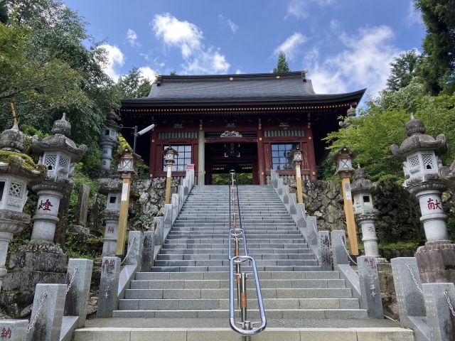
Musashi-Mitake Shrine
A 10-minute walk from the visitor center. This ancient shrine sits near the summit of Mt. Mitake (929m). It’s a perfect detour to experience Japan’s mountain worship traditions and add a spiritual dimension to your run.
Seoto-no-Yu (Onsen)
The ultimate post-run recovery. Take a short bus ride from Musashi-Itsukaichi Station to soak in these local hot springs. It’s the best way to experience authentic Japanese trail culture while soothing your tired legs.
Upgrade Your Run with the Full Guide
🏃♂️ Personalized Trail Planning
Looking for a custom itinerary? I also offer personalized trail planning tailored to your fitness level and schedule. Feel free to contact me for a bespoke running plan!
👉[Check out my Custom Itineraries here]