
This 12.8 km loop starting and finishing at Musashi-Yokote Station is the perfect half-day adventure.
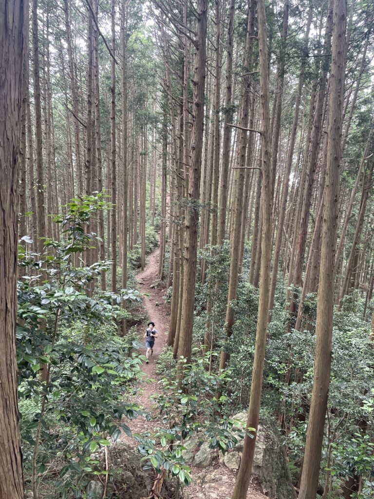
With 80% of the route on trail and minimal pavement, it offers a pure, high-quality trail run that feels miles away from the city.
Why choose this route?
・The “Two-Part” Strategy: The route naturally divides into two distinct sections—the northern Yugate area and the southern Tenkakusan area—giving the run great variety and a satisfying rhythm.
・Built-in Safety Net: Because the course passes directly by Higashi-Agano Station halfway through, you have a “get-out-of-jail-free card.” If you’re short on time or feeling tired, you can simply finish there.
・Highly Runnable: The trails are smooth and flowing. While there are a few short, steep climbs, they are over quickly, allowing you to maintain a steady and enjoyable pace.
・Trail-Focused: With roughly 80% of the route on dirt, you get an authentic mountain experience without the boredom of long road sections.

Who Is This Route For?
・Visitors staying in Tokyo without a car
・Runners looking for a half-day mountain experience
・Those who prefer runnable trails over technical terrain
・Anyone wanting a flexible route with a built-in escape option
Quick Facts & Access
Start / Finish: Musashi-Yokote Station
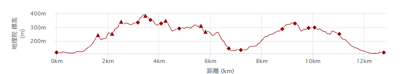
Distance: 12.8 km
Elevation Gain: 767 m
Escape Option: Higashi-Agano Station (midpoint)
Moderate pace with breaks: 3–4.5 hours
Best season: Autumn to Spring (roughly September through May)
⚠Summers are very hot and humid in this area. Plan carefully and start early if running in warmer months.
GPX:Dawnload here
Note: To help us improve our guides for the climbing community, please answer a quick 2-minute survey to unlock the GPX download link.
Access to Musashi-Yokote Station: From Shinjuku:
1.Take the JR Yamanote Line to Ikebukuro Station.
2.From Ikebukuro: Transfer to the Seibu Ikebukuro Line. Take a train bound for Hanno.
3.At Hanno Station, switch to the local train bound for Seibu-Chichibu. Musashi-Yokote is the third stop from Hanno.
(Approx. travel time: 1 hr 15–30 min. All covered by Suica/PASMO)
⚠ Trains run roughly 1–2 times per hour beyond Hanno. Check the return timetable before entering the mountains.
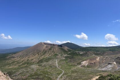
Peaks & Facilities
・Mt. Atago (250 m)
・Mt. Fukazawa (350 m)
・Omine Takamine (390 m)
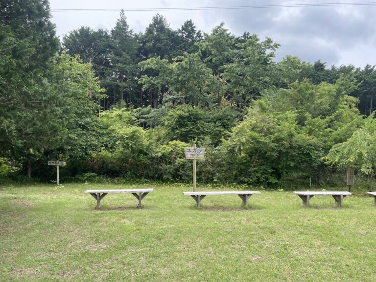
・Yugate (290 m)
・Kuzumisaka (pass)
Facilities
Convenience Stores on Route: None
Toilets Available:
・Musashi-Yokote Station
・ Yugate
Water: There is no water access. Carry sufficient water, especially in warmer months.
Summer conditions can be extremely hot and humid due to the relatively low elevation.
Route Breakdown
Section 1: Musashi-Yokote → Yugate → Higashi-Agano
Distance: ~7 km
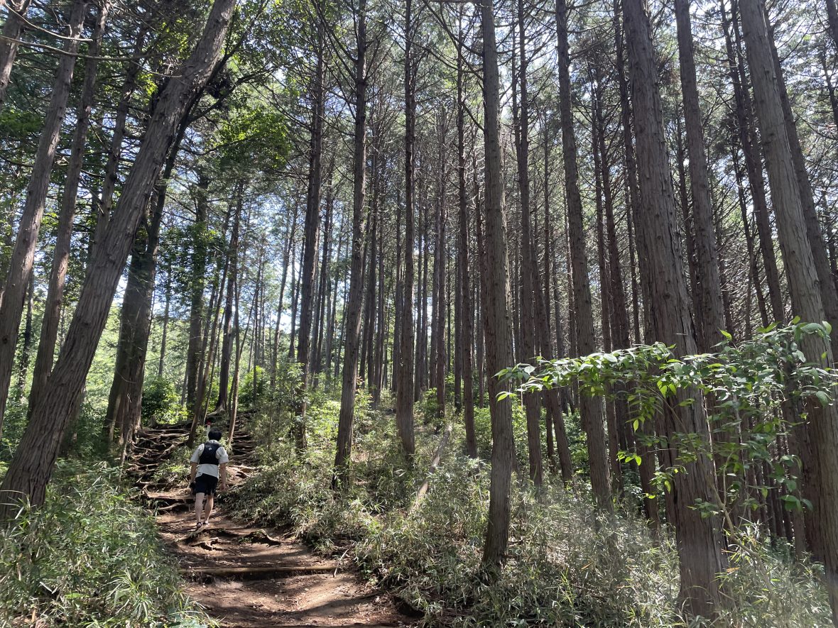
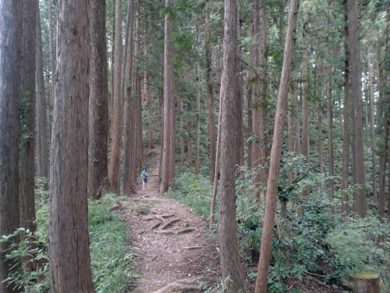
The route begins by heading toward Chonenji(長念寺) Temple before entering singletrack.
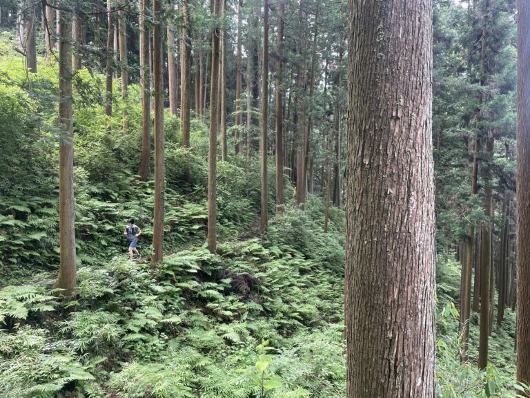
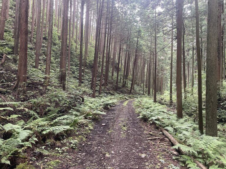
Expect rolling terrain with several short but punchy climbs. None of the ascents are long, and most are runnable depending on fitness level.
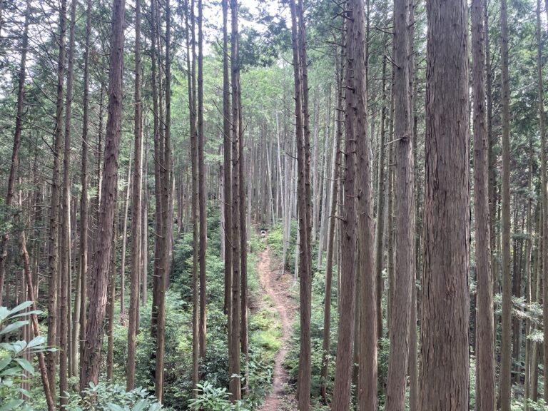
After merging with the trail near Kitamuki-Jizo(北向地蔵), the climbing gradually eases.
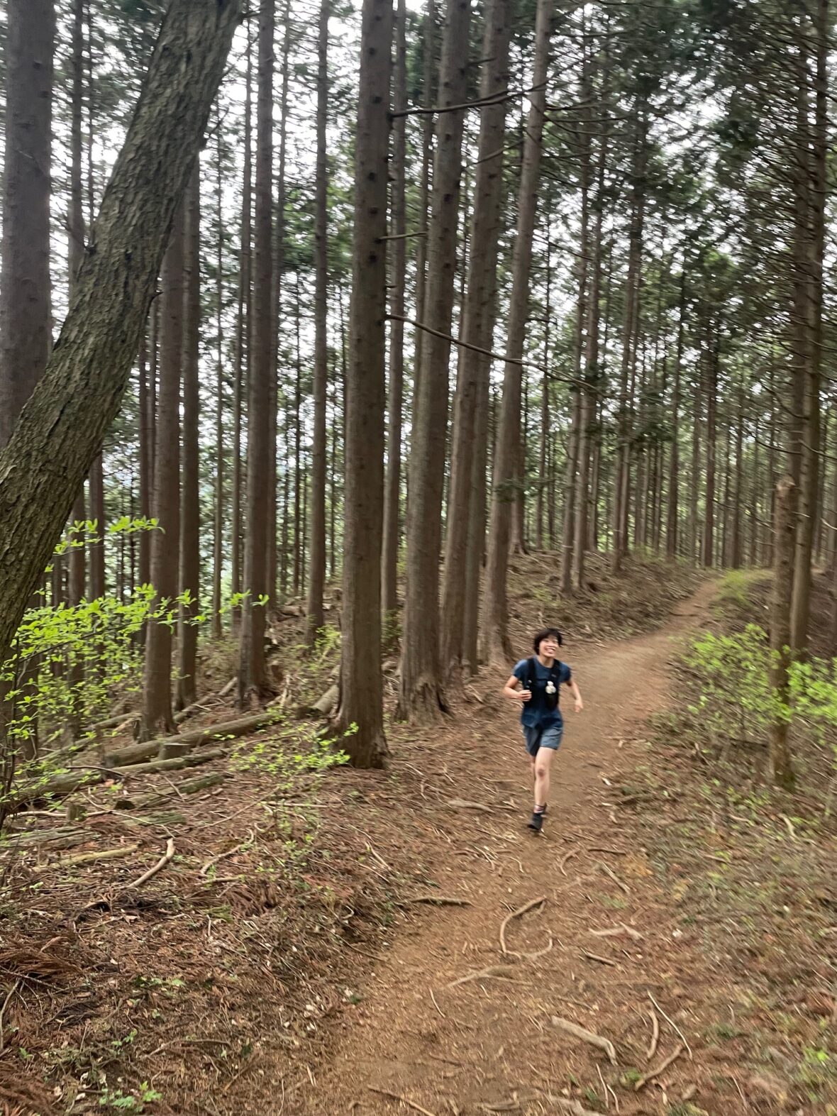
From here to Yugate (ユガテ), the trail becomes notably smooth and flowy.
This section is one of the most runnable parts of the course.
From Yugate, descend toward Higashi-Agano Station.
(Yugate has public toilet and Benches)
⚠ Escape Option:
If necessary, you can end your run at Higashi-Agano Station and return to Tokyo from there.
Section 2: Higashi-Agano → Tenkakusan Area → Musashi-Yokote
Distance: ~6 km
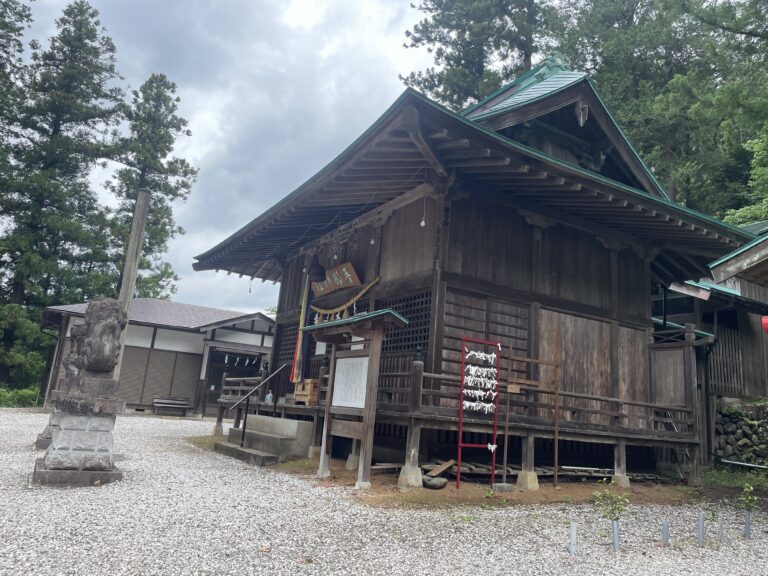
After a short paved transition near Agano Shrine, the course climbs gradually toward the Tenkakusan(天覚山)area.
Compared to the first half, the climb here is steadier and slightly less punchy.
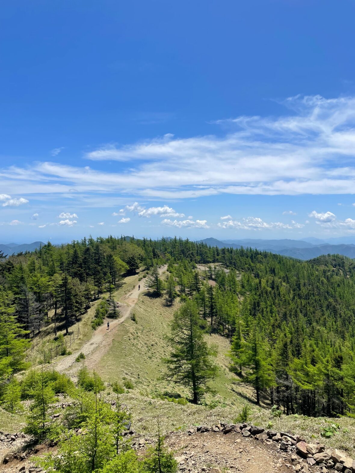
The trail along the Hanno Alps ridgeline is well-marked and generally easy to follow.

Instead of summiting Tenkakusan directly, the route traverses east from Azuma Pass toward Kuzumisaka(久須美坂).
This ridgeline section is consistently runnable and fast.
From Kusumizaka, descend back toward Musashi-Yokote Station.
Navigation & Trail Conditions
🚩 Navigation Notes
Overall, this course is relatively straightforward.
However, pay attention at:
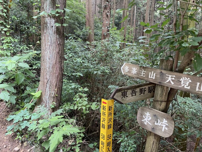
・Kitamuki-Jizo: A junction with multiple trails. Follow the signs for Yugate.
・Azuma Pass (東峠): Ensure you head east toward Kuzumisaka (look for signs pointing to Mt. Tonosu/多峯主山).
Signage is generally clear, but checking your GPX at major intersections is recommended.
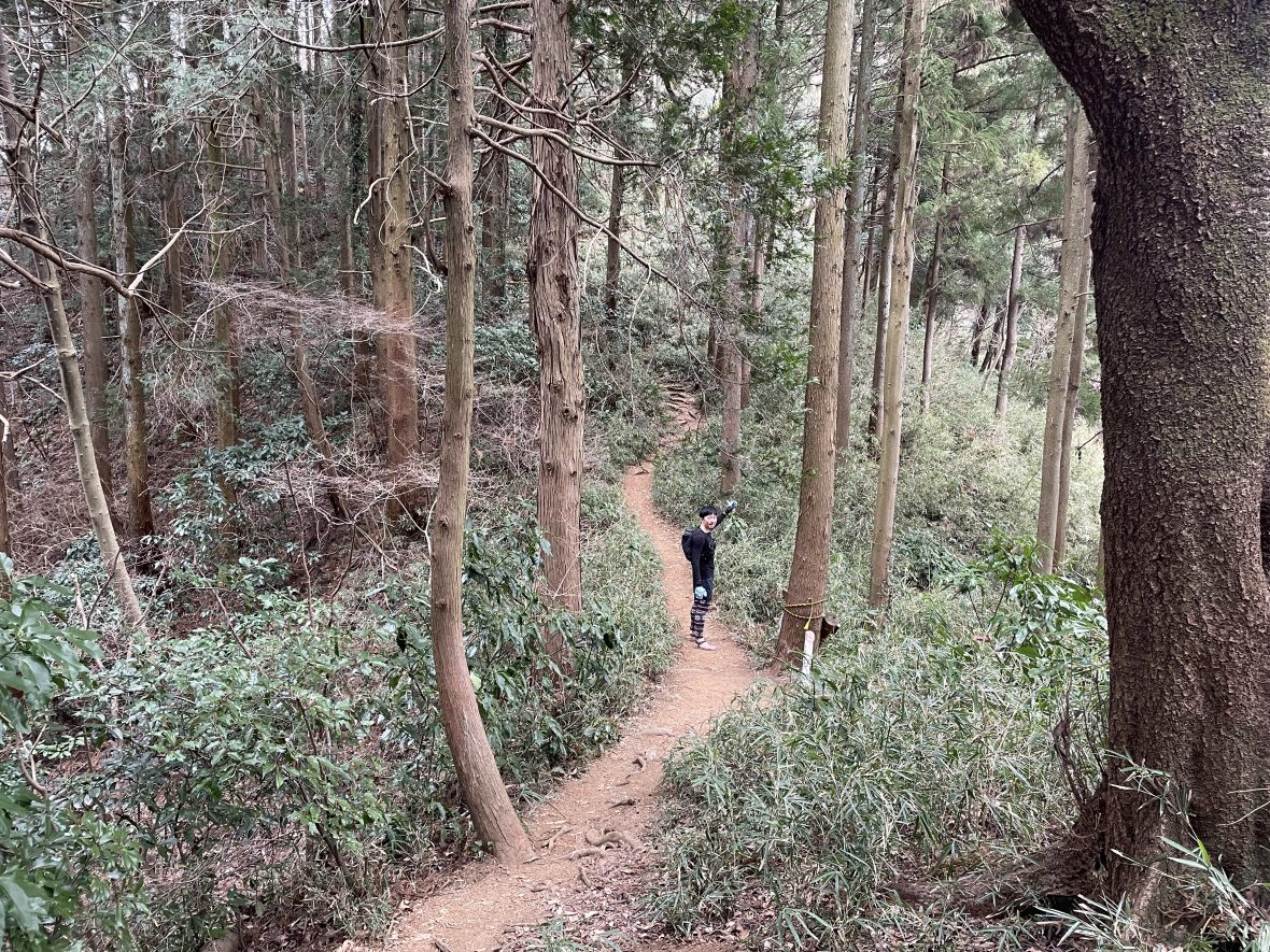
⚠️ A Note on the Final Descent
The last stretch back to Musashi-Yokote follows a beautiful riverside path, but it can become deceptive after rain.
I’ve personally taken a spill here after a rainy day! The wooden steps can be incredibly slick when hidden under damp, fallen leaves. Keep an eye out for hidden steps!
Estimated Time
Japanese Standard Hiking Time: 6 hours 28 minutes
My Time (example): 3h 05m
8:15 Musashi-Yokote Station → 10:00 Higashi-Agano Station → 11:20 Musashi-Yokote Station
Estimated trail running times:
・Strong intermediate runner: 2.5–3 hours
・Moderate pace with breaks: 3–4.5 hours
Always allow buffer time for navigation and train schedules.
FAQ: Running the Musashi-Yokote Loop
Q: Is this route beginner-friendly?
A: Yes! While there are some climbs, the trails are well-maintained and the escape option at Higashi-Agano Station makes it very safe for those new to Japanese trails.
Q: Do I need technical trail running shoes?
A: Highly recommended. While some sections are smooth, the final descent can be slippery, and the 767m of elevation gain requires good grip.
Q: Are there places to buy food or water on the trail?
A: There are no convenience stores on this route. However, you can refill your water at the vending machines at Higashi-Agano Station, which you will pass at the midpoint (approx. 7km).
Please note: There are NO vending machines or water sources on the actual mountain trails (including Yugate). You must carry at least 500ml to 1 liter of water and all your snacks before you start running. I recommend stocking up at Ikebukuro or Hanno Station!
Q: Can I run this route in the summer?
A: It’s possible, but be prepared for high humidity and heat. Because the elevation is relatively low, it stays warm. Early morning starts are a must from July to September.
Q: Is the trail marked in English?
A: Most signs on this trail are in Japanese only, with very few English translations. To avoid getting lost at confusing junctions, I strongly recommend downloading my GPX file to stay on track.
Upgrade Your Run with the Full Guide
🏃♂️ Personalized Trail Planning
Looking for a custom itinerary? I also offer personalized trail planning tailored to your fitness level and schedule. Feel free to contact me for a bespoke running plan!
👉[Check out my Custom Itineraries here]