
If you’re looking for a truly runnable trail near Tokyo, this 17.3 km point-to-point from Sagamiko to Takao is one of the best options in the area.
The elevation gain is manageable for the distance, and the South Takao ridge section offers some of the most flowing, continuous running you’ll find within an hour of the city.
The route also solves one of the biggest frustrations with trail running in this area: the crowds. By starting from Sagamiko instead of Takao, you skip the most congested section of Mt. Takao entirely and join the ridge where the trail opens up and the running gets good. This is a perfect step up from shorter routes around Mt. Takao, offering both distance and sustained runnable terrain.
Why choose this route?
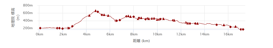
・Highly runnable terrain: At 17.3 km with 1,139 m of elevation gain, the ratio of climbing to distance is lower than most routes in the area. Long flat sections, plenty of bypass trails (makimichi — contour trails that avoid steep climbs) after Odarumi Pass, and a predominantly downhill second half mean you can keep moving from start to finish.
・Skips the crowds: Starting from Sagamiko lets you bypass the tourist-heavy Mt. Takao summit area entirely. The South Takao ridge has just enough other runners and hikers to feel comfortable, without the bottlenecks.
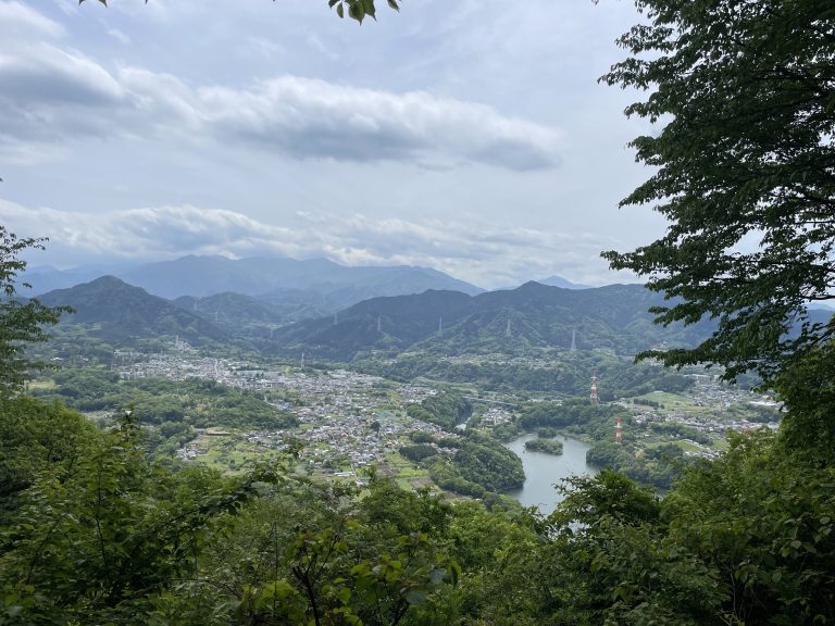
・Scenic variety: Lake Tsukui, the Nishiyama Dragon wood sculpture, a mountaintop teahouse with legendary kakigori (shaved ice) — there’s enough to look forward to that the distance never drags.
Who Is This Route For?
・Runners ready to step up from shorter routes in the Takao area
・Those who prefer gradual, sustained running over constant steep climbs and descents
・Visitors to Tokyo without a car looking for a full day on the trails
・Anyone who’s run the shorter Takao area routes and wants more
Quick Facts & Access
Distance: 17.3 km
Elevation Gain: 1,139 m (approx. 3,740 ft)
Start: Sagamiko Station (JR Chuo Line)
Finish: Takao Station (JR Chuo Line)
Moderate pace with breaks: 5 – 6 hours
Level: Beginner–Intermediate
Best season: Autumn to Spring (roughly September through May)
⚠ Summers are very hot and humid. Plan carefully and start early.
GPX: Download here.
Note: To help us improve our guides for the climbing community, please answer a quick 2-minute survey to unlock the GPX download link.
Access from Shinjuku:
1.Take the JR Chuo Line to Takao Station.
2.Transfer to the local service one stop further to Sagamiko Station.
(Approx. 55 min total. Fully covered by Suica/PASMO)
Peaks & Facilities
Peaks & Landmarks
・Kobotoke-Shiroyama (小仏城山) (670.3 m): The high point of the route and home to Shiroyama Chaya — a beloved mountain teahouse famous for its kakigori (shaved ice) and nameko mushroom soup. Busy, lively, and a great mid-run stop.
・Mount Oborayama (大洞山) (536 m): A quiet peak marking the transition onto the South Takao ridge.
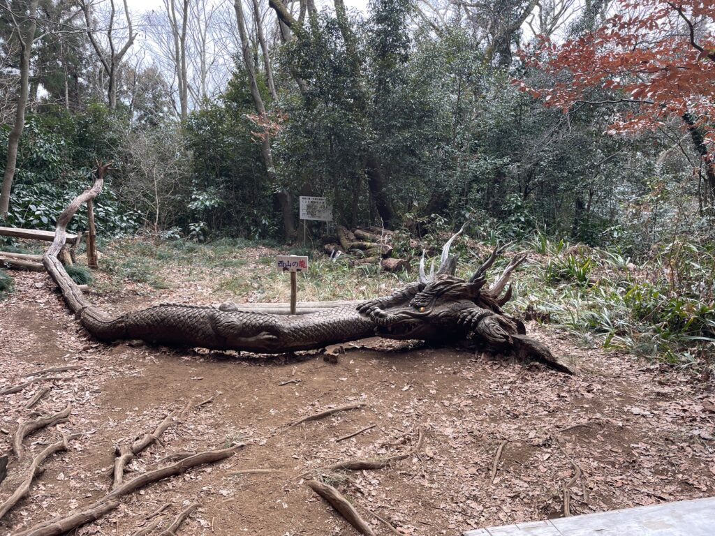
・Nishiyama Dragon (西山の龍): A large dragon carved from a fallen tree by chainsaw — one of the most unexpected and memorable sights on any trail run near Tokyo.
・Mount Kusatoyama (草戸山) (364 m): The final major peak before the descent to Takao Station.
Facilities
Convenience Stores: Near Sagamiko Station (turn right, approx. 500 m) and Takao Station (both exits)
Toilets: Sagamiko Station, Tokaido Nature Trail entrance, Kobotoke-Shiroyama summit, Takao Station
Water: Stock up at Sagamiko Station. The only reliable resupply point is Shiroyama Chaya at Kobotoke-Shiroyama (see FAQ). After that, there are no water sources until Takao Station.Carry at least 0.5–1L from the summit onward.
Route Breakdown
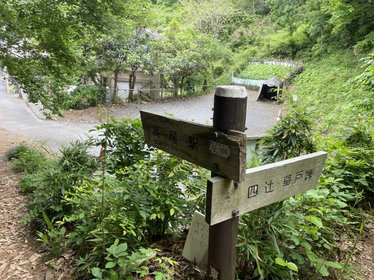
Sagamiko Station → Tokaido Nature Trail Entrance
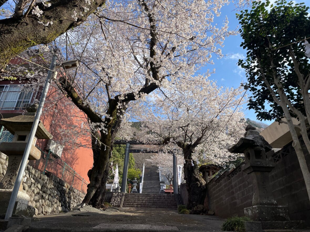
The run starts from Sagamiko Station — a surprisingly well-equipped little station with coin lockers, a changing room for hikers and runners, and even a snack vending machine.
The first 2 km follows paved road. You can take the old Koshu Kaido road directly to the Tokaido Nature Trail entrance, but there’s also a trail shortcut that cuts through the trees alongside a small river.
It’s a slight detour, but the sound of running water makes it a pleasant way to ease into the run.

The Nature Trail entrance has a public toilet — the last one until the summit, so worth a stop.
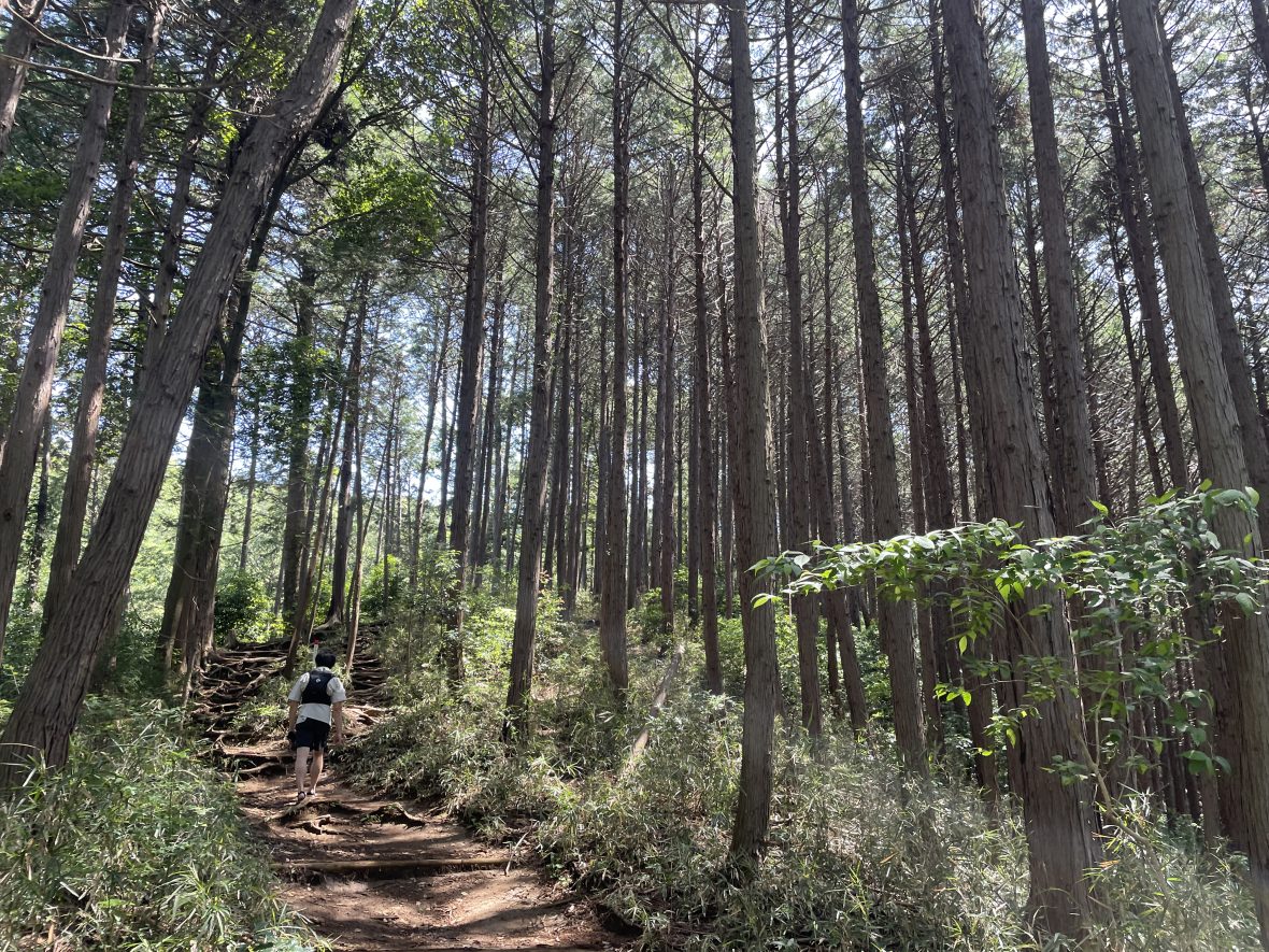
Tokaido Nature Trail → Kobotoke-Shiroyama
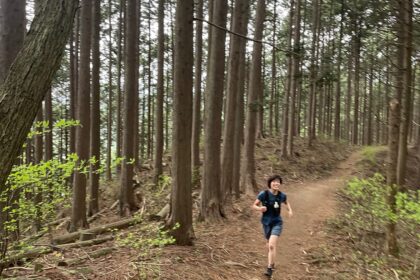
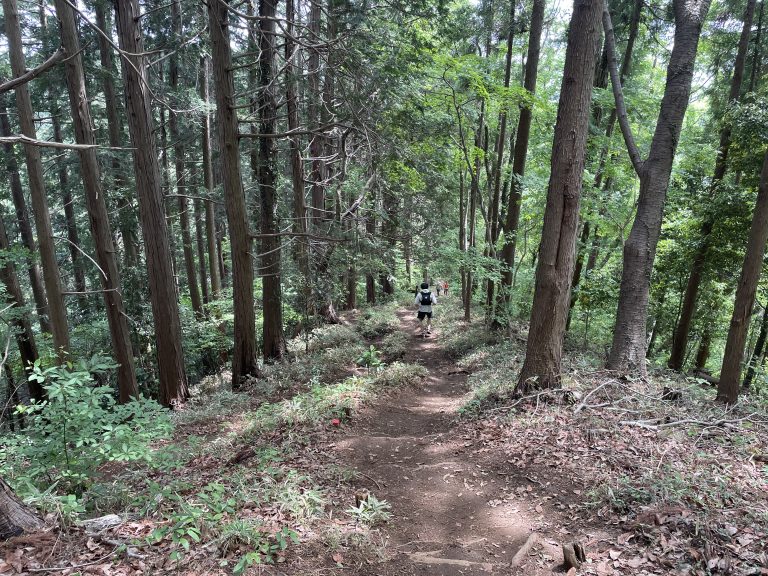
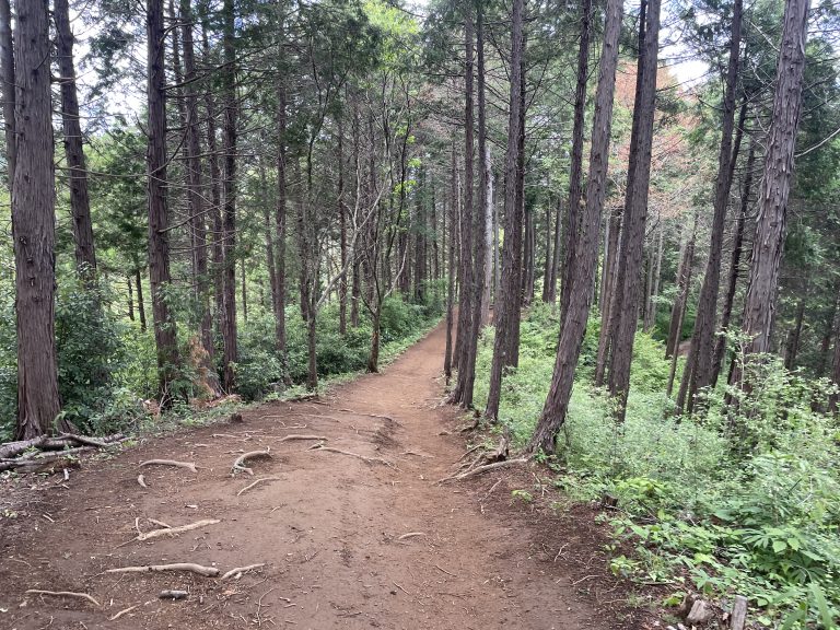
From the trailhead, it’s roughly 2 km of climbing to the summit of Kobotoke-Shiroyama.
The path is well-used and the gradient is steady without being brutal. On my run, there were noticeably more trail runners than hikers on this section — a sign that the local running community knows something.

Arriving at the summit about 1 hour 15 minutes from the station, the first thing you notice is the crowd. After a quiet climb, the teahouse atmosphere is a genuine surprise — hikers, families, and runners all gathered around Shiroyama Chaya, with staff enthusiastically calling out the day’s menu.

The kakigori comes in two sizes — and the larger “Shiroyama-mori” is seriously generous, the kind of size that one person could never finish alone. It looked incredible, and honestly, Shiroyama Chaya alone seems to be reason enough for many hikers to make the trip.
Take a proper break here. This is the highest point on the route and the last reliable food stop before Takao Station.
Kobotoke-Shiroyama → Odarumi Pass → Nishiyama Dragon
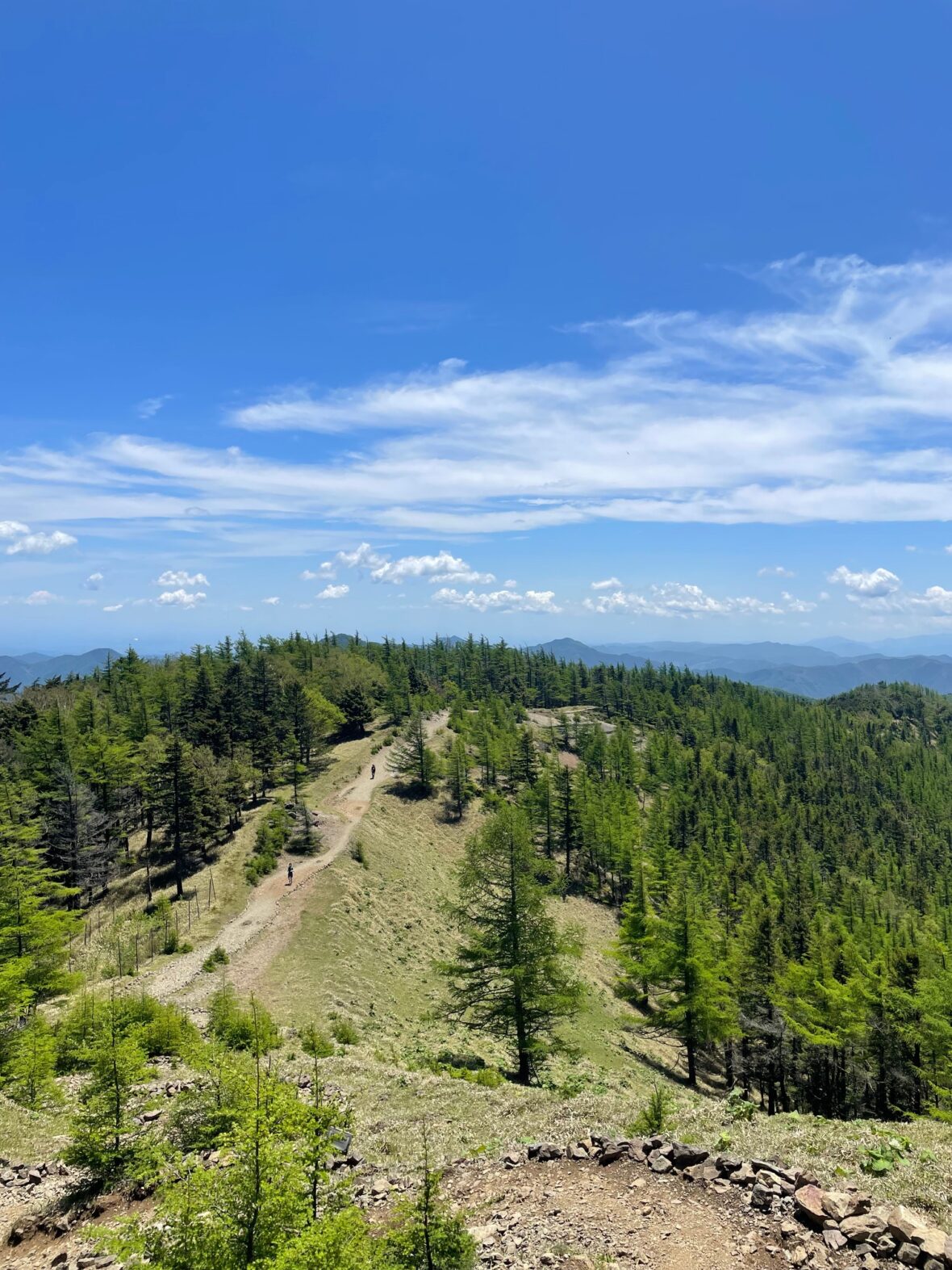
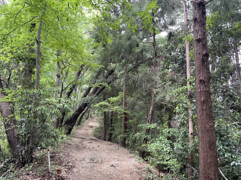
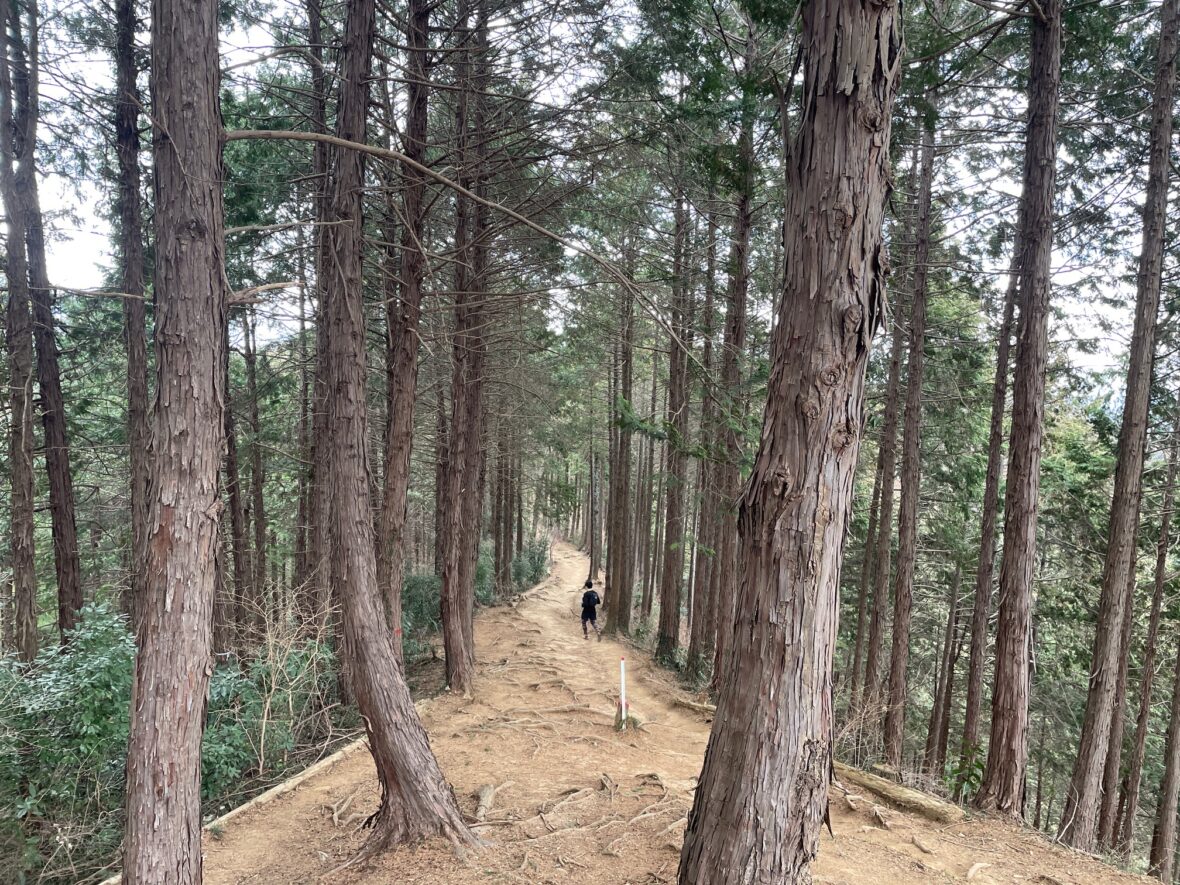
From the summit, the course heads toward Odarumi Pass. This is where the run really opens up.

Kobotoke-Shiroyama is the highest point on the route, so from here it’s predominantly downhill or flat — and the trail quality matches.
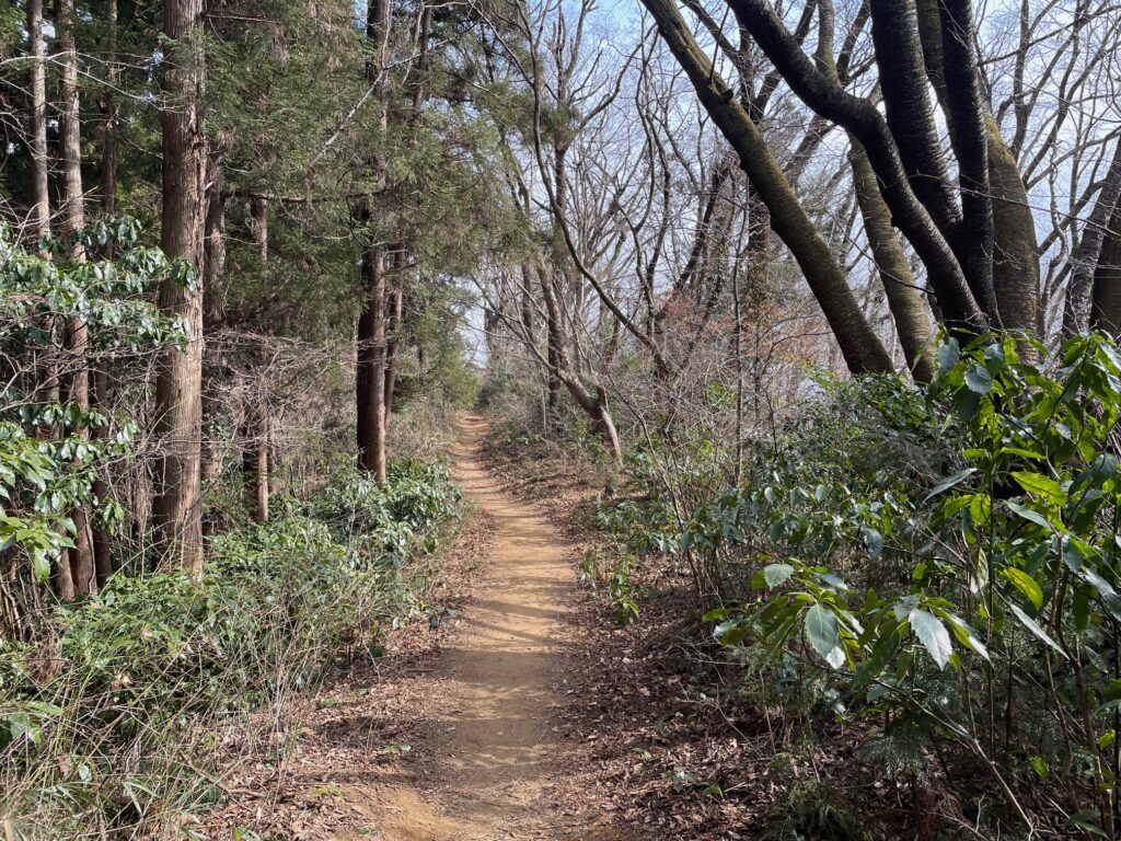
Wide, smooth, flowing singletrack continues along the South Takao ridge, and with bypass trails (makimichi) around the steeper peaks, you can keep running comfortably without interruption.
This section is what makes the route special for runners who want to actually run.
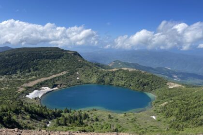
Along the way, a gap in the trees reveals Lake Tsukui — the bright blue water catching you off guard on a clear day.
Then comes the Nishiyama Dragon (西山の龍). Carved from a fallen tree by a local artist in 2021, this large chainsaw sculpture sits right on the trail and stops almost everyone in their tracks.
There’s even a smartphone stand set up nearby for photos. The wood deepens and gains presence every year — worth pausing for. Just beyond it, keep an eye out for a smaller owl carving in a tree trunk.
Nishiyama Dragon → Mount Kusatoyama → Takao Station
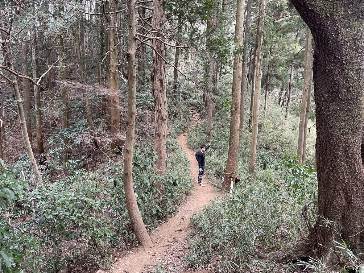
After the dragon, the trail continues along the South Takao ridge toward Mount Kusatoyama.
The path is wide and comfortable here, and the combination of open trail and manageable gradient makes this one of the most enjoyable sections of any trail run in the Takao area. Not isolated, not crowded — just good running.
One honest warning: when you reach the summit of Mount Kusatoyama, your brain will tell you that you’re almost done. You are not. It’s still approximately 1 hour 30 minutes to Takao Station from here, with some rolling ups and downs that feel surprisingly demanding on tired legs.
Enjoy the view from the summit, have a snack, and reset your expectations before heading down.
The final descent brings you back to the suburbs. From the paved road, it’s a short run through a residential neighbourhood to Takao Station North Exit — where the route officially ends, and where a convenience store is immediately available for post-run supplies.
Estimated Time
Japanese Standard Hiking Time: 9 hr 16 min
My Time (example): 4 hr 50 min
09:40 Sagamiko Station → 11:00 Kobotoke-Shiroyama → 12:30 Nishiyama Dragon → 13:05 Mount Kusatoyama → 14:30 Takao Station
Estimated trail running times:
・Strong intermediate runner: 3.5 – 4.5 hours
・Moderate pace with breaks: 5 – 6 hours
Always allow extra time for train schedules.
FAQ: Sagamiko to Takao
Q: The route starts at Sagamiko and finishes at Takao — how do I get back to my starting point?
A: No need to worry. Both stations are on the JR Chuo Line, just one stop apart. From Takao Station, it’s a 5-minute train ride back to Sagamiko if needed — though most runners simply head back to Tokyo directly from Takao Station, which has excellent connections to Shinjuku and beyond.
Q: Where can I get water on the route?
A: The only resupply point between the two stations is Shiroyama Chaya at the summit of Kobotoke-Shiroyama, where you can buy drinks and food — cash only. That said, teahouses can occasionally be closed without notice, so don’t rely on it entirely. Carry at least 1L of water from the start.
Q: Does Shiroyama Chaya accept card payments?
A: No — cash only. Bring enough yen before you start.
Q: I thought this area was crowded. Will I be stuck behind hikers?
A: The route is specifically designed to avoid the most congested parts of Mt. Takao, so you won’t hit the tourist bottlenecks. That said, the area around Kobotoke-Shiroyama and Shiroyama Chaya draws a lot of hikers and families and can get busy. In this section, yield to hikers and walk rather than run when passing — the standard trail etiquette applies.
Q: What is the Nishiyama Dragon?
A: A large dragon sculpture carved from a fallen tree using a chainsaw, created in 2021 by a local artist named Ito-san. It’s become a genuine landmark and rest spot on the trail, complete with a smartphone stand for photos. The wood has grown more striking every year. There’s also a smaller owl carving nearby.
Q: How far is it from Mount Kusatoyama to Takao Station?
A: About 1 hour 30 minutes at a running pace, or around 2.5 hours at a standard hiking pace. It feels closer than it is — the rolling ups and downs after Kusatoyama have a way of catching tired legs off guard. Don’t make the mistake of thinking you’re almost done when you reach the summit.
Upgrade Your Run with the Full Guide
🏃♂️ Personalized Trail Planning
Looking for a custom itinerary? I also offer personalized trail planning tailored to your fitness level and schedule. Feel free to contact me for a bespoke running plan!
👉[Check out my Custom Itineraries here]
This is part of a series of trail running routes near Tokyo, from beginner to longer runs.
👉 Looking for more trail running routes in Takao area? Check out my complete guide here.
👉 Ready to explore more? See the full list of Tokyo trail routes here