
If you’ve already ticked off a beginner trail run near Tokyo and you’re ready for the next step, this 10.2 km loop from Sagamiko Station is one of the most satisfying options in the Takao area.
The climb is long and runnable, the descent is narrow and technical, and the whole thing is just one stop beyond Takao on the JR Chuo Line on the JR Chuo Line.
What makes this route stand out is its contrast. The first half is flowing and fast — exactly the kind of trail where you can settle into a rhythm and just run. The second half flips the script with a steep, technical descent through bamboo forest that demands your full attention.
Two very different experiences packed into a compact 10 km. This is a perfect “next step” after your first trail run near Tokyo.
Why choose this route?
・A climb you can actually run: Unlike many routes in the area, the ascent to Myoo-toge is mostly gradual and flat enough to run for long stretches. No grinding up endless switchbacks — just smooth, flowing trail.
・Technical descent for those who want a challenge: The descent back toward Sagamiko is narrow, steep in places, and genuinely engaging. It’s a great way to develop your downhill technique without committing to a long or remote course.
・Quiet trails, even on weekends: Just one station beyond the famously crowded Takao area, the trails here feel like a different world. On my visit, I didn’t pass a single person on the entire climb — then met 12 people at the summit, 11 of whom were trail runners. Clearly a local favourite.

Who Is This Route For?
・Runners who’ve done a beginner trail run near Tokyo and want more challenge
・Those who want to develop technical downhill skills
・Visitors to Tokyo without a car looking for an uncrowded trail experience
・Anyone who enjoys variety — a fast climb followed by a demanding descent
Quick Facts & Access
Distance: 10.2 km
Elevation Gain: 645 m (approx. 2,170 ft)
Start / Finish: Sagamiko Station (JR Chuo Line)
Level: Beginner–Intermediate
Moderate pace with breaks: 3 – 3.5 hours
Best season: Autumn to Spring (roughly September through May)
⚠Summers are very hot and humid. Plan carefully and start early.
Access from Shinjuku:
1.Take the JR Chuo Line to Takao Station
2.then transfer to the local service one stop further to Sagamiko Station.
(Approx. 55 min. Fully covered by Suica/PASMO)
Peaks & Facilities
Peaks & Landmarks
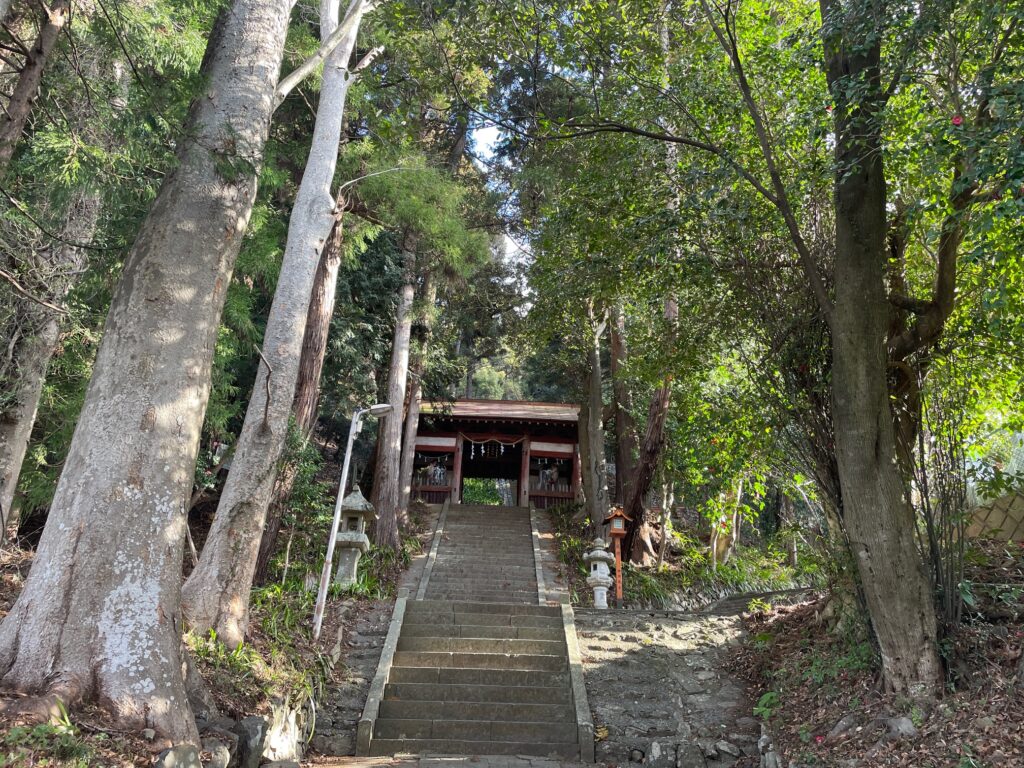
・Yose Shrine (與瀬神社): The trailhead — and worth slowing down to appreciate, especially in cherry blossom season.
・Ohira (大平): A rest spot roughly mid-way on the climb. A good checkpoint.
・Myoo-toge (明王峠) (738.9 m): The high point of the route. There’s a toilet here and an old teahouse (currently closed).
Facilities
Convenience Stores: 7-Eleven, approx. 500 m from Sagamiko Station (turn right out of the exit)
Coin Lockers: Sagamiko Station — there’s also a dedicated changing room for hikers and runners
Toilets: Sagamiko Station, and next to the old teahouse at Myoo-toge
Water: Stock up before you leave the station area. There are no vending machines or water sources on the trail. Carry at least 1L.
Route Breakdown
Sagamiko Station → Yose Shrine → Trailhead
The run starts from Sagamiko Station. It’s a well-equipped little station — coin lockers, a changing room, even a snack vending machine.
Head right out of the exit and you’ll pass a 7-Eleven about 500 m along — your last chance to stock up. From there, follow the signs toward Yose Shrine (與瀬神社).
The shrine is the official trailhead, and it’s a genuinely beautiful spot. On my visit the cherry blossoms were in full bloom and I found myself stopping just to look.
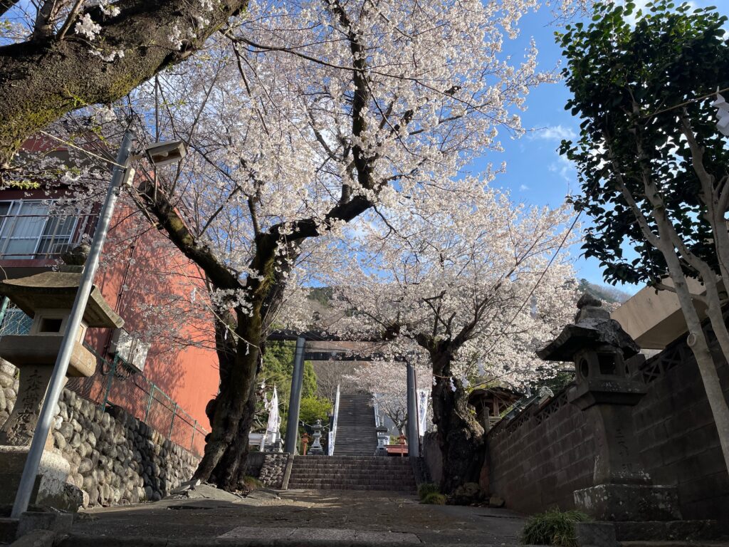
A small temple, Jigenji (慈眼寺), sits nearby at the entrance. Take a moment — then climb the 50 stone steps up to the shrine and find the trail entrance to the right of the main building. There’s a signboard, so it’s easy to spot.
Yose Shrine → Ohira → Myoo-toge
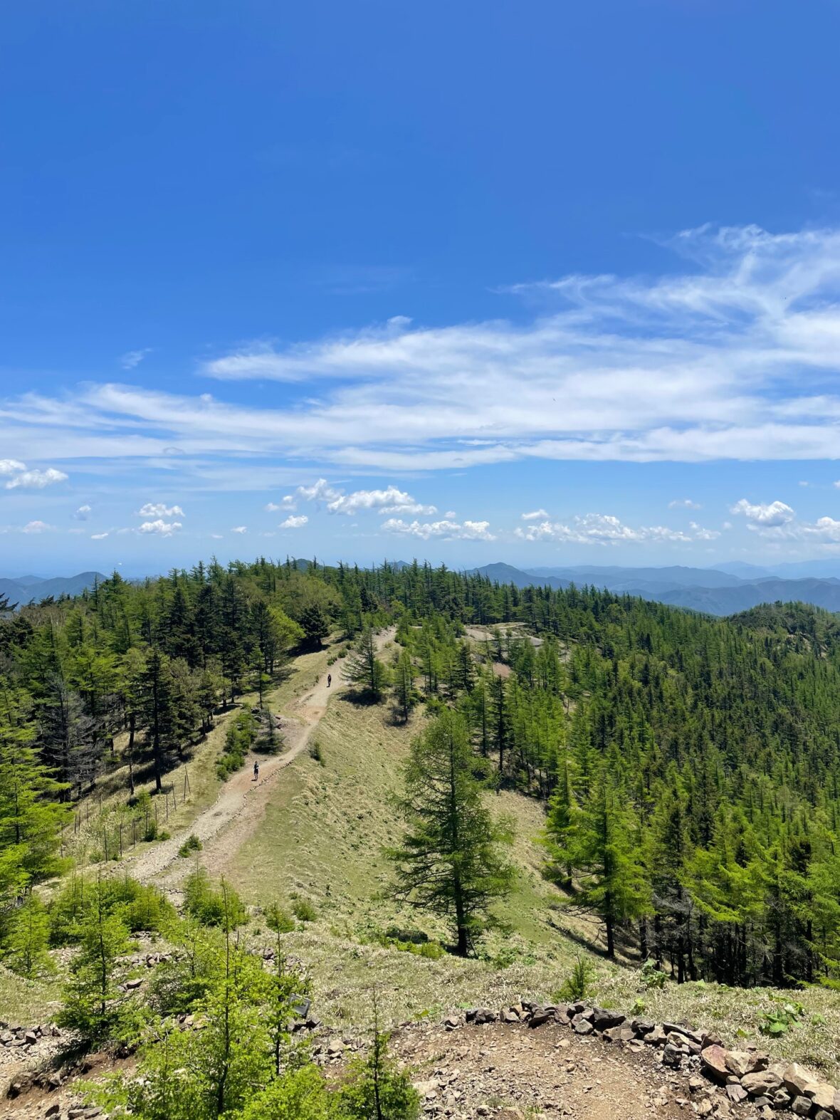
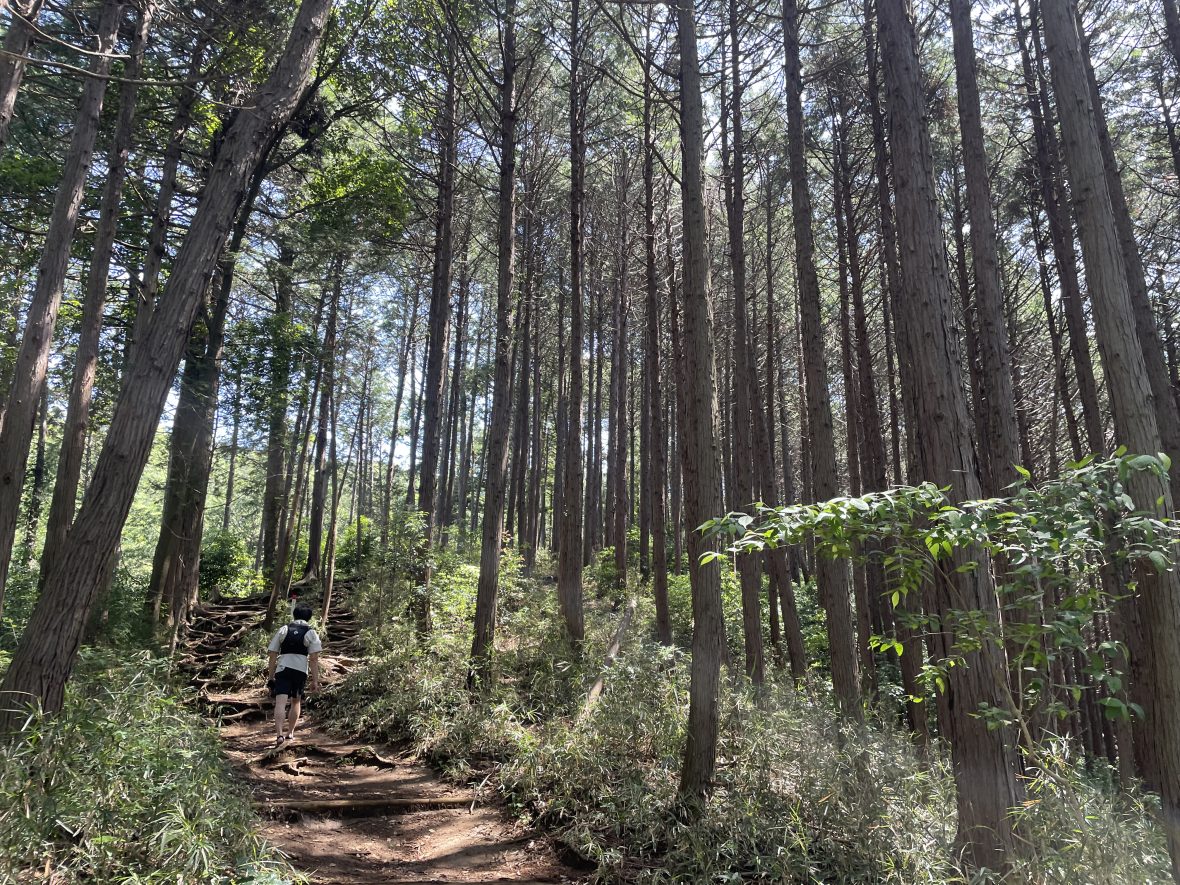
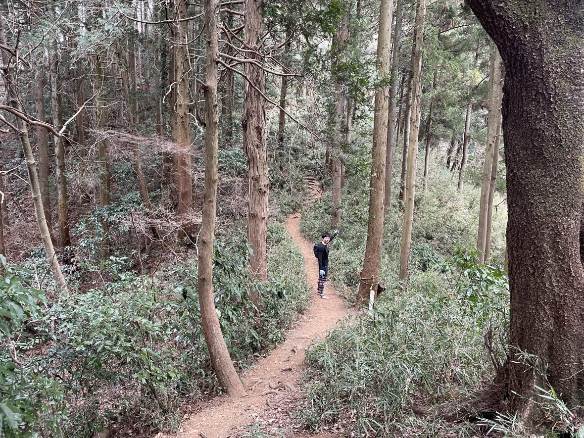
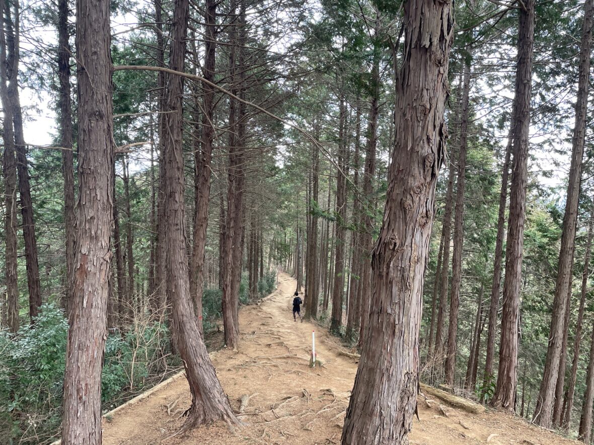
The trail starts with a short steep section, but after about 1 km the gradient eases off and the real running begins.
This is where the route earns its reputation as one of the most runnable climbs in the Takao area — long flat sections, a comfortable trail width, and just enough undulation to keep it interesting.
Along the way there are glimpses of Lake Sagamiko through the trees — a nice surprise on a clear day.
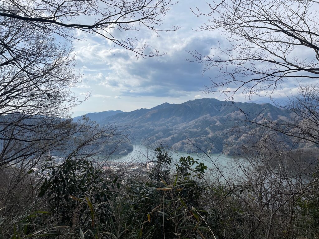
Ohira appears roughly mid-way and makes a natural rest stop if you need one. From there the trail continues in much the same vein, finishing with a short climb up wooden steps to Myoo-toge.
The summit has an old teahouse (currently closed) with a toilet beside it, and enough open space to sit and eat. I had an onigiri here and enjoyed a few quiet minutes before the descent.
One thing worth mentioning: I didn’t pass another person for the entire climb. Then at the summit, I suddenly encountered 12 people — 11 of them trail runners. It felt like a secret training ground that the local running community had quietly claimed for themselves.

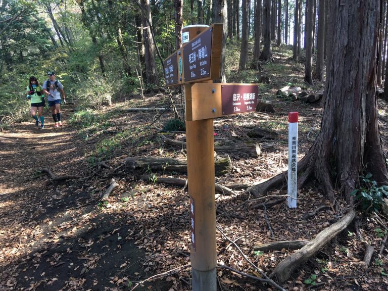
Myoo-toge → Descent → Sagamiko Station
Follow the signs toward Mt. Takao, then look for the Sokozawa (底沢) direction marker a few metres further on.

The initial descent is gentle and fast. Then the trail narrows, the gradient increases, and things get interesting.
The first section passes through dense bamboo grass — thick enough that I briefly wondered if I’d taken a wrong turn. Stay calm: the grass clears quickly and pink trail markers keep you on track throughout.
After the bamboo grass, the trail drops through a proper bamboo forest. It’s steep, narrow, rooty, and genuinely fun — the kind of descent that makes you focus completely on where your feet are landing.
The trail eventually leads out onto a paved road. From here it’s 3 km back to Sagamiko Station — flat, fast, and honestly a bit of a welcome mental reset after the intensity of the descent.
Estimated Time & Navigation
Japanese Standard Hiking Time: 5 hr 06 min
My Time (example): 2 hr 25 min
07:30 Sagamiko Station → 08:48 Myoo-toge → 09:55 Sagamiko Station
Estimated trail running times:
・Strong intermediate runner: 1.5 – 2 hours
・Moderate pace with breaks: 3– 3.5 hours
Always allow extra time for navigation and train schedules.
🚩 Navigation Notes
Overall, this course is relatively straightforward.
However, pay attention when descending from Myoo Pass
First head toward “Sokozawa Pass.”
You’ll soon come across the first trail sign, which doesn’t mention either “Sagamiko (相模湖)” or “Sokozawa (底沢),” and can feel a bit confusing.
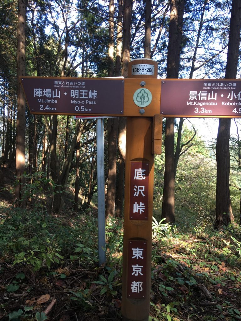
Don’t worry—if you continue a little further, you’ll find another sign that clearly indicates both “Sagamiko (相模湖)” and “Sokozawa (底沢).”
Follow that sign and turn right.
FAQ: Myoo-toge Out-and-Back
Q: Why start from Sagamiko Station instead of Takao Station?
A. Just one stop apart, but a completely different experience.
Takao Station is one of the busiest trailheads in Japan — even on weekdays, the area is packed. Sagamiko, on the other hand, is quiet enough that you may have the trail entirely to yourself. Compared to popular routes around Mt. Takao, this trail feels significantly quieter and more technical.If you want to run at your own pace without weaving through crowds, this is the better starting point.
Q: How technical is the descent? Can a beginner manage it?
A: The descent may be a little challenging for beginners. That said, there’s no shame in walking the technical parts — and with a full hiking time of around 5 hours, there’s plenty of buffer if you take it slow. Think of it as a natural next step after your first beginner trail run near Tokyo.
Q: Is it okay to pass through the shrine?
A: Yes — the trailhead runs through the grounds of Yose Shrine, and this is a well-established access point used by locals and runners alike. Please walk (don’t run) through the shrine grounds and be respectful of the space.
Q: Where’s the trickiest navigation point?
A: Myoo Pass is the trickiest navigation point. For details, please refer to the Navigation Notes above.
Q: Can I run this in summer?
A: Yes, but the elevation is relatively low and it can get hot. An early morning start is strongly recommended. Carry at least 1L of water as there are no sources on the trail.
Q: Is Yose Shrine worth visiting as a tourist attraction?
A: Yes — especially during cherry blossom season, which usually peaks in early April. The shrine’s annual festival (held in early April) has continued for over 250 years and features a portable shrine procession through the neighbourhood. The highlight is the “mikoshi staircase descent,” where the shrine is carried down the stone steps — a striking and unusual sight.
Upgrade Your Run with the Full Guide
🏃♂️ Personalized Trail Planning
Looking for a custom itinerary? I also offer personalized trail planning tailored to your fitness level and schedule. Feel free to contact me for a bespoke running plan!
👉[Check out my Custom Itineraries here]
This is part of a series of trail running routes near Tokyo, from beginner to longer runs.
👉 Looking for more trail running routes in Takao area? Check out my complete guide here.
👉 Ready to explore more? See the full list of Tokyo trail routes here