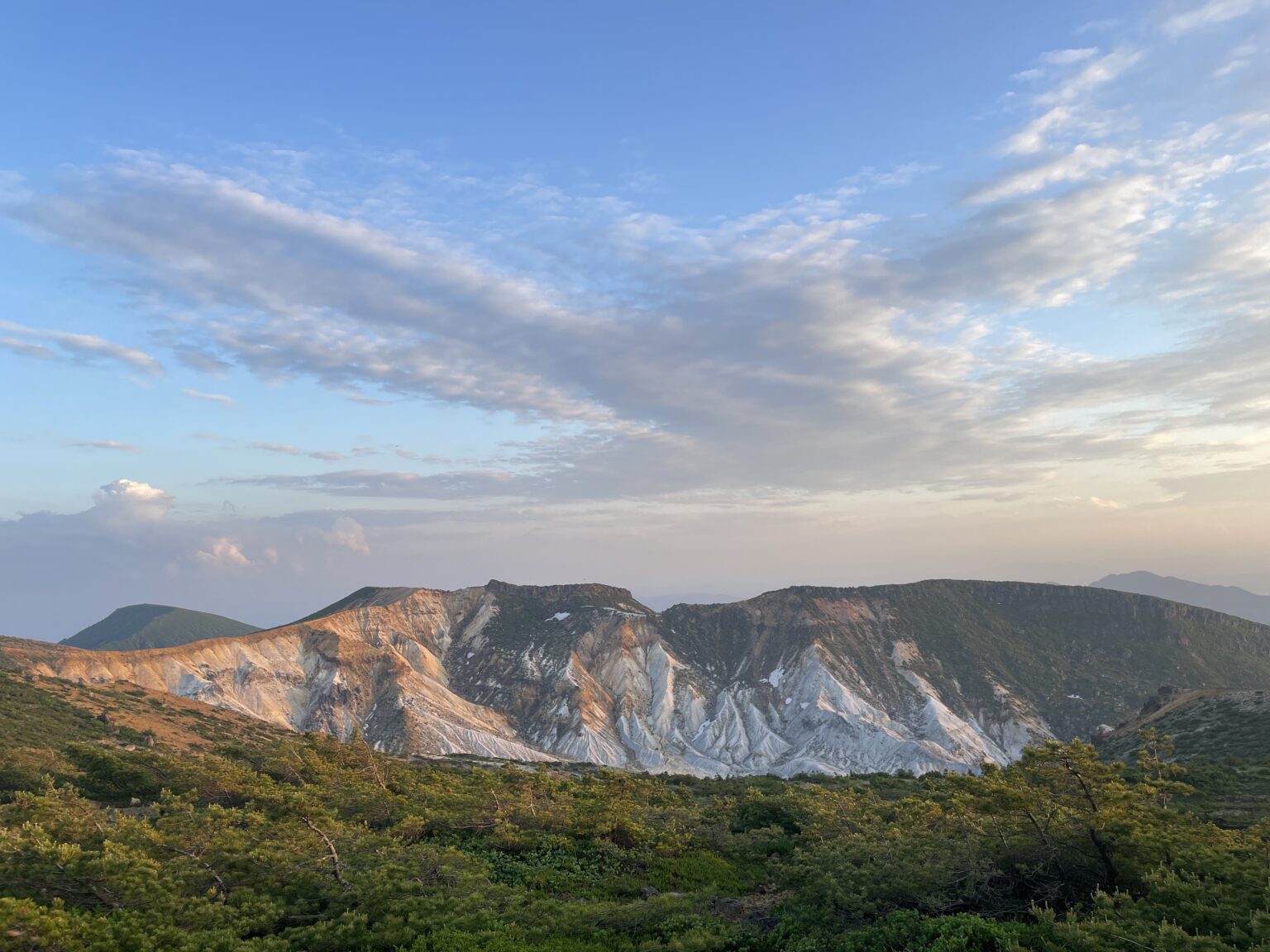
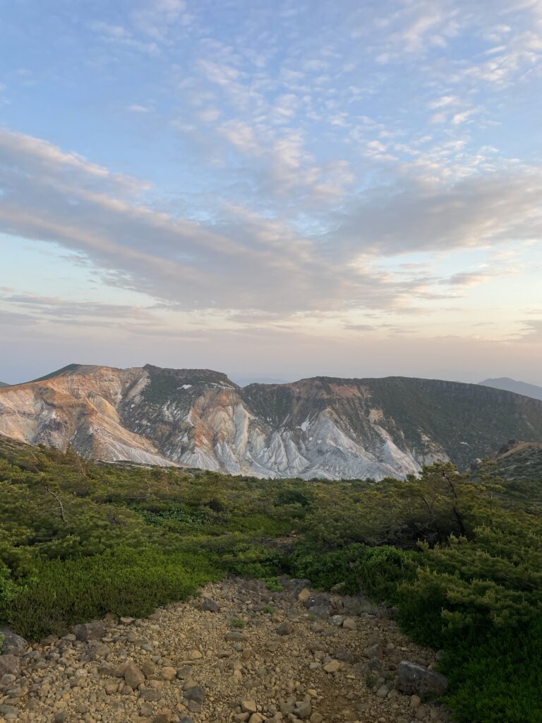
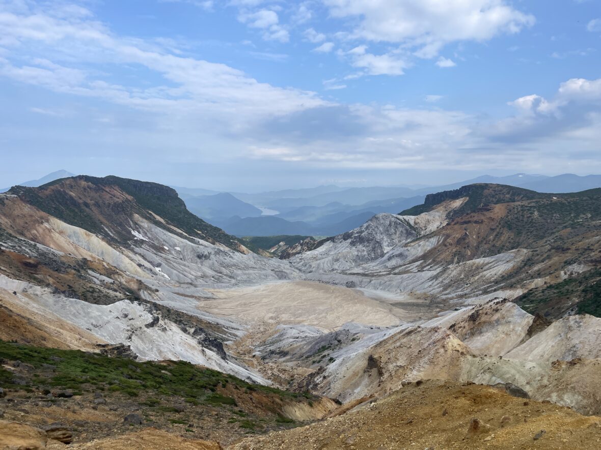
The sharply defined ridgelines. The white volcanic slopes carved by past eruptions. The vast crater basin unfolding like a folding screen painting. It was beyond beautiful — it felt sacred.
This was the most powerful view of the entire Volcano Trail. More than Day 1. More than any summit. This was the place.
Day 2 had felt like a trial. But it was all for this moment.
1.Long Trail Route Overview
Long Trail Route Overview (3 Days / 2 Nights)
• Day 1: Takayu – Nakatengu – Mt. Issaikyo – Jododaira – Mt. Azuma-Kofuji
• Day 2: Jododaira – Mt. Higashi-Azuma – Makukawa Onsen – Noji Onsen – Tetsuzan Hut
• Day 3: Tetsuzan Hut – Umanose – Mt. Adatara – Dake Onsen
Day 2 – Azuma to Adatara — From Endurance to Awe
Route: Jododaira – Kamanuma –東吾妻 (Higashi-Azuma) – Makukawa Onsen – Noji Onsen – 鬼面山 (Mt.Kimen) – 箕輪山 (Mt. Minowa) – Tetsu-zan Hut
The Theme of the Day: “Patience and Payoff”
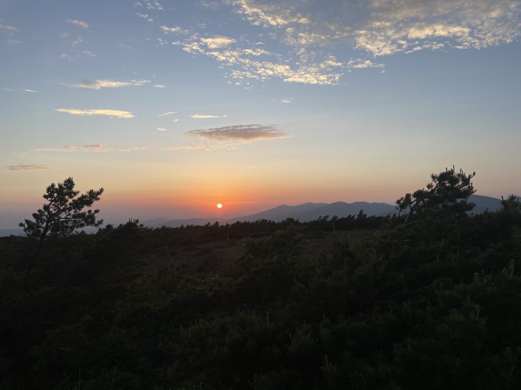
If Day 1 was a dream, Day 2 was a test of character. Moving from the Azuma area to the Adatara area meant facing what I call “The Grind.”
It was hot. The air was stagnant. The brush was overgrown, and the bugs… let’s just say I accidentally “ate” one.
There were long stretches with no views, just a mental battle against the humidity and the swarm. And yet, that made what came later even more powerful.
2.Highlights of Day2
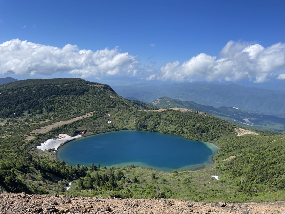
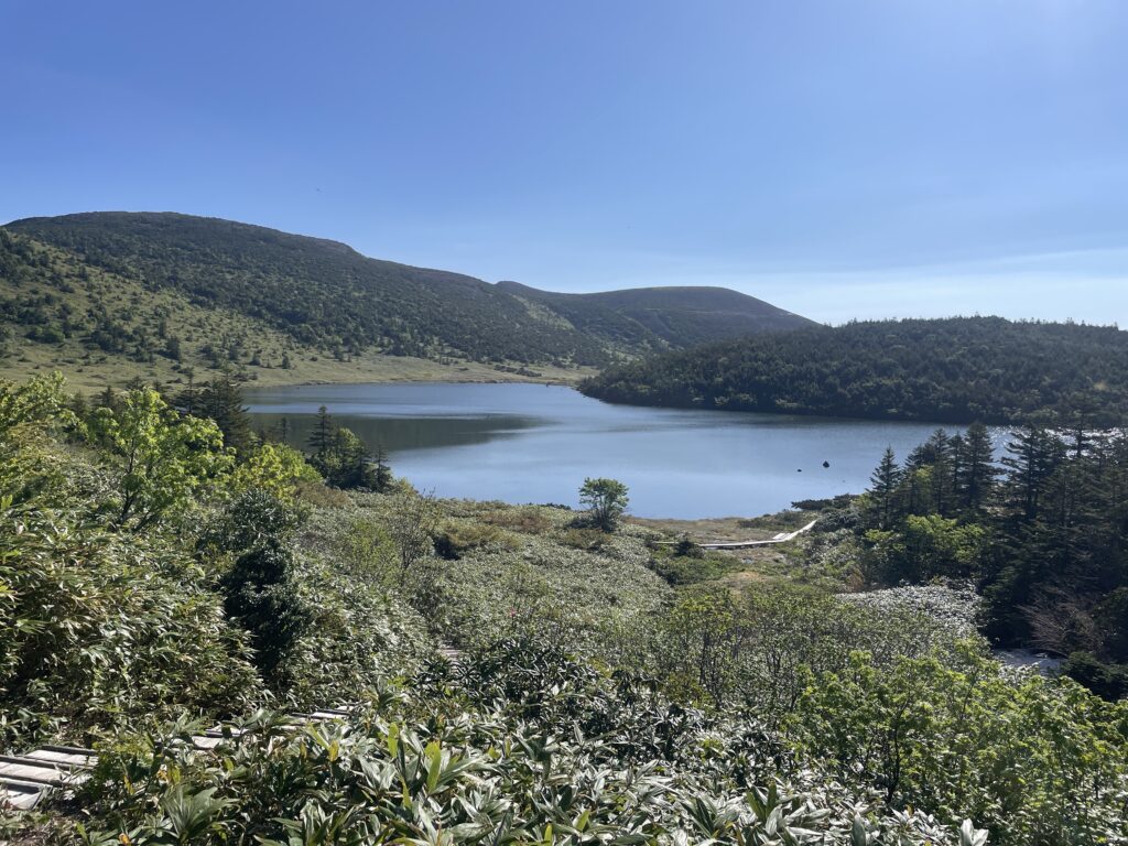
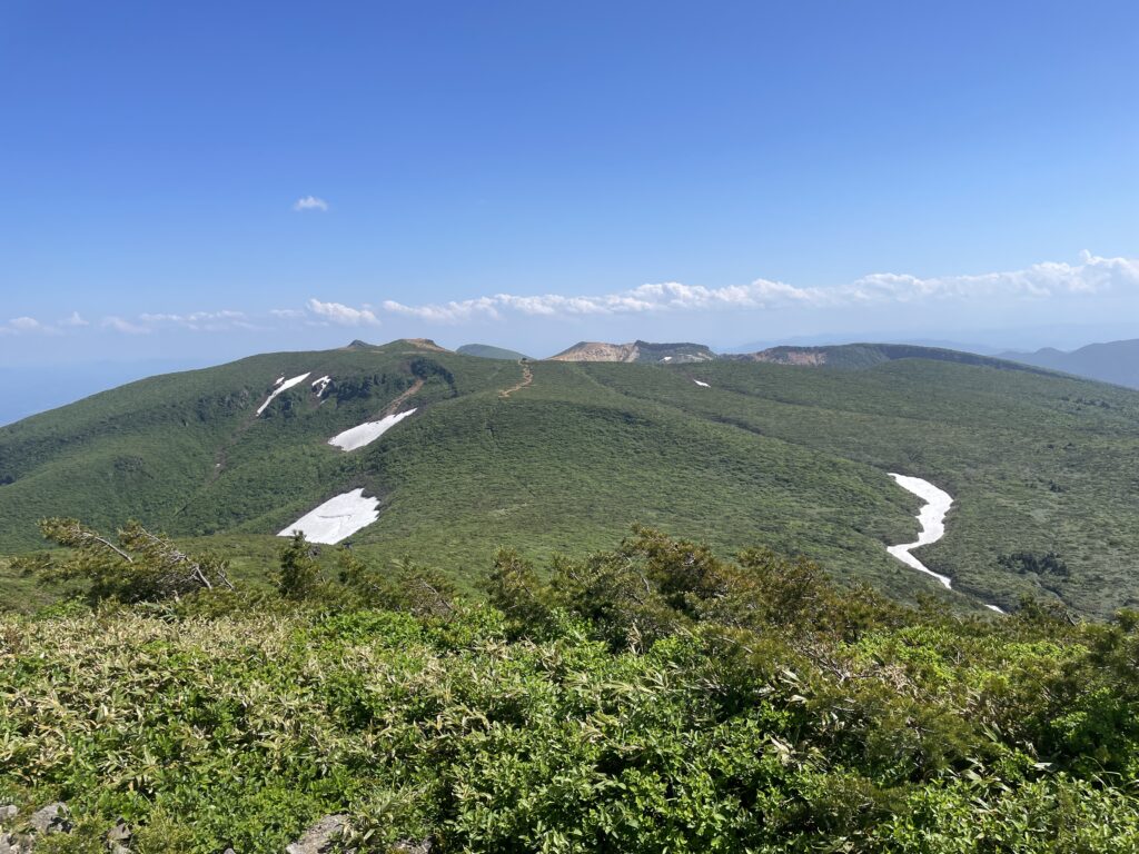
1. The Divine View: Numanotaira Crater
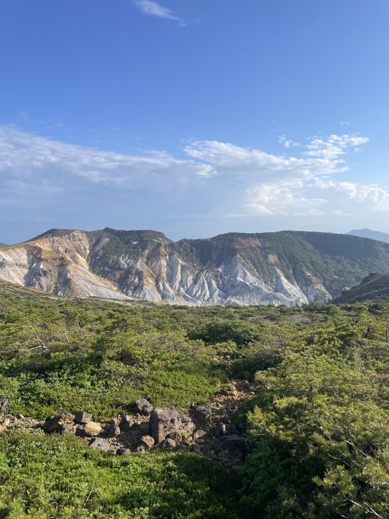
Everything—the sweat, the bugs, the exhaustion—was worth it the moment I stood by the Tetsu-zan Hut and looked out over Numanotaira.
It’s a massive, hauntingly beautiful volcanic crater. The stark white slopes and the sharp, sculpted ridges look like a giant piece of earth-art or a traditional Japanese folding screen (Byobu).
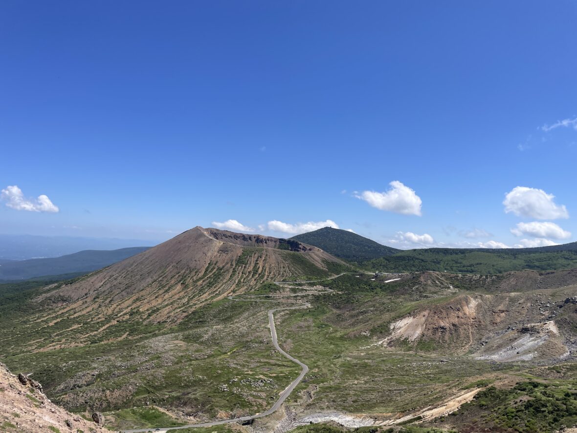
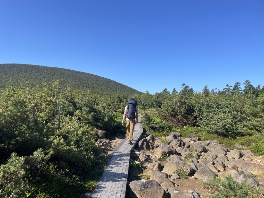
2. Mt. Minowa: The Great Green Sea
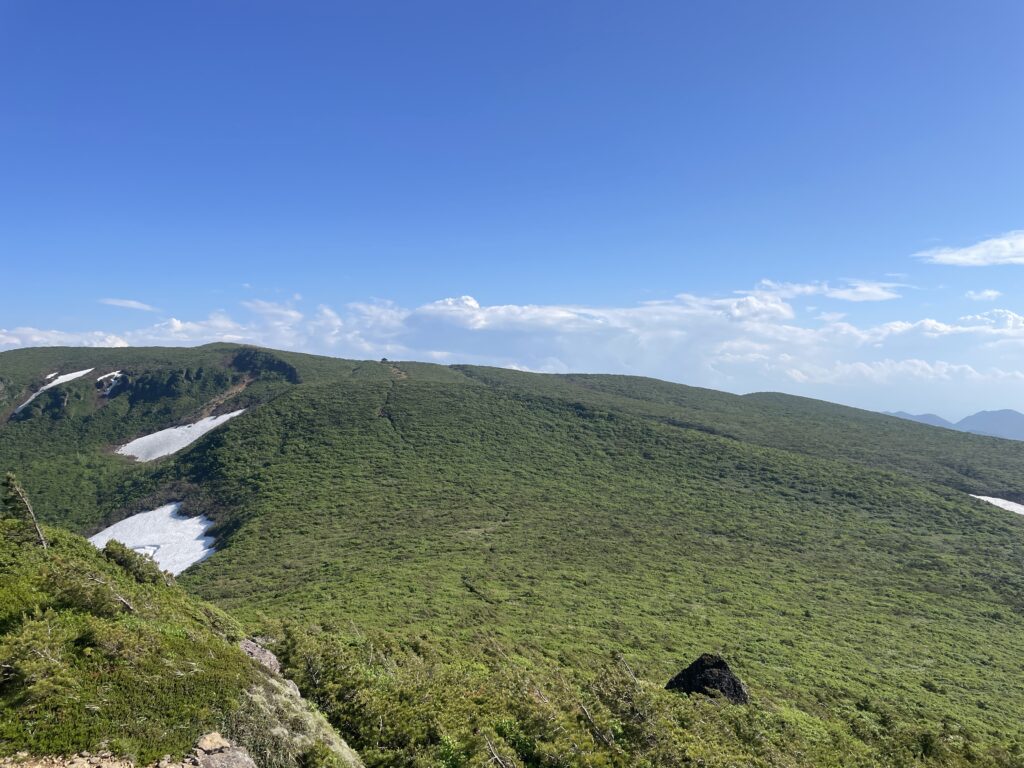
Before reaching the hut, I crossed Mt. Minowa, the highest peak in the Adatara Range. Once you break through the treeline, the world opens up.
To the south, I could see the tiny Tetsu-zan Hut sitting lonely in the middle of a deep, heavy “sea of green.”
It felt like I had traveled so incredibly far on my own two feet. The wind here was refreshing, and the bugs finally vanished. I actually ended up taking a 90-minute nap at the summit—it was pure bliss.
3.Trail Notes
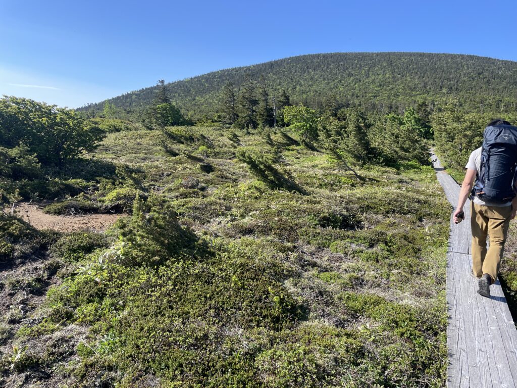
Kamanuma to Higashi-Azuma
The boardwalk around Kamanuma was peaceful and well maintained.
This crater lake is surrounded by wetland vegetation that gives the area a gentle atmosphere.
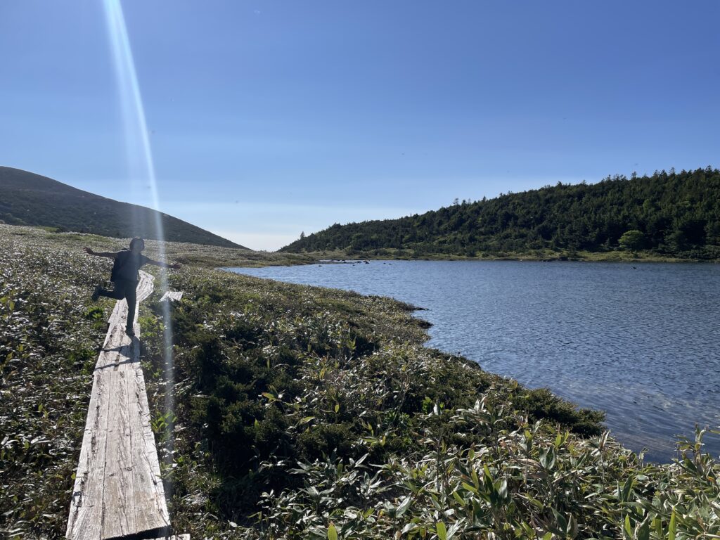
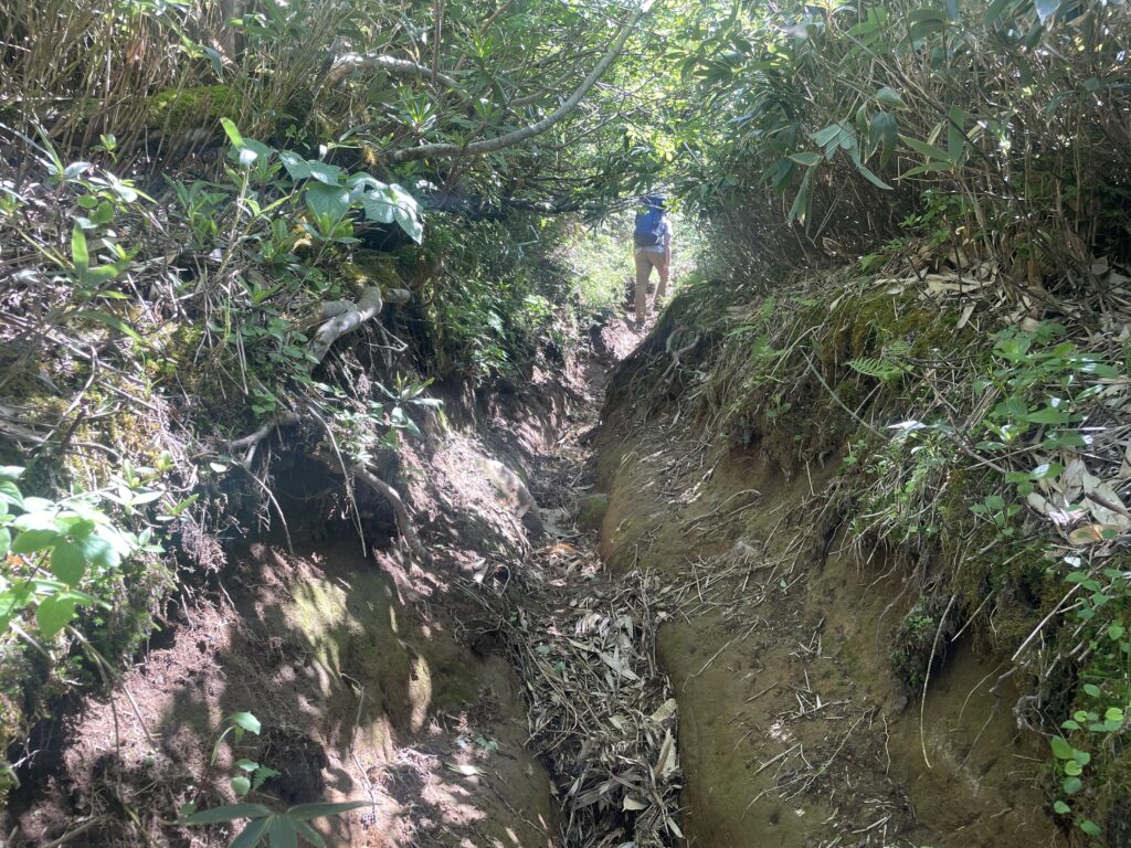
But once past Kamanuma, the trail entered dense forest.
The insects were relentless — I even swallowed one mid-stride. I pushed forward without stopping until reaching the summit of Higashi-Azuma.
From there, descending toward Keibadaira, the path opened slightly, but the heat remained intense. It was a day that demanded patience.
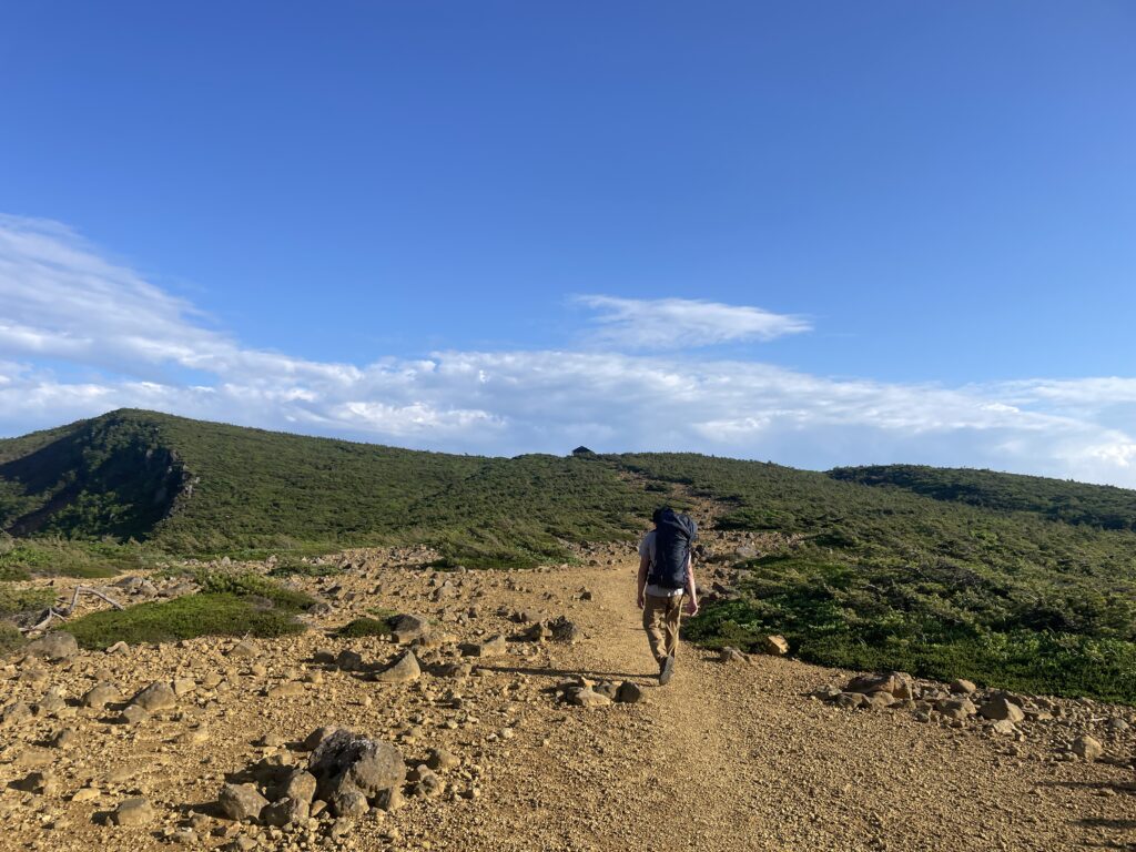
Through Makukawa Onsen and Toward the Mountains Again
After Keibadaira, the trail joined part of the “New Oku-no-Hosomichi” route, a section of the Tohoku Nature Trail.
On a cooler day, it might have felt pleasant. But under the burning sun, even the road walk from Makukawa Onsen felt endless.
I secretly hoped for a vending machine — I was craving a cold cola — but none appeared. So I continued on toward Mt.Kimen.
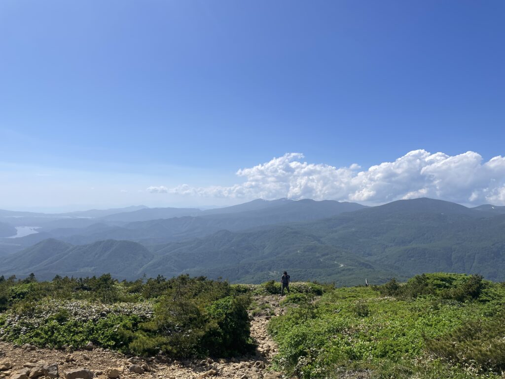
Mt.Kimen and the Vast Green World
After about five hours from Kamanuma, I reached Mt.Kimen.
The views finally opened — layers of deep green mountains stretching in every direction.
“This is Tohoku,” I thought. Wild, expansive, quiet. But the real surprise was still ahead.
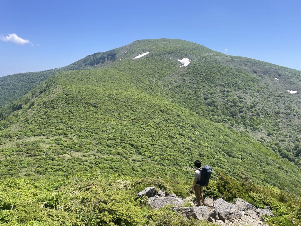
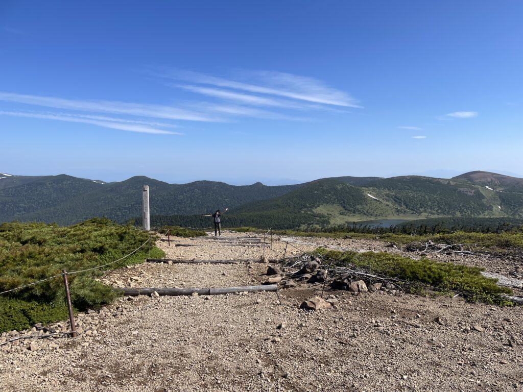
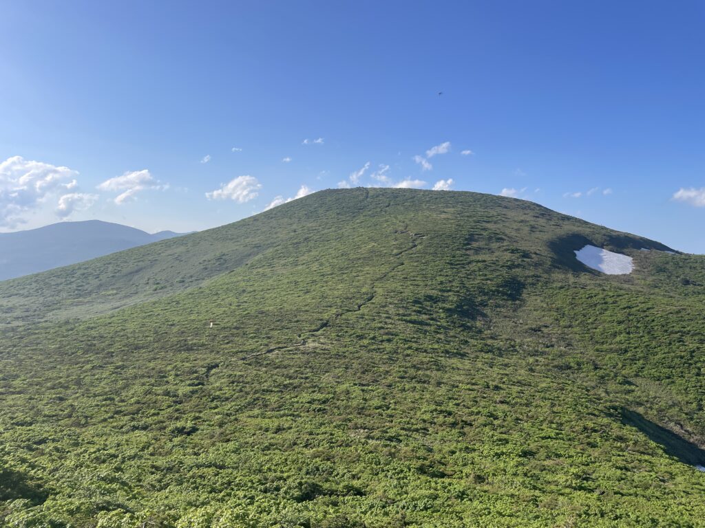
Mt.Minowa — A Sea of Green
About an hour and a half beyond Mt.Kimen lies Mt.Minowa, the highest peak in the Adatara range.
Looking north: mountain after mountain fading into deep green.
Looking south: a small hut standing alone in the vast landscape — Tetsu-zan Hut — and a single trail leading toward it.
It wasn’t pastoral. It felt heavier than that — like being surrounded by a dense ocean of green. “I’ve come so far,” I thought.
The wind moved freely across the summit. There were no insects.
Without realizing it, I fell asleep there for over an hour.
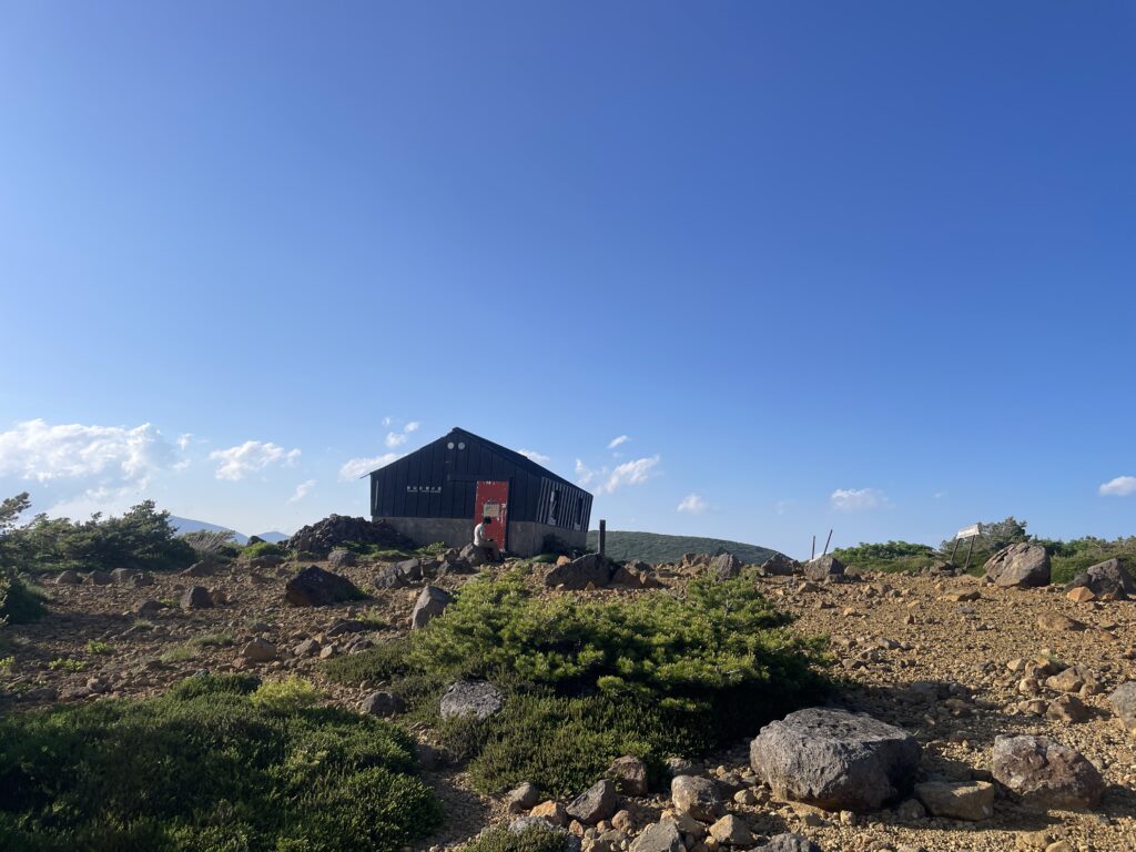
The Final Stretch to Tetsu-zan Hut
From Mt.Minowa, Tetsu-zan Hut looks close — almost within reach.
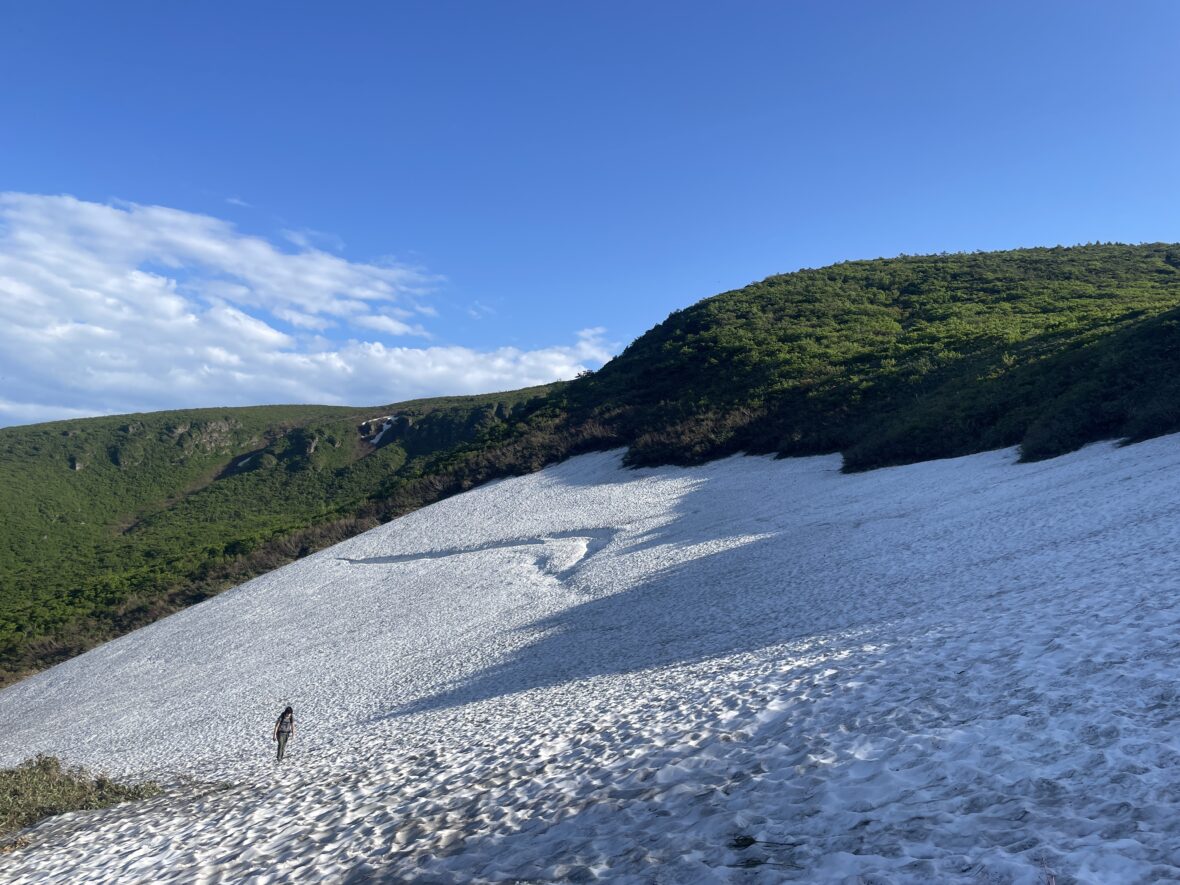
Before heading there, I detoured to a water source about ten minutes off the trail. Snowfields still lingered on the steep slope, and I slipped more than once, using my hands to steady myself.

After thinking the hardest part of the day was over, those few snowy meters felt surprisingly tough.
But the meltwater was incredibly fresh and cold. Under the scorching sun, it revived me completely.
Then I climbed back up and walked toward the hut.
Tetsu-zan Hut— And Numano-taira
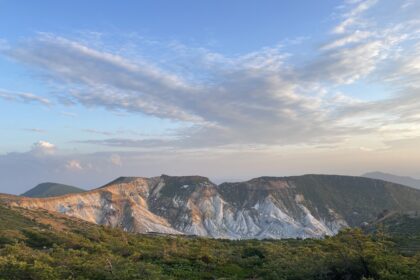
When I reached Tetsu-zan Hut, the view suddenly opened.
There it was — Numano-taira.

I had looked at photos before this trip. But I hadn’t understood the scale.
The sharply defined ridgelines. The white volcanic slopes carved by past eruptions. The vast crater basin unfolding like a folding screen painting. It was beyond beautiful — it felt sacred.
This was the most powerful view of the entire Volcano Trail. More than Day 1. More than any summit. This was the place.
Day 2 had felt like a trial. But it was all for this moment.
As the sun slowly shifted, the light over Numano-taira changed with it.
And strangely, almost no one was there. We encountered only three groups the entire day.
By nightfall, insects returned around the hut, and I retreated quickly into my tent.
Tomorrow, I finally summit Mt. Adatara. The final chapter of the Volcano Trail begins!
The map below was used as a reference for this hike. this is the most detailed hiking map covering the Bandai, Azuma and Adatara volcanic area. Essential for route planning.