
We finished at Dake Onsen bus stop, where a FamilyMart (convenience store) awaited us. I grabbed a Coke and an ice cream—pure heaven.
With the image of that white, majestic crater burned into my heart, I’m ready to head back to reality.
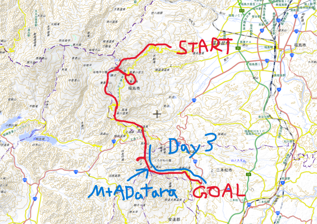
1.Overall Route
Long Trail Route Overview(3 Days / 2 Nights)
• Day 1: Takayu – Nakatengu – Mt. Issaikyo – Jododaira – Mt. Azuma-Kofuji
• Day 2: Jododaira – Mt. Higashi-Azuma – Makukawa Onsen – Noji Onsen – Tetsuzan Hut
• Day 3: Tetsuzan Hut – Umanose – Mt. Adatara – Dake Onsen
Day 3 – Adatara Area Route
Tetsu-zan Hut – Ushi-no-Se Ridge – Yahazu-mori – Funamyojin – 安達太良山(Mt. Adatara) – Adatara Kogen Ski Area – Dake Onsen
Finally, the last day.
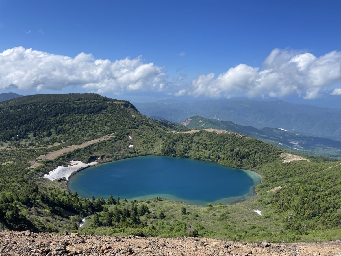
I’ve been watching the “Numano-taira” crater from afar. Today is the day I finally walk along its rim to see it up close.
2.Highlights of Day3
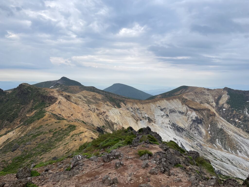
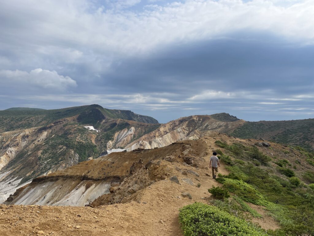
Ushinosé to Funamyojin-yama
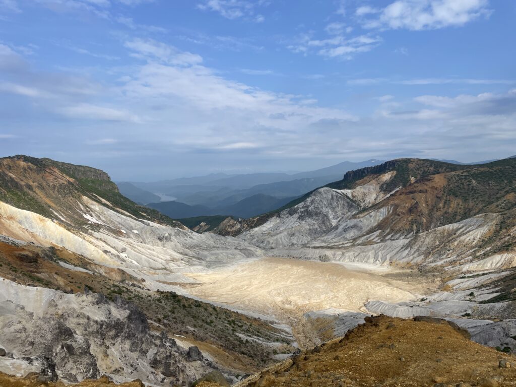
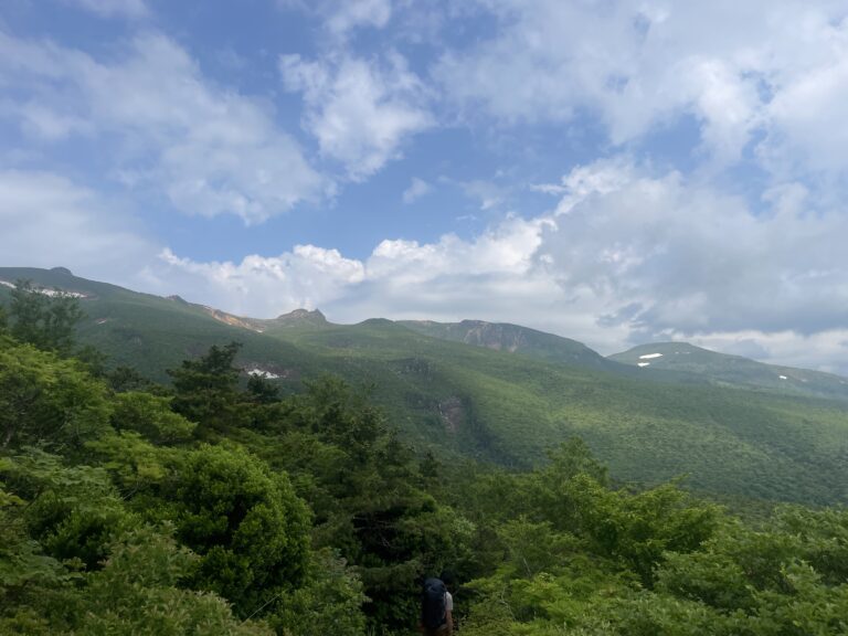
The ridge between Ushi-no-Se and Funamyojin is not only a joy to walk — it offers the most dramatic views of Numano-taira.
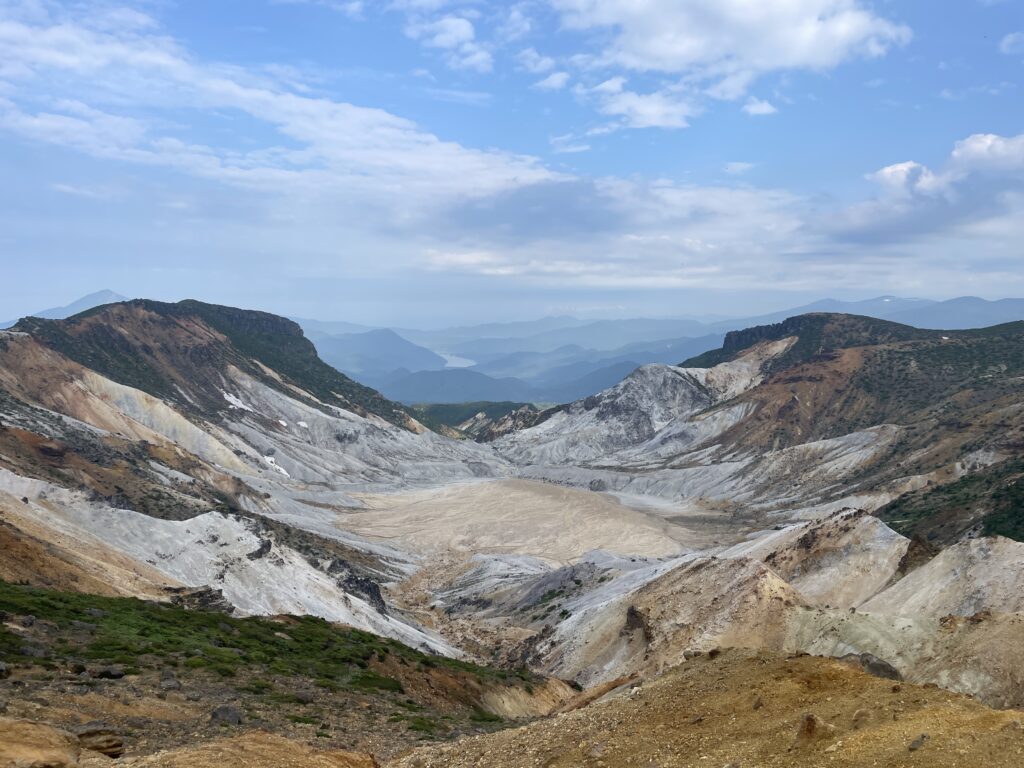
From Tetsuzan Hut, the crater itself is hidden. But once you gain the ridge, the vast volcanic basin suddenly opens up in front of you.
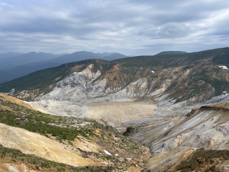
From every angle, Numano-taira shows a different face. I found myself moved again and again.
3.Trail Notes
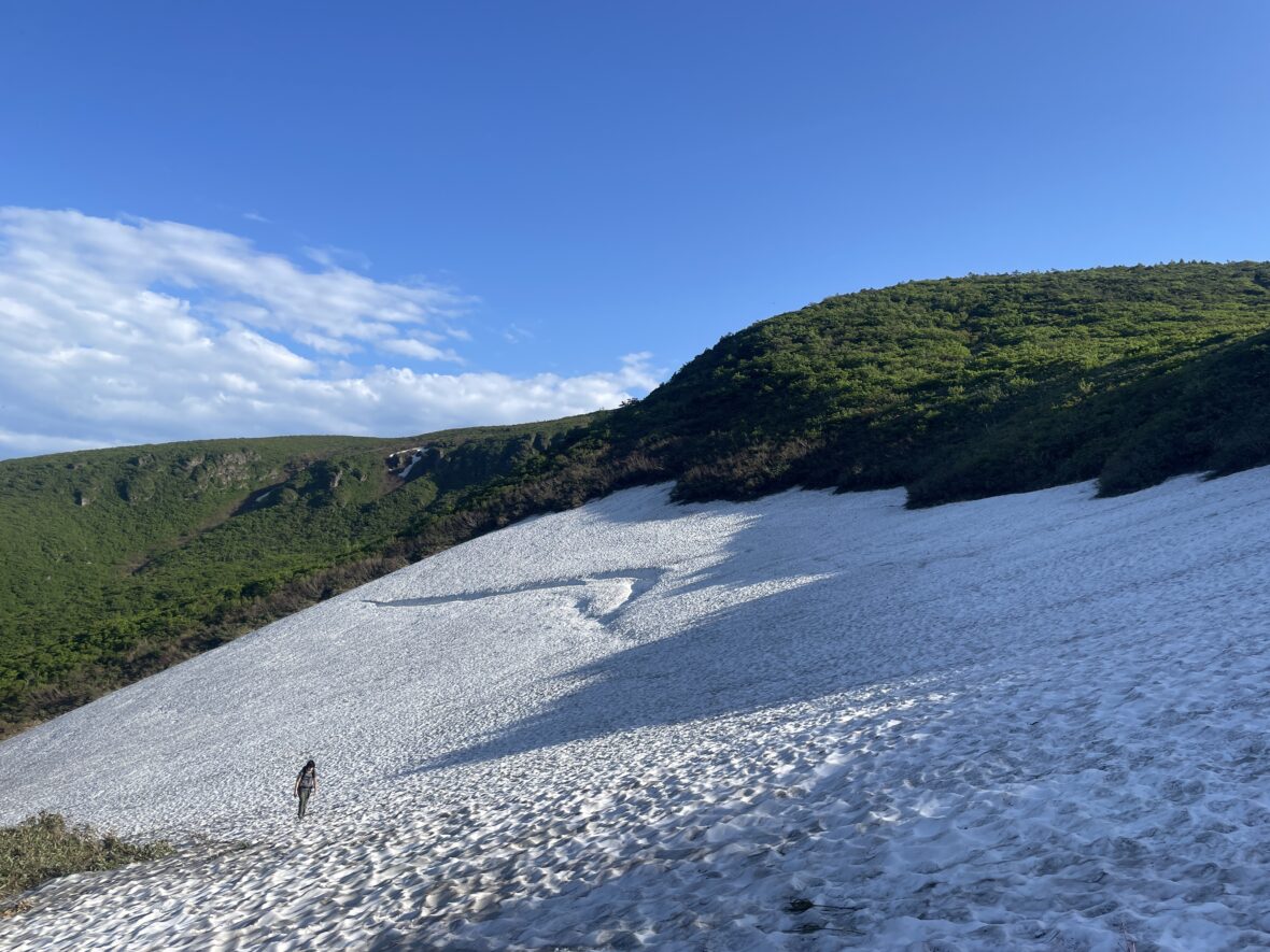
Tetsuzan Hut to Yahazu-mori
Originally, we had planned to take the Tainai-iwa and Shoji-iwa route toward Mt. Adatara.
But the moment we arrived at Tetsuzan Hut and saw the elegance of the ridge, I thought, “I want to walk Ushi-no-Se.” So we changed plans.
The “Ushinosé” (Cow’s Back) and “Umanosé” (Horse’s Back) ridges are so beautiful they make you want to start running.
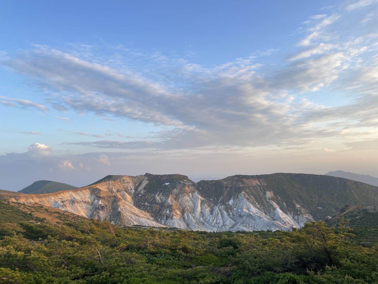
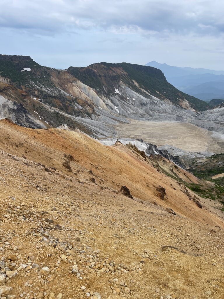
The crater, which looked like a flat painting from a distance, suddenly gained 3D depth and overwhelming scale. And then there is Numano-taira.
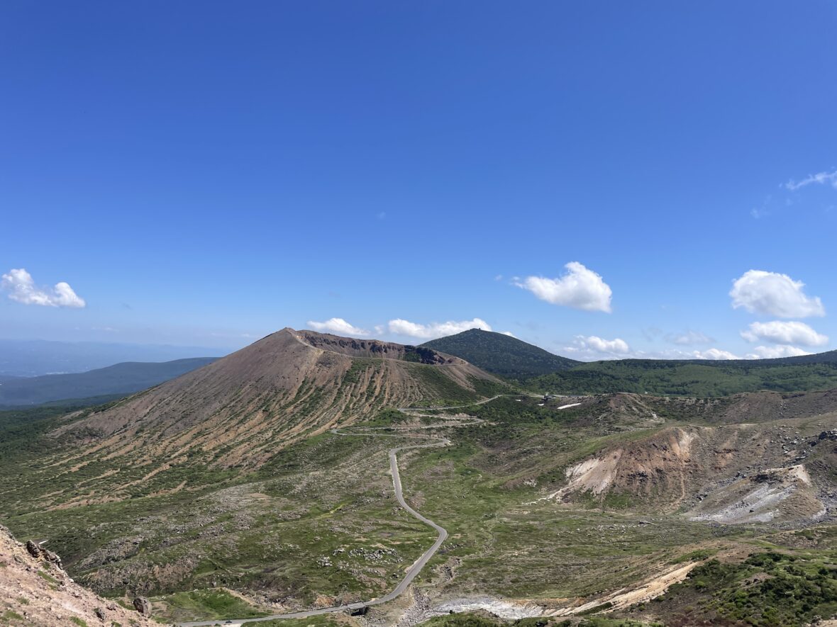
The sharp ridgelines, the stark white volcanic slopes carved by past eruptions — the scale is overwhelming.
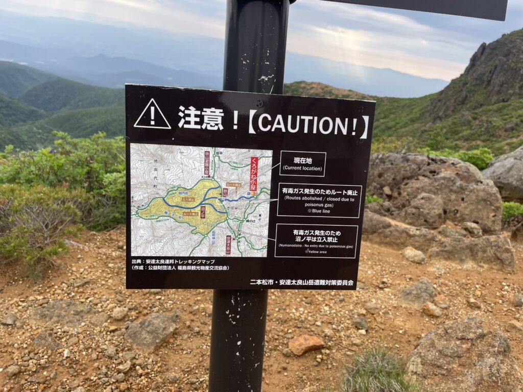
Along the ridge, we passed a closed trail toward Kurogane Hut. The smell of sulfur grew stronger there.
Interestingly, that was the only place without insects. I wondered if volcanic gas had something to do with it.
Yahazu-mori to Funamyojin
At the junction toward Mt. Adatara, we decided to leave our packs and make a quick side trip to Funamyojin.
From this angle, Numano-taira looked different again. Calling it a simple “crater rim walk” doesn’t quite capture it. It’s too vast for that.
Between Tetsuzan Hut t and Funamyojin, nearly every step offers another stunning composition.
If you truly want to experience the beauty of Numano-taira, the Tetsuzan Hut – Ushi-no-Se – Funamyojin traverse is the one to choose.
Farewell to Numano-taira — Toward Mt. Adatara
Leaving the crater behind, we headed toward Mt. Adatara. It was closer than it looked.
I had been looking forward to this mountain long before the trip began. I had known its name for years — and even associated it with the Adatara bouldering area — so finally standing here felt meaningful.
The actual summit is atop a rocky peak nicknamed “The Nipple.” You can approach from either side, but there are ladders and narrow sections, so it could be tricky when crowded.
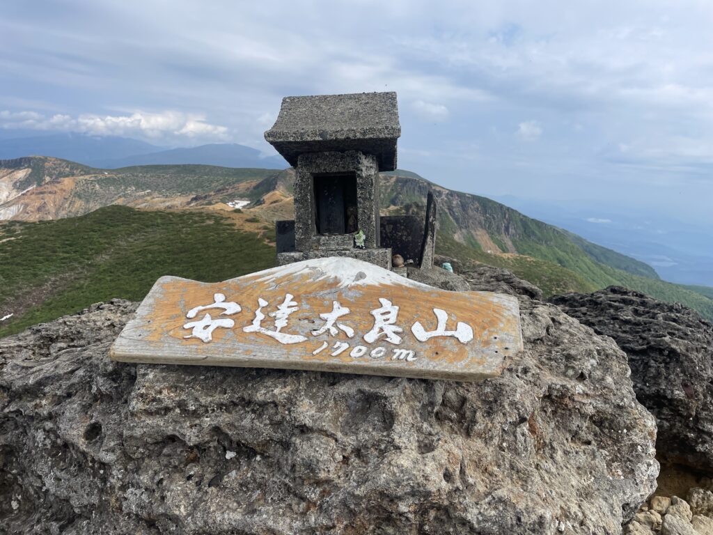
We arrived around 8 a.m., when only a few hikers were there. On our way down, however, we passed a steady stream of climbers — clearly a beloved mountain.
The insects returned with force, and I nearly screamed in frustration.
But the 360-degree view from the top made it all worth it. I felt a deep sense of “This is it, the journey is ending.”
Descent to Dake Onsen
From Mt. Adatara, it was a long descent.
The trail was dense and windless. Heat built up, insects swarmed, and the bites from earlier in the morning began to itch fiercely — probably black flies. My patience wore thin.
Despite it being a weekday, hikers kept ascending. We met more people here than during the previous three days combined.
Once we hit the ski resort, the bugs vanished. The final hour was a road walk to the bus stop. Knowing the “war” with the bugs was over, I actually enjoyed the stroll.
We finished at Dake Onsen bus stop, where a FamilyMart (convenience store) awaited us. I grabbed a Coke and an ice cream—pure heaven.
With the image of that white, majestic crater burned into my heart, I’m ready to head back to reality.
4.About Our Route
If you’ve followed this blog from Day 1, you may have noticed that we skipped parts of the official ATA route.
We omitted:
・Yajidaira (Day 1)
・Umagaeshi / Kurogane Hut (Day 2)
・Tainai-iwa and Shoji-iwa (Day 3)
The official course totals 72 km, but our variation was approximately 50 km.
In terms of time, all three days felt manageable. Even the full route could likely be completed in 2 nights and 3 days, though 3 nights and 4 days would allow for a more relaxed pace.
The map below was used as a reference for this hike. This is the most detailed hiking map covering the Bandai, Azuma and Adatara volcanic area. Essential for route planning.

If you’d like to read how this journey began, you can find the full stories of Day 1 and Day 2 below.
You can also explore my other recommended hiking destinations across Japan below.